Safety Score: 2,7 of 5.0 based on data from 9 authorites. Meaning we advice caution when travelling to United States.
Travel warnings are updated daily. Source: Travel Warning United States. Last Update: 2024-08-13 08:21:03
Discover Oakleigh Estates
The district Oakleigh Estates of Saraland in Mobile County (Alabama) is a subburb in United States about 838 mi south-west of Washington DC, the country's capital city.
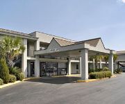
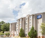
If you need a hotel, we compiled a list of available hotels close to the map centre further down the page.
While being here, you might want to pay a visit to some of the following locations: Mobile, Bay Minette, Lucedale, Leakesville and Pascagoula. To further explore this place, just scroll down and browse the available info.
Local weather forecast
Todays Local Weather Conditions & Forecast: 20°C / 67 °F
| Morning Temperature | 11°C / 52 °F |
| Evening Temperature | 18°C / 64 °F |
| Night Temperature | 13°C / 56 °F |
| Chance of rainfall | 0% |
| Air Humidity | 47% |
| Air Pressure | 1018 hPa |
| Wind Speed | Gentle Breeze with 6 km/h (4 mph) from South-West |
| Cloud Conditions | Clear sky, covering 0% of sky |
| General Conditions | Sky is clear |
Saturday, 16th of November 2024
21°C (70 °F)
16°C (61 °F)
Sky is clear, light breeze, clear sky.
Sunday, 17th of November 2024
24°C (75 °F)
18°C (65 °F)
Broken clouds, light breeze.
Monday, 18th of November 2024
25°C (76 °F)
21°C (69 °F)
Light rain, gentle breeze, few clouds.
Hotels and Places to Stay
Fairfield Inn & Suites Mobile Saraland
BEST WESTERN SARALAND HOTEL
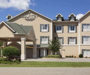
AL Saraland Country Inn and Suites by Radisson
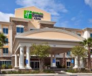
Holiday Inn Express & Suites MOBILE/SARALAND
Baymont Inn & Suites Saraland
La Quinta Inn & Suites Mobile Satsuma / Saraland
M STAR HOTEL NORTH MOBILE
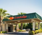
Econo Lodge
DAYS INN SARALAND
MICROTEL INN & SUITES BY WYNDH
Videos from this area
These are videos related to the place based on their proximity to this place.
2012 Quarterback Recruit -- Cody Robison -- Junior Year Highlights -- Short Version
Cody Robison, 6' 0", 180 lbs, 4.8 x 40 yd, 4.6 GPA 4A Saraland High School - Saraland, AL Season Stats: 1921 P. Yds., 398 R. Yds., 10 P. TD's, 3 R. TD's.
Room158OpenMicNov2010
Jarvis Wright(Sax), Jarryd Wright(Percussion) performing at Room 158 Open Mic, Nov 14, 2010. Located in Saraland, Alabama (North Mobile County)
1987 Toyota Pickup Used Cars Satsuma AL
http://www.piercecartrucksales.net This 1987 Toyota Pickup is available from Pierce Car & Truck Sales Inc.. For details, call us at 251-679-9994.
1987 Duracraft 1860 Used Cars Satsuma AL
http://www.piercecartrucksales.com This 1987 Duracraft 1860 is available from Pierce Car & Truck Sales Inc.. For details, call us at 251-679-9994.
It's your money don't throw it away!
Helping you find the deductions you deserve. THYSSENKRUPP employees welcome and if need be we will come to you.
Satsuma High School 5-6-2009
Phillip Herring, science teacher at Satsuma High School in Mobile, Alabama, demostrates the implosion of a 55 gallon metal drum by boiling some water in the drum until the water vapor displaces...
2008 Xpress Bay boat Used Cars Satsuma AL
http://www.piercecartrucksales.net This 2008 Xpress Bay boat is available from Pierce Car & Truck Sales Inc.. For details, call us at 251-679-9994.
2000 G3 Bass Boat Used Cars Satsuma AL
http://www.piercecartrucksales.net This 2000 G3 Bass Boat is available from Pierce Car & Truck Sales Inc.. For details, call us at 251-679-9994.
Videos provided by Youtube are under the copyright of their owners.
Attractions and noteworthy things
Distances are based on the centre of the city/town and sightseeing location. This list contains brief abstracts about monuments, holiday activities, national parcs, museums, organisations and more from the area as well as interesting facts about the region itself. Where available, you'll find the corresponding homepage. Otherwise the related wikipedia article.
Chickasaw, Alabama
Chickasaw is a city in Mobile County, Alabama, United States. As of July 2007, the population was 5,979. It is included in the Mobile metropolitan statistical area.
Prichard, Alabama
Prichard is a city in Mobile County, Alabama, in the United States. Prichard borders the north side of Mobile, as well as the Mobile suburbs of Chickasaw, Alabama, Saraland, Alabama, and the unincorporated sections of Eight Mile, Alabama. As of the 2010 Census, the population of the city was 22,659. It is a part of the Mobile metropolitan statistical area.
Satsuma, Alabama
Satsuma is a city in Mobile County, Alabama, United States. At the 2000 census the population was 5,687. Known prior to 1915 as Fig Tree Island, the city was named after the Satsuma orange, which was successfully cultivated and grown in Alabama starting in 1878, a gift from Meiji Japan. Satsuma is a part of the Mobile metropolitan statistical area.
Saraland, Alabama
Saraland is a city in Mobile County, Alabama, in the United States, and a suburb of Mobile, Alabama. As of the 2010 census, the population of the city is 13,405. It is a part of the Mobile metropolitan area. Saraland is the third largest city in Mobile County.
University of Mobile
The University of Mobile is an American four-year, private, Baptist-affiliated university in Mobile, Alabama. The master's-level university has an enrollment of 1,577.
1993 Big Bayou Canot train wreck
The 1993 Big Bayou Canot train wreck was the derailing of an Amtrak train on the CSXT Big Bayou Canot bridge in northeast Mobile, Alabama, USA, killing 47 and injuring 103, on September 22, 1993. It is the deadliest train wreck in Amtrak's history and the deadliest rail disaster in the United States since the Newark Bay, New Jersey rail accident in 1958. In terms of fatalities and destruction, this wreck substantially exceeded the severity of the Chase, Maryland accident that occurred in 1987.
WNTM
WNTM (710 AM, "NewsRadio 710") is a talk radio station based in Mobile, Alabama, USA. The station, which began broadcasting in 1946, is currently owned by Clear Channel Communications and the broadcast license is held by CC Licenses, LLC.
Satsuma High School
Satsuma High School is a public high school (7-12) in Satsuma, Alabama, United States. It is a part of the Satsuma City School System. Prior to 2012 it was a part of the Mobile County Public School System. Satsuma was first opened in 1958. The building that housed the first Satsuma High School in 1918 to 2000 has recently been remodeled to hold the history department, a few mathematics classes, and a gymnasium. The current building was built in 1983 and holds the rest of the campus.
Cochrane–Africatown USA Bridge
The Cochrane–Africatown USA Bridge is a cable-stayed bridge carrying mainline US 90 and Truck Route US 98 across the Mobile River from the mainland to Blakeley Island in Mobile, Alabama.
WTKD
WTKD is an American radio station licensed to serve the community of Mobile, Alabama. The station, established in 1948, is owned by Dittman Broadcasting and the broadcast license is held by WABB-FM, Inc. WTKD broadcasts from midtown Mobile's Springhill Avenue, its home since 1969, after leaving its former Government Street studio in downtown Mobile.
WAVH
WAVH (106.5 FM, "FM Talk 106-5") is a radio station licensed to serve Daphne, Alabama, USA. The station is owned by Bigler Broadcasting, LLC.
Mattie T. Blount High School
Mattie Thomas Blount High School is a high school, 1 of 16 high schools in the Mobile County Public School System. It is located in 8 Mile, Prichard, Alabama.
WLPR (AM)
WLPR (960 AM, "Solid Gospel 960 AM") is a radio station licensed to serve Prichard, Alabama, USA. The station is owned by Goforth Media, Inc. WLPR broadcasts a Southern Gospel music format to the Mobile, Alabama, area. The station features programming from Salem Communications.
WBHY (AM)
WBHY (840 AM, "Christian 840") is a radio station broadcasting a Christian radio format. Licensed to Mobile, Alabama, USA, the station serves the greater Mobile area. The station is currently owned by Goforth Media, Inc. and features programing from the Salem Radio Network. The station was assigned the WBHY call letters by the Federal Communications Commission on December 23, 1984.
WIJD
WIJD is a radio station licensed to the community of Prichard, Alabama, USA, and serves the greater Mobile, Alabama, area. The station is owned by Wilkins Communications Network Inc. and the license is held by the Mobile Bay Corporation. It airs a Christian talk radio format.
Eight Mile, Alabama
Eight Mile is an unincorporated community in Mobile County, Alabama, United States. The community is named for its distance from the city of Mobile.
Kushla, Alabama
Kushla is an unincorporated community in Mobile County, Alabama, United States.
Mauvilla, Alabama
Mauvilla is an unincorporated community in Mobile County, Alabama, United States.
Alabama Motorsports Park
Alabama Motorsports Park is currently being developed north of Mobile, AL with opening projected for 2012. The park has plans for a lighted 'D'-shaped oval, a 2.6-mile road course, and a karting track along with RV parks, retail shops, and condominium units on the 2,400-acre tract. The park is projected to be host to a variety of motorsports, including stock-cars, trucks, open-wheel cars, sports cars, sprint cars, and motorcycles.
Vigor High School
Vigor High School, located in Prichard, Alabama, is a public high school that educates grades 9-12. It is operated by the Mobile County Public School System.
LeFlore Magnet High School
John L. LeFlore Preparatory Academy, formally known as John L. Leflore Magnet High School of Advanced Communication and Fine Arts, is a historic public magnet preparatory academy located in Toulminville, Mobile, Alabama. LeFlore offers advanced communication, academic, fine and performing art, and career technical programs. LeFlore Magnet High School is also accredited by the Southern Association of Colleges and Schools. LeFlore currently enrolls 947 students in grades 9-12.
CSS Huntsville
CSS Huntsville was a Confederate ironclad floating battery built at Selma, Alabama from 1862 to 1863.
CSS Tuscaloosa (ironclad)
CSS Tuscaloosa was a screw ironclad steamer ram in the Confederate States Navy that was laid down by the Confederate Naval Works at Selma in 1862.
Spanish River (Alabama)
The Spanish River is a brackish distributary river that forms part of the border between Baldwin and Mobile counties in Alabama. It is approximately 8 miles long and is influenced by tides. It begins at the northernmost tip of Blakeley Island, where it diverges from the Mobile River, at {{#invoke:Coordinates|coord}}{{#coordinates:30.77241|-88.02222||||||| |primary |name= }}.
Saraland High School
Saraland High School (SHS), located in Saraland, Alabama, is a public high school operated by the Saraland City School System that educates grades 9–12.


