Safety Score: 2,7 of 5.0 based on data from 9 authorites. Meaning we advice caution when travelling to United States.
Travel warnings are updated daily. Source: Travel Warning United States. Last Update: 2024-08-13 08:21:03
Discover Gulf Dale
The district Gulf Dale of Brills Trailer Court in Mobile County (Alabama) is a subburb in United States about 848 mi south-west of Washington DC, the country's capital city.
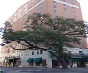
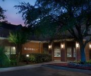
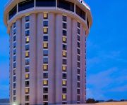
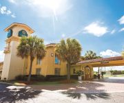
If you need a hotel, we compiled a list of available hotels close to the map centre further down the page.
While being here, you might want to pay a visit to some of the following locations: Mobile, Bay Minette, Pascagoula, Lucedale and Leakesville. To further explore this place, just scroll down and browse the available info.
Local weather forecast
Todays Local Weather Conditions & Forecast: 20°C / 67 °F
| Morning Temperature | 12°C / 53 °F |
| Evening Temperature | 18°C / 65 °F |
| Night Temperature | 14°C / 56 °F |
| Chance of rainfall | 0% |
| Air Humidity | 47% |
| Air Pressure | 1018 hPa |
| Wind Speed | Gentle Breeze with 7 km/h (4 mph) from South-West |
| Cloud Conditions | Clear sky, covering 0% of sky |
| General Conditions | Sky is clear |
Saturday, 16th of November 2024
21°C (70 °F)
17°C (62 °F)
Sky is clear, light breeze, clear sky.
Sunday, 17th of November 2024
24°C (75 °F)
18°C (65 °F)
Broken clouds, gentle breeze.
Monday, 18th of November 2024
24°C (76 °F)
21°C (70 °F)
Light rain, gentle breeze, few clouds.
Hotels and Places to Stay
The Admiral Hotel Mobile Curio Collection by Hilton
Mobile Marriott
Homewood Suites by Hilton Mobile I-65-Airport Blvd AL
Fairfield Inn & Suites Mobile
Holiday Inn MOBILE-DWTN/HIST. DISTRICT
Comfort Inn Mobile
LA QUINTA INN MOBILE
Hilton Garden Inn Mobile West I-65-Airport Blvd
TownePlace Suites Mobile
Residence Inn Mobile
Videos from this area
These are videos related to the place based on their proximity to this place.
Dog River Litter Woes 9
The City of Mobile drainage ditches are responsible for channeling the public's illegal litter into Dog River. When the trash accumulates along the shoreline after each rain, the City of Mobile...
Dog River Litter 07/19/14
Following the overnight rains, once again massive amounts of litter and yard debris are flowing down Dog River. This 15 minute video takes you on a 2 mile ride starting at Dog River Park;...
Dog River Litter Woes 5
The saga of litter in Dog River after it rains flows on. The problem is, no one is responsible to remove the floatable litter once it enters the water. How stupid can you get Mobile?
chassity naval piercing 251-423-0854 la body art
la body art 422 dauphin island parkway mobile alabama call for directions and price tattoo-piercing-microdermal- 251-423-0854.
Clearing trees for new McGowin Park Shopping Center in Mobile, AL
Aerial video of tree removal for the new McGowin Park Shopping Center going in with Costco, Dick's Sporting Goods and many other shops. This is south of Government Blvd near Bay Bear Stadium...
chassity two piercings lip and naval la body art 251-423-085
la body art 422 dauphin island parkway mobile alabama 251-423-0854 myspace.com/tattochassity open 7 days a week 24 hours tattoo -piercing-microdermal call for quotes and directions mobile...
Watermeat Twenty Five - Fishing Bass in Dog River Creeks - 1-21-12
A great day of Bass fishing Mobile's Dog River creeks! :) Follow us on Twitter @TeamWatermeat and check out http://watermeat.com for more fishing goodies!
WZEW - The Last Report
Wen Hurricane Gustav made landfall. WZEW-FM (Mobile) was knocked off air. In the 4 hours of silemce, the staff filmed a report on the storm..until something went very wrong.
microdermals. piercing tattoos chassity works in the cold
chassity ebbole i s at la body art tattoo mobile alabama 251-476-0008 apppointment or walkin in.18 yrs established.price quotes by phone or text 251-423-0854 open 24 hours.
belly button chassity la body art 251-423-0854
chassity pierces at la body art art 422 dauphin island parkway mobile alabama call for prices tattoo piercing microdermal text for quotes under 18 permitted with parent.
Videos provided by Youtube are under the copyright of their owners.
Attractions and noteworthy things
Distances are based on the centre of the city/town and sightseeing location. This list contains brief abstracts about monuments, holiday activities, national parcs, museums, organisations and more from the area as well as interesting facts about the region itself. Where available, you'll find the corresponding homepage. Otherwise the related wikipedia article.
Alabama School of Mathematics and Science
The Alabama School of Mathematics and Science (ASMS) is a public residential high school in the Midtown neighborhood of Mobile, Alabama. ASMS is a member of the National Consortium for Specialized Secondary Schools of Mathematics, Science and Technology. It graduated its first class in 1993. The school was founded in 1989 as a unique public-private partnership.
Mobile River
The Mobile River is located in southern Alabama in the United States. Formed out of the confluence of the Tombigbee and Alabama rivers, the approximately 45-mile-long river drains an area of 44,000 square miles of Alabama, with a watershed extending into Mississippi, Georgia, and Tennessee. Its drainage basin is the fourth-largest of primary stream drainage basins entirely in the United States. The river has historically provided the principal navigational access for Alabama.
Dog River (Alabama)
The Dog River is a river in Mobile County, Alabama. The Dog River watershed drains more than 90 square miles . The river is about 8 miles long and is influenced by tides. It originates at {{#invoke:Coordinates|coord}}{{#coordinates:30.64158|-88.09666||||||| | |name= }} within the city of Mobile. It discharges into Mobile Bay, a tidal estuary on the northern Gulf of Mexico, at {{#invoke:Coordinates|coord}}{{#coordinates:30.56491|-88.08833||||||| | |name= }} near Hollinger's Island.
Ladd Peebles Stadium
Ladd Peebles Stadium (formerly Ernest F. Ladd Memorial Stadium) is a stadium in Mobile, Alabama. It is primarily used for American football, and is the home field for the Senior Bowl, the GoDaddy. com Bowl, the Alabama-Mississippi All-Star Classic, and the University of South Alabama Jaguars. It opened in 1948 and has a seating capacity of 33,471. It was originally named for Ernest F. Ladd, a local banking magnate who died in 1941. In 1997, it was renamed to honor E.B.
Hank Aaron Stadium
Hank Aaron Stadium is a baseball park in Mobile, Alabama. It hosts the Mobile BayBears, a minor-league professional team in the Southern League. The stadium opened in 1997 and has a capacity of 6,000. The ballpark was named after Major League Baseball's home run king (from 1974 to 2007) and Mobile native Hank Aaron. It also features a commemorative plaque outside the stadium to honor each Mobilian enshrined at the Hall of Fame in Cooperstown, New York.
Mobile Downtown Airport
For the United States Air Force use of the airport before 1969, see: Brookley Air Force Base See also: Brookley Aeroplex Mobile Downtown Airport is a public use airport located three nautical miles (6 km) south of the central business district of Mobile, a city in Mobile County, Alabama, United States. The airport is a principle component of the Brookley Aeroplex, a 1,650-acre industrial complex. It is owned and operated by the Mobile Airport Authority.
Mobile Civic Center
Mobile Civic Center is a multi-purpose arena located in Mobile, Alabama. Owned by the City of Mobile and operated by SMG, the arena comprises three venues: A theater, an expo hall, and an arena. It is suitable for large indoor events; including sporting events and trade shows. The theater has seating for 1,940, while the expo hall can seat 3,000. The largest venue of the Mobile Civic Center is the arena, which can seat 10,112.
McGill-Toolen Catholic High School
McGill-Toolen Catholic High School, located in Mobile, Alabama, is a private co-educational high school operated by the educational system of the Roman Catholic Archdiocese of Mobile.
Murphy High School (Mobile, Alabama)
Murphy High School, located in Mobile, Alabama, is a public high school operated by the Mobile County Public School System, that educates grades 9–12.
Springdale Mall
Springdale Mall is a shopping center located in Mobile, Alabama, United States, directly across from Bel Air Mall. Opened in 1959 as an open-air shopping center, Springdale Mall was later redeveloped as an enclosed shopping center. Facing competition from larger shopping centers in the area, Springdale was demolished in stages in the 2000s, with most of the former enclosed mall being replaced with big box stores.
Brookley Air Force Base
For the civil use of Brookley AFB after 1969, see: Mobile Downtown Airport Brookley Air Force Base is a former United States Air Force base located in Mobile, Alabama. After it closed in 1969, it became what is now known as the Brookley Aeroplex.
Bel Air Mall
Bel Air Mall is a super-regional shopping mall, located in Mobile, Alabama, United States. The mall has a gross leasable area of 1,345,000 square feet (125,000 m²). It is the oldest continuously operating enclosed super-regional mall in Alabama and serves as one of the primary retail venues for the west Mobile shopping district located at the vicinity of Airport Boulevard (Mobile County Highway 56) and Interstate 65.
Church Street Graveyard
Church Street Graveyard is a historic city cemetery located in Mobile, Alabama. The cemetery is situated on 4 acres and is surrounded by a brick wall that dates to 1830. At the time that the cemetery was established it lay about a half mile away from most development, but it is now considered to be in downtown.
Mobile Public Library
The Mobile Public Library is public library system primarily serving Mobile County, Alabama. The system is a department of the city of Mobile and receives funding from Mobile County and the city of Saraland.
Sha'arai Shomayim Cemetery
Sha'arai Shomayim Cemetery, also known as the Reformed Temple Jewish Cemetery, is a historic Jewish cemetery located in Mobile, Alabama, United States. It was established by Congregation Sha'arai Shomayim in 1876 after their previous cemetery, Jewish Rest in the adjacent Magnolia Cemetery, was filled to capacity. The cemetery is situated on 15 acres and is surrounded by a 19th century cast-iron fence and live oak trees.
Ahavas Chesed Cemetery
Ahavas Chesed Cemetery, is a historic Jewish cemetery located in Mobile, Alabama. It was established by the Ahavas Chesed congregation in 1898. It covers about 2 acres of land in a narrow strip that adjoins the Sha'arai Shomayim Cemetery.
Congregation Sha'arai Shomayim (Mobile, Alabama)
Congregation Sha'arai Shomayim is the oldest Jewish congregation in the state of Alabama and one of the oldest Reform Jewish congregations in the United States. Located in Mobile, the congregation was formally organized in 1844. The current synagogue for the congregation is the Springhill Avenue Temple.
George Hall Elementary School
George Hall Elementary School is an American elementary school that was honored by the Blue Ribbon Schools Program in 2008. George Hall serves students in grades 1 through 5 as well as preschool and early childhood education.
CSS Phoenix
CSS Phoenix was a Confederate ironclad floating battery built at Selma, Alabama from 1863–64.
Pinto Island
Pinto Island is an island in the U.S. state of Alabama, within the city limits of Mobile. Located on the northwestern coast of Mobile Bay, it is bounded on the west by the Mobile River, on the south by Mobile Bay, on the east by the Spanish River, and on the north by Pinto Pass (now partially infilled with dredged material to form a land bridge) and Blakeley Island. It is dedicated to industrial uses, primarily shipbuilding.
Brookley Aeroplex
The Brookley Aeroplex is industrial complex and airport in Mobile, Alabama which lies adjacent to the western shore of Mobile Bay. It is owned and operated by the Mobile Airport Authority. It was known by a variety of names until being renamed in 2010 as the Brookley Aeroplex.
Boyington Oak
The Boyington Oak is a historic Southern live oak in Mobile, Alabama. In a city with many live oaks that are famous for their age and size, the Boyington Oak stands out as a singular example of one famous for the folklore surrounding its origin.
Duffie Oak
The Duffie Oak is a historic Southern live oak in Mobile, Alabama. At approximately 300 years old, it is considered by scholars to be the oldest living landmark in the city. It was originally known as the Seven Sisters Oak for its number of large limbs. It was later renamed for former mayor of Mobile George A. Duffie, who lived nearby. The tree has a circumference at breast height (CBH) of 30 feet 11 inches, a height of 48 feet and a limb spread of 126 feet .
Williamson High School (Alabama)
L. B. Williamson High School (WHS) is a public high school in the Maysville community in Mobile, Alabama. From 2010 to 2011 the school lost 29% of its students and was one of the two county public schools with the most severe population declines. The No Child Left Behind Act required the school, which was underperforming academically, to offer transfers to students, contributing to the population decline. It is a part of the Mobile County Public School System.
Naval Station Mobile
Naval Station Mobile, is a former United States Navy Naval Station. It opened in 1985 during the creation of the Strategic Homeport program under the administration of President Ronald Reagan. In 1994, the homeport was closed, as part of declining funding under the 1993 Base Realignment and Closure Commission.


