Safety Score: 2,7 of 5.0 based on data from 9 authorites. Meaning we advice caution when travelling to United States.
Travel warnings are updated daily. Source: Travel Warning United States. Last Update: 2024-08-13 08:21:03
Discover Fultondale Estates
The district Fultondale Estates of Fultondale in Jefferson County (Alabama) is a district in United States about 654 mi south-west of Washington DC, the country's capital city.
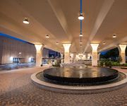
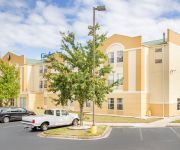
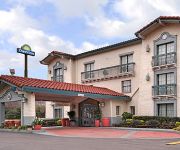
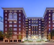
Looking for a place to stay? we compiled a list of available hotels close to the map centre further down the page.
When in this area, you might want to pay a visit to some of the following locations: Birmingham, Columbiana, Oneonta, Jasper and Cullman. To further explore this place, just scroll down and browse the available info.
Local weather forecast
Todays Local Weather Conditions & Forecast: 8°C / 47 °F
| Morning Temperature | 0°C / 32 °F |
| Evening Temperature | 8°C / 47 °F |
| Night Temperature | 7°C / 45 °F |
| Chance of rainfall | 1% |
| Air Humidity | 31% |
| Air Pressure | 1029 hPa |
| Wind Speed | Gentle Breeze with 7 km/h (4 mph) from North-East |
| Cloud Conditions | Broken clouds, covering 72% of sky |
| General Conditions | Moderate rain |
Thursday, 5th of December 2024
9°C (48 °F)
1°C (33 °F)
Moderate rain, gentle breeze, broken clouds.
Friday, 6th of December 2024
9°C (48 °F)
4°C (40 °F)
Few clouds, light breeze.
Saturday, 7th of December 2024
7°C (45 °F)
8°C (46 °F)
Overcast clouds, light breeze.
Hotels and Places to Stay
The Westin Birmingham
Sheraton Birmingham Hotel
Comfort Inn Birmingham - Irondale
Fairfield Inn & Suites Birmingham Fultondale/I-65
DAYS INN BIRMINGHAM WEST
Hampton Inn - Suites Birmingham-Downtown-Tutwiler
Hampton Inn Birmingham-Fultondale -I-65-
BW GARDENDALE
La Quinta Inn and Suites Fultondale Birmingham North
Holiday Inn BIRMINGHAM-AIRPORT
Videos from this area
These are videos related to the place based on their proximity to this place.
CampTalk Episode 7: DIY Camping Seat (on the cheap)
This is simple tutorial for making a comfortable light camping seat for $5. Questions or comments? http://forums.camptalk.net/viewtopic.php?f=1&t=39.
42nd Street! July 13-15 come see it!!!!!
Video created with the Socialcam app on iPhone: http://socialcam.com.
Fultondale doodles
This is what's left of Doodle's in Fultondale Alabama after the April 27th tornado.
City of Tarrant Quality of Life Award
" The Quality of Life Awards Program recognizes successful, innovative municipal projects that improve the quality of life for citizens and add value to the community by establishing partnerships...
Tragic City Rollers 7
Bama "Tha Hamma" Slamma's last practice with The Team To Beat In The Derby South shot by Ralph S. Mouse.
The Cambridge Plan Chapel Hills Neighborhood Fultondale, AL
This is the Cambridge Plan in Chapel Hills Neighborhood. A 3 BR 2 1/2 BA Home with an additional loft area that sits over the Dining Room and is open to the Great Room... Great Master Suite......
Block knife sharpener.proving it's the Best knife sharpener
Block knife Sharpener is still family owned business and made in the U.S.A. Many have tried to copy...
Sam baseball April 6 2014 - home run over right field fence
Sam's first out-of-the-park HR. USSSA tournament bracket game played in Fultondale, Alabama. Sam and the 10U Diamond Dawgs took on Vulcan Baseball and won 8-5. Go Dawgs!
Videos provided by Youtube are under the copyright of their owners.
Attractions and noteworthy things
Distances are based on the centre of the city/town and sightseeing location. This list contains brief abstracts about monuments, holiday activities, national parcs, museums, organisations and more from the area as well as interesting facts about the region itself. Where available, you'll find the corresponding homepage. Otherwise the related wikipedia article.
Jefferson County, Alabama
Jefferson County is the most populous county in the U.S. state of Alabama, with its county seat being located in Birmingham. As of the 2010 census, the population of Jefferson County was 658,466. Jefferson County is the principal and most populous county in the Birmingham metropolitan area.
Gardendale, Alabama
Gardendale is a city in Jefferson County, Alabama, United States, and a northern suburb of Birmingham. The population was 13,893 at the 2010 census.
Fultondale, Alabama
Fultondale is a city in Jefferson County, Alabama, United States and a northern suburb of Birmingham. As of the 2010 census, the population of the city is 8,380.
Tarrant, Alabama
Tarrant is a city in Jefferson County, Alabama, United States southeast of Fultondale. At the 2010 census the population was 6,397.
Birmingham–Shuttlesworth International Airport
See: Birmingham Air National Guard Base for the United States Air Force use of the airport Birmingham–Shuttlesworth International Airport, formerly Birmingham Municipal Airport and later Birmingham International Airport, is the major airport that serves Birmingham, Alabama and Central Alabama, United States. A joint civil-military facility, it is located five miles (8 km) northeast of downtown Birmingham, near the interchange of I-20 and I-59.
Birmingham-Hoover, AL Metropolitan Statistical Area
The Birmingham-Hoover, AL Metropolitan Statistical Area, also known as Greater Birmingham, is a metropolitan area composed of seven counties in central part of the U.S. state of Alabama centered around its primary city of Birmingham. The population of this metropolitan area as of the 2010 census was 1,128,047, making it the 49th largest metropolitan area in the United States according to the U.S. Census 2010.
Sheraton Birmingham
The Sheraton Birmingham is Alabama's largest convention hotel, featuring 757 rooms and suites adjacent to the Birmingham Jefferson Convention Complex (BJCC) in downtown Birmingham, Alabama. The 17-story hotel was built in two phases. The first opened in 1975 as the Hyatt House Birmingham Hotel, and along with the Parliament House, it was one of Birmingham's premier hotels of the Jet age, featuring 380 rooms, a luxurious rooftop restaurant, and a sumptious Presidential suite.
Southern Museum of Flight
The Southern Museum of Flight is an aviation museum located three blocks east of the Birmingham-Shuttlesworth International Airport in Birmingham, Alabama. It features a valuable collection of aviation artifacts spanning the 20th century in the various areas of aviation. It explores eight decades of winged history with both military and civil aircraft.
Fultondale High School
Fultondale High School is a public high school located in Birmingham, Alabama. 474 students attended the school in 2005. It is part of the Jefferson County School System. It was formed in the 1960s as New Castle High School and the mascot was the Knights until 1972, when the school was renamed Fultondale High School. The mascot was changed to the Wildcats, and the colors were changed to blue and orange.
Woodlawn High School (Birmingham, Alabama)
Woodlawn High School is a magnet high school serving about 800 students in the Woodlawn neighborhood of Birmingham, Alabama and is part of the Birmingham City Schools system. The mascot is the Colonels, and the school colors are green and gold. The school newspaper is "The Tattler". The principal is currently Fred Stewart.
Hayes High School (Birmingham, Alabama)
Carol W. Hayes High School was a public 9-12 high school in Birmingham, Alabama. It was closed after the 2007-08 school year.
Agnes (gallery)
Agnes was a Birmingham, Alabama photography gallery from 1993 to 2001. Shawn Boley, Jon Coffelt and Jan Hughes opened the gallery with the mission of attempting to raise awareness of social issues — such as cancer, AIDS, death and dying, the environment, homelessness, ethics, racism, classism, imprisonment — through photojournalism, film, video, poetry, and book arts. Controversial, Agnes was picketed on several occasions, one of which resulted in a USA Today article on December 5, 1994.
WYDE (AM)
WYDE is a radio station currently acting as a simulcast partner of WYDE-FM. It was formerly known as WLGD, an adult standards/oldies radio station that served Birmingham, Alabama, and nearly all of Jefferson County. The station was previously known on the air as "Legends 1260". The station is owned by Crawford Broadcasting Company. The transmitter for WYDE is located near the eastern edge of downtown Birmingham.
Birmingham Terminal Station
Birmingham Terminal Station, completed in 1909, was the principal railway station for Birmingham, Alabama until the 1950s. It was demolished in 1969 and its loss still serves as a rallying image for local preservationists.
WENN (AM)
WENN (1320 AM, simulcast on translator W297BF) is a radio station licensed to Birmingham, Alabama. Its daytime power is 5,000 watts, and at nighttime, it broadcasts at 111 watts. WENN-AM is a full-time affiliate of ESPN Radio. It is owned by Cox Radio, who also owns six other Birmingham stations.
Gardendale High School
Gardendale High School is a public high school located in Gardendale, Alabama, United States, operated by the Jefferson County Board of Education. The school's first graduating class was in 1968. Gardendale High School was developed in the mid-1960s as a result of population growth in the area. Until this time, local students mostly attended Mortimer Jordan High School in nearby Morris. The school mascot/nickname is "Rockets.
Roman Catholic Diocese of Birmingham in Alabama
The Roman Catholic Diocese of Birmingham in Alabama is a particular church of the Latin Rite of the Roman Catholic Church that encompasses the northern 39 counties of the U.S. state of Alabama. It was erected on December 9, 1969, when it was split from the Archdiocese of Mobile. The diocese is part of the ecclesiastical province of Mobile. EWTN's studios are located within the borders of the Diocese of Birmingham in Alabama.
Collegeville (Birmingham)
Collegeville is a city neighborhood in North Birmingham, Birmingham, Alabama, United States. It is the location of Bethel Baptist Church, a National Historic Landmark. It includes the neighborhoods of Acipco-Finley, Collegeville, Fairmont, Harriman Park, Hooper City, and Pratt City.
WXJC (AM)
WXJC (850 AM, "The Truth") is a radio station licensed to serve Birmingham, Alabama. The station is licensed to Kimtron, Inc. and owned by Crawford Broadcasting Company. It airs a Southern Gospel music and Talk radio format. The station has been assigned the WXJC call letters by the Federal Communications Commission since July 15, 2004.
Alabama International Auto Show
The Alabama International Auto Show is held each year at the Birmingham Jefferson Convention Complex, in Birmingham, Alabama. This event is organized by the Birmingham Automobile Dealers Association in the month of November. Hundreds of vehicles representing over 30 domestic and imported car and truck lines are on display across 230,000 square feet of exhibition space at the BJCC.
George Washington Carver High School (Birmingham, Alabama)
George Washington Carver High School for the Health Professions, Engineering, and Technology (CHS) is a four-year public high school within the city of Birmingham, Alabama, United States. It is one seven high schools in the Birmingham City Schools System. Carver High School serves grades 9-12. The CHS administration comprises principal Darrell Hudson along with assistant principals.
Carraway Methodist Medical Center
Carraway Methodist Medical Center was a medical facility in Birmingham, Alabama founded as Carraway Infirmary in 1908 by Dr. Charles N. Carraway. It was moved in 1917 to Birmingham's Norwood neighborhood. Its facilities were segregated according to skin color for much of its history and, in one instance, excluded James Peck, an injured white civil rights activist. This hospital was three miles from St. Vincent's.
Pennsylvania Central Airlines Flight 105
Pennsylvania Central Airlines Flight 105 was a regularly scheduled commercial flight between New York City and Birmingham, Alabama which crashed in the pre-dawn hours of January 6, 1946 while landing at Birmingham Municipal Airport, resulting in three fatalities. The accident is the only fatal recorded Part 121 (Air Carrier) accident at the airport.
Birmingham Air National Guard Base
See: Birmingham-Shuttlesworth International Airport for civil airport information Birmingham Air National Guard Base is the home of the United States Air Force 117th Air Refueling Wing.
Gardendale First Baptist Church
Gardendale First Baptist Church (sometimes styled as "Gardendale's") is a Southern Baptist megachurch in Gardendale, Alabama. The church's senior pastor is Dr. Kevin Hamm, a native of Bowling Green, Kentucky; he has served the church since 2006. The church is located on two campuses in Gardendale. The North Campus, which houses a 2,500-seat sanctuary and features a 125-foot white metal cross outside, is located near the Mount Olive Road interchange on Interstate 65.


