Safety Score: 2,7 of 5.0 based on data from 9 authorites. Meaning we advice caution when travelling to United States.
Travel warnings are updated daily. Source: Travel Warning United States. Last Update: 2024-08-13 08:21:03
Delve into Saddlewood
The district Saddlewood of Cotton Ridge in Jefferson County (Alabama) is a district located in United States about 643 mi south-west of Washington DC, the country's capital town.
In need of a room? We compiled a list of available hotels close to the map centre further down the page.
Since you are here already, you might want to pay a visit to some of the following locations: Birmingham, Oneonta, Columbiana, Talladega and Cullman. To further explore this place, just scroll down and browse the available info.
Local weather forecast
Todays Local Weather Conditions & Forecast: 12°C / 54 °F
| Morning Temperature | 4°C / 39 °F |
| Evening Temperature | 10°C / 50 °F |
| Night Temperature | 8°C / 46 °F |
| Chance of rainfall | 0% |
| Air Humidity | 51% |
| Air Pressure | 1021 hPa |
| Wind Speed | Light breeze with 5 km/h (3 mph) from South-East |
| Cloud Conditions | Few clouds, covering 12% of sky |
| General Conditions | Few clouds |
Sunday, 24th of November 2024
16°C (61 °F)
10°C (49 °F)
Sky is clear, light breeze, clear sky.
Monday, 25th of November 2024
21°C (70 °F)
18°C (65 °F)
Few clouds, gentle breeze.
Tuesday, 26th of November 2024
17°C (63 °F)
10°C (50 °F)
Light rain, gentle breeze, overcast clouds.
Hotels and Places to Stay
Holiday Inn Express & Suites BIRMINGHAM NE - TRUSSVILLE
Courtyard Birmingham Trussville
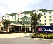
Hilton Garden Inn Birmingham-Trussville
Hampton Inn Birmingham-Trussville
Comfort Inn & Suites
Comfort Inn & Suites
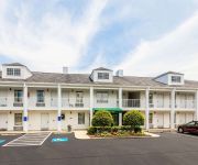
Quality Inn Trussville
SUPER 8 MOTEL - MOODY
BW PLUS BASS HOTEL SUITES
LEEDS-DAYS INN
Videos from this area
These are videos related to the place based on their proximity to this place.
Trussville Real Estate Agent: Trussville 2014 year in review
http://joshvernongroup.blogspot.com/2015/01/blog-post.html - This last year was a wild one in Trussville real estate. We saw interest rates remain around all-time lows throughout the year and...
Trussville Springs - Life Flows Within
Trussville Springs is a new village that is being built along the Cahaba River in Trussville. It will have a village center filled with shops and markets and new homes withink walking distance...
Emergency Roof Repair Trussville AL Call 205 686-4605
Are you looking for the best Trussville AL roofing company? Trussville AL Roofing is your best source to find all things roofing! We have the best roofing material selections and the highest...
Trussville Real Estate Agent: Do you need a good lender?
http://joshvernongroup.blogspot.com/2015/02/trussville-real-estate-agent-mortgage.html - Most buyers will make the mistake of searching for homes before they get their finances together. We...
Ice Storm Trussville AL January 28 2014
Driving through Highway 11 Trussville AL 2014 winter blizzard storm.
Trussville Real Estate Agent: Advantages to selling your home now
http://joshvernongroup.blogspot.com/2014/10/trussville-alabama-real-estate.html - What many people don't know is that the winter months are a great time to list your home. If you've been thinking...
Trussville Line Dance Day
Attendees of Jackie Tally's Trussville Line Day event perform It's Line Dance Day choreographed by Michele Burton.
Trussville AL Plumbers - Call 205 490-2676
Are you looking for a plumber in Trussville, AL? One you can really trust? We've helped hundreds of Trussville families with their plumbing needs. Our licensed, professional and experienced...
Exterminator Sound & Lighting at the Trussville Civic Center
This is a behind the scenes look at a birthday party we did at the Trussville Civic Center on Dec 12, 2008. It shows our new Mixmeister Control software and interface that we now use for mixing...
Alabama Masters Games 2014 - Line Dancing - Madison Starlighters
The Madison Starlighters compete in line dancing at the 2014 Alabama Masters Games with the line dance Fiesta La Bamba.
Videos provided by Youtube are under the copyright of their owners.
Attractions and noteworthy things
Distances are based on the centre of the city/town and sightseeing location. This list contains brief abstracts about monuments, holiday activities, national parcs, museums, organisations and more from the area as well as interesting facts about the region itself. Where available, you'll find the corresponding homepage. Otherwise the related wikipedia article.
Argo, Alabama
Argo is a town in Jefferson and St. Clair Counties in the U.S. state of Alabama. At the 2010 census the population was 4,071. Argo is located at {{#invoke:Coordinates|coord}}{{#coordinates:33|42|1|N|86|30|44|W|type:city | |name= }} (33.700210, -86.512357). According to the U.S. Census Bureau, the town has a total area of 12.3 square miles, of which, 12.2 square miles of it is land and 0.1 square miles of it (0.81%) is water.
Chalkville, Alabama
Chalkville is a former census-designated place in Jefferson County, Alabama, United States. At the 2000 census the population was 3,829. The area is now part of the city of Clay.
Clay, Alabama
Clay is a city in northeastern Jefferson County, Alabama, United States. It is part of the Birmingham–Hoover–Cullman Combined Statistical Area. Local government is run by a mayor and city council. Before incorporation on June 6, 2000, it was a census-designated place (CDP). The population was 9,708 at the 2010 census.
Center Point, Alabama
Center Point is a newly incorporated city and a former census-designated place (CDP) in northeastern Jefferson County, Alabama, United States. It is part of the Birmingham–Hoover Metropolitan Area. At the 2000 census the population was 22,784. However, after its incorporation in 2002, the city's boundaries are much smaller than those of the CDP. As of the 2010 census, the population of the incorporated city was 16,921. The public high school for Center Point is Center Point High School.
Grayson Valley, Alabama
Grayson Valley is an unincorporated community and census-designated place in Jefferson County, Alabama, United States. At the 2010 census the population was 5,736.
Leeds, Alabama
Leeds is a tri-county municipality located in Jefferson, St. Clair, and Shelby Counties in the U.S. state of Alabama. It is an eastern suburb of Birmingham. As of the 2010 census, the population of the city is 11,773.
Pinson, Alabama
Pinson is a city near Birmingham, Alabama, United States northwest from Center Point. As of the 2010 census, the population was 7,163.
Trussville, Alabama
Trussville is a city in Jefferson and St. Clair counties in the U.S. state of Alabama. The population was 19,933 at the 2010 census. Trussville was ranked as number 56 out of 100 in Money Magazine's Best Places to Live 2005.
Branchville, Alabama
Branchville is a town in St. Clair County, Alabama in the United States. As of the 2000 census, the population of the town is 825.
Margaret, Alabama
Margaret is a city in St. Clair County, Alabama, United States. At the 2000 census the population was 1,169. As of the 2010 census, the population is 4,428, an increase of 278.8%. Margaret became a city in October 2011.
Moody, Alabama
Moody is a city in St. Clair County, Alabama, United States. At the 2010 census the population was 11,726.
Huffman High School
Huffman High School is a secondary school located in Birmingham, Alabama. The school colors are orange and green. The school's athletic teams are known as the Vikings. The first graduating class of Huffman High School [1970 1970] had to attend classes at another Birmingham high school [Woodlawn Woodlawn] until the Huffman buildings were completed during the 1966-67 school year. The name of the original school yearbook was the Valhalla.
Barber Motorsports Park
The Barber Motorsports Park is a 740 acres multi-purpose racing facility located on the eastern fringes of Birmingham, Alabama, USA near Leeds. It was built by George Barber, and includes the Barber Vintage Motorsport Museum. It has been the site of the IndyCar Series Grand Prix of Alabama since 2010 season. Barber is also the home of the North American Porsche Driving School and the Kevin Schwantz Motorcycle School.
Clay-Chalkville High School
Clay-Chalkville High School (CCHS) is an United States high school which was established on August 14, 1996 in Clay, Alabama. The school is the largest of 17 high schools operated by the Jefferson County Board of Education, the second-largest of 127 school systems in the state of Alabama.
Hewitt-Trussville High School
Hewitt-Trussville High School is a high school located in Trussville, Alabama. The school was named after Robert Hewitt, who was school superintendent in 1869. Hewitt-Trussville has several varsity sports teams, including baseball, football, basketball, soccer, golf, wrestling, cross-country, indoor and outdoor track and field, cheerleading, and volleyball. The school also has several reputable electives and extra-curricular activities. The former R.G.
Irondale Middle School
Irondale Middle School is a public middle school located in Irondale, Alabama, USA. The school is operated by the Jefferson County Board of Education (Alabama). The school was established as Gresham Middle School in unincorporated Jefferson County, Alabama and was moved to its present location in Irondale in the fall of 2007, where its name was changed to Irondale Middle School. Irondale Middle serves grades 6-8.
WJSR
WJSR (91.1 FM, "91.1 The Edge") is a non-commercial educational College radio station licensed to serve Birmingham, Alabama, USA. The station is owned by Jefferson State Community College. It broadcasts a college radio format to the greater Birmingham area. WJSR is a student-run station which operates five days a week, Monday through Friday, when classes are in session. WJSR went on the air in 1979 operating as only 10 watts of effective radiated power.
Hewitt-Trussville Middle School
Hewitt-Trussville Middle School was founded in 1967, as a part of Jefferson County Schools. It is now a part of Trussville City Schools school system. Hewitt-Trussville Middle School(more commonly known as "HTMS") teaches students from grades sixth through eighth. Over the years, Hewitt-Trussville Middle School has become renowned for its outstanding academic education and quality teaching methods. The HTMS mascot is the husky, and HTMS has a heated rivalry with the Clay-Chalkville Cougars.
List of peaks named Bear Mountain
WURL
WURL is a radio station broadcasting a Southern Gospel music format, and has since its inception. Licensed to Moody, Alabama, USA, the station serves the eastern area of the Birmingham metropolitan area. The station is currently owned by The Bill Davidson Evangelistic Association.
WQOH (AM)
WQOH is a radio station licensed to the community of Irondale, Alabama, USA, and serving the greater Birmingham, Alabama, area. The station, which began broadcasting in 1960, is currently owned by Queen of Heaven Catholic Radio, Inc. It airs a Catholic radio format including some programming provided by EWTN.
Pinnacle at Tutwiler Farm
The Pinnacle at Tutwiler Farm is a 75-acre, 644,000 square feet, $100 million lifestyle center located in Trussville, Alabama, which opened on October 11, 2006. The center was developed by Colonial Properties on land previously distinguished by a rocky hillside. Nearby is the Colonial Promenade at Tutwiler Farm, which was also developed by Colonial Properties. Anchor tenants include Belk and JCPenney (who relocated their existing stores from Century Plaza).
Pinson Valley High School
Pinson Valley High School is a public high school located in Pinson, Alabama. It is a part of the Jefferson County Board of Education.
Center Point High School
Center Point High school is a public high school in Center Point, Alabama, serving grades 9-12 in the Jefferson County Board of Education (Alabama). Van Phillips is the principal, heading a faculty of 70 teachers responsible for instructing 1,216 students. The school replaces (and assumes the athletic history of) E.B. Erwin High School, which has been converted to a middle school.
WKRE
WKRE (88.1 FM, "Revocation Radio") is an American non-commercial educational radio station licensed to serve the community of Argo, Alabama. The station, established in 2011, is owned and operated by TBTA Ministries.


