Safety Score: 2,7 of 5.0 based on data from 9 authorites. Meaning we advice caution when travelling to United States.
Travel warnings are updated daily. Source: Travel Warning United States. Last Update: 2024-08-13 08:21:03
Delve into Avon Park
Avon Park in Jefferson County (Alabama) is located in United States about 656 mi (or 1,056 km) south-west of Washington DC, the country's capital town.
Current time in Avon Park is now 11:22 AM (Tuesday). The local timezone is named America / Chicago with an UTC offset of -6 hours. We know of 8 airports close to Avon Park, of which 3 are larger airports. The closest airport in United States is Birmingham-Shuttlesworth International Airport in a distance of 2 mi (or 2 km), North-East. Besides the airports, there are other travel options available (check left side).
Also, if you like playing golf, there are some options within driving distance. If you need a hotel, we compiled a list of available hotels close to the map centre further down the page.
While being here, you might want to pay a visit to some of the following locations: Birmingham, Columbiana, Oneonta, Jasper and Cullman. To further explore this place, just scroll down and browse the available info.
Local weather forecast
Todays Local Weather Conditions & Forecast: 4°C / 39 °F
| Morning Temperature | -0°C / 32 °F |
| Evening Temperature | 4°C / 39 °F |
| Night Temperature | 1°C / 35 °F |
| Chance of rainfall | 0% |
| Air Humidity | 34% |
| Air Pressure | 1036 hPa |
| Wind Speed | Gentle Breeze with 6 km/h (4 mph) from South |
| Cloud Conditions | Clear sky, covering 4% of sky |
| General Conditions | Sky is clear |
Tuesday, 3rd of December 2024
8°C (47 °F)
8°C (46 °F)
Moderate rain, gentle breeze, broken clouds.
Wednesday, 4th of December 2024
9°C (48 °F)
1°C (34 °F)
Moderate rain, gentle breeze, overcast clouds.
Thursday, 5th of December 2024
9°C (48 °F)
5°C (41 °F)
Few clouds, light breeze.
Hotels and Places to Stay
Grand Bohemian Hotel Mountain Brook Autograph Collection
The Westin Birmingham
Elyton Hotel Autograph Collection
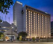
DoubleTree by Hilton Birmingham
Sheraton Birmingham Hotel
Redmont Hotel Birmingham Curio Collection by Hilton
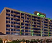
Holiday Inn BIRMINGHAM-AIRPORT
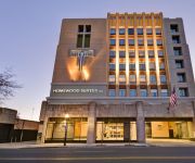
Homewood Stes Birmingham Dtwn
Independent (SPHC) HOTEL HIGHLAND DOWNTOWN
Hilton Garden Inn Downtown Birmingham
Videos from this area
These are videos related to the place based on their proximity to this place.
Landing in Snowy Birmingham, AL
This is vectors to final for an ILS RWY 6 into snowy KBHM. They wouldn't give me a visual approach because the official reported visibility was still too low following the snowstorm that had...
Alabama Tornado Outbreak - KMBX Base Reflectivity
Alabama Tornado Outbreak - KMBX Base Reflectivity Radar loop of the Alabama tornado outbreak as seen from the National Weather Service radar in Birmingham, Alabama.
Southwest Airlines 737-301 [N659SW] - BHM Landing
Southwest Airlines 737-301 landing on 6 at Birmingham-Shuttlesworth International Airport (BHM) on August 23, 2013 Shot from inside the cabin on a HTC One.
Time Lapse 6 : Birmingham to Baltimore on Southwest Airlines
Time lapse video of my flight from Birmingham, AL to Baltimore, MD on Southwest Airlines.
United Express 5810 - Morning Departure From Birmingham
Taking off on runway 24 at BHM, as seen from 19C aboard Expressjet's ERJ-145 N11544. We pass over downtown Birmingham before turning to the northeast, headed to Chicago.
FSX - Birmingham-Wolverhampton - Curtiss Reid MK III Rambler - By JMCV 2012
Microsoft Flight Simulator X Acceleration Pack EGBB Birmingham [Intl], Warwickshire, England, GB EGBO Wolverhampton [Halfpenny Green], Worcestershire, England, GB Flight : 22 Miles - 35 Km...
NS 3537 - NS A38 Ex BN SD40-2 Leader with RS3K
I made a trip to Birmingham, AL in March to meet with a couple of my good friends. This is NS A38 heading towards Norris Yard. Gotta love the consist on this one. The Ex BN leader still sports...
Salvation Army Christmas Donations
This commercial is an invitation to make donations to the Salvation Army during the Holiday season. I shot and edited this commercial for the Salvation Army in Central Alabama at WVTM Alabama's 13.
Something Old - Something New, or I Need A Change! 2 of 3
Something Old - Something New, or "I Need A Change!" (Rev. jr Finney, II) Rev. jr Finney, II 6/22/08 Covenant Community Church Birmingham An Inclusive C...
LED Display Matrix circuit board test by @redmountainmake
Follow this project as we build it here: http://www.redmountainmakers.org The LED display matrix project group tests one of the custom circuit boards and controllers with a couple of the...
Videos provided by Youtube are under the copyright of their owners.
Attractions and noteworthy things
Distances are based on the centre of the city/town and sightseeing location. This list contains brief abstracts about monuments, holiday activities, national parcs, museums, organisations and more from the area as well as interesting facts about the region itself. Where available, you'll find the corresponding homepage. Otherwise the related wikipedia article.
Birmingham–Shuttlesworth International Airport
See: Birmingham Air National Guard Base for the United States Air Force use of the airport Birmingham–Shuttlesworth International Airport, formerly Birmingham Municipal Airport and later Birmingham International Airport, is the major airport that serves Birmingham, Alabama and Central Alabama, United States. A joint civil-military facility, it is located five miles (8 km) northeast of downtown Birmingham, near the interchange of I-20 and I-59.
Altamont School
The Altamont School, located in Birmingham, Alabama atop Red Mountain, is a college preparatory day school with coeducational enrollment of grades 5-12. In 2005-2006, The Altamont School enrolled 425 students, with 188 in the Lower School and 237 in the Upper School. Most of the students live in Birmingham and the surrounding communities.
Woodlawn High School (Birmingham, Alabama)
Woodlawn High School is a magnet high school serving about 800 students in the Woodlawn neighborhood of Birmingham, Alabama and is part of the Birmingham City Schools system. The mascot is the Colonels, and the school colors are green and gold. The school newspaper is "The Tattler". The principal is currently Fred Stewart.
Hayes High School (Birmingham, Alabama)
Carol W. Hayes High School was a public 9-12 high school in Birmingham, Alabama. It was closed after the 2007-08 school year.
WYDE (AM)
WYDE is a radio station currently acting as a simulcast partner of WYDE-FM. It was formerly known as WLGD, an adult standards/oldies radio station that served Birmingham, Alabama, and nearly all of Jefferson County. The station was previously known on the air as "Legends 1260". The station is owned by Crawford Broadcasting Company. The transmitter for WYDE is located near the eastern edge of downtown Birmingham.
Collegeville (Birmingham)
Collegeville is a city neighborhood in North Birmingham, Birmingham, Alabama, United States. It is the location of Bethel Baptist Church, a National Historic Landmark. It includes the neighborhoods of Acipco-Finley, Collegeville, Fairmont, Harriman Park, Hooper City, and Pratt City.
Pennsylvania Central Airlines Flight 105
Pennsylvania Central Airlines Flight 105 was a regularly scheduled commercial flight between New York City and Birmingham, Alabama which crashed in the pre-dawn hours of January 6, 1946 while landing at Birmingham Municipal Airport, resulting in three fatalities. The accident is the only fatal recorded Part 121 (Air Carrier) accident at the airport.
Birmingham Air National Guard Base
See: Birmingham-Shuttlesworth International Airport for civil airport information Birmingham Air National Guard Base is the home of the United States Air Force 117th Air Refueling Wing.









!['Southwest Airlines 737-301 [N659SW] - BHM Landing' preview picture of video 'Southwest Airlines 737-301 [N659SW] - BHM Landing'](https://img.youtube.com/vi/1biExp4TeT0/mqdefault.jpg)


