Safety Score: 2,7 of 5.0 based on data from 9 authorites. Meaning we advice caution when travelling to United States.
Travel warnings are updated daily. Source: Travel Warning United States. Last Update: 2024-08-13 08:21:03
Delve into Sunset Mill Village
The district Sunset Mill Village of Selma in Dallas County (Alabama) is a district located in United States about 718 mi south-west of Washington DC, the country's capital town.
In need of a room? We compiled a list of available hotels close to the map centre further down the page.
Since you are here already, you might want to pay a visit to some of the following locations: Marion, Camden, Hayneville, Centreville and Prattville. To further explore this place, just scroll down and browse the available info.
Local weather forecast
Todays Local Weather Conditions & Forecast: 7°C / 44 °F
| Morning Temperature | -0°C / 31 °F |
| Evening Temperature | 5°C / 40 °F |
| Night Temperature | 1°C / 34 °F |
| Chance of rainfall | 0% |
| Air Humidity | 35% |
| Air Pressure | 1035 hPa |
| Wind Speed | Gentle Breeze with 6 km/h (3 mph) from South |
| Cloud Conditions | Clear sky, covering 4% of sky |
| General Conditions | Sky is clear |
Wednesday, 4th of December 2024
11°C (51 °F)
10°C (50 °F)
Light rain, light breeze, broken clouds.
Thursday, 5th of December 2024
12°C (53 °F)
4°C (40 °F)
Moderate rain, gentle breeze, overcast clouds.
Friday, 6th of December 2024
11°C (52 °F)
6°C (42 °F)
Scattered clouds, light breeze.
Hotels and Places to Stay
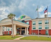
Holiday Inn Express & Suites SELMA
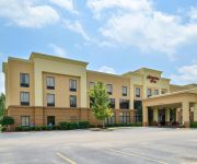
Hampton Inn Selma
BUDGET INN SELMA
Alabama Ramada Selma
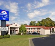
AMERICAS BEST VALUE INN
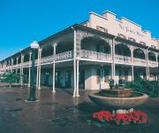
ST. JAMES HOTEL SELMA
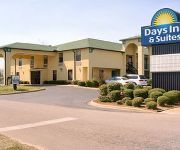
DAYS INN AND SUITES SELMA
Quality Inn Selma
Comfort Inn Selma
Videos from this area
These are videos related to the place based on their proximity to this place.
Selma Celebration 2015 (ver 2)
Another slideshow of images captured during the 50th Anniversary of the Voting Rights Act March from Selma to Montgomery.
Bruks Rockwood - Zilkha Biomass Woodyard Selma, Alabama
Bruks Rockwood was selected to provide complete engineering and equipment to receive and feed raw material to Zilkha's Black Wood pellet plant in Selma, AL. The following video is a compilation...
Selma Celebration 2015
Images captured during the 50th Anniversary of the Selma to Montgomery March (Bloody Sunday). Thanks to NAACP Legal Defense Fund for allowing me an opportunity to capture images from such a.
John Lewis in SELMA - UNCUT - 50th Anniversary of the March on Bloody Sunday
Tens of thousands roar on their feet with applause at first sight of Congressman John Lewis' arrival with President Obama and the entire First Family at the foot of the Edmund Pettus Bridge...
Selma 50th Anniversary - Martin Luther King, III giving remarks at Brown Chapel AME 3/8/15
Commemorating the 50th Anniversary of Bloody Sunday at Brown Chapel A.M.E. Church, Marty King shares his thoughts during this 8 minute clip. The event was historic as the church was full to...
The Selma Experience
Students from Catawba Valley Community College's African American History Class, Spring 2010 traveled to Selma, Alabama to participate in the 45th anniversary of events surrounding "Bloody...
Deepwoods racing - March 1, 2010 -Testing the Chevy II in Selma
Nitrous Pass- Dallas County Dragway (Selma, Alabama) - Watch the dude at the burnout box.
Selma Brain injury Lawyers | Brain injury Lawsuit in Selma CA
Selma brain injury lawyers http://www.aggressive-accident-lawyers.com/california-accident-lawyers/ helping people file brain injury related lawsuits for over 30 years. If you have you have...
Videos provided by Youtube are under the copyright of their owners.
Attractions and noteworthy things
Distances are based on the centre of the city/town and sightseeing location. This list contains brief abstracts about monuments, holiday activities, national parcs, museums, organisations and more from the area as well as interesting facts about the region itself. Where available, you'll find the corresponding homepage. Otherwise the related wikipedia article.
Dallas County, Alabama
Dallas County is a county of the U.S. state of Alabama. Its name is in honor of United States Secretary of the Treasury Alexander J. Dallas. The county seat is Selma.
Selma, Alabama
Selma is a city in and the county seat of Dallas County, Alabama, United States, located on the banks of the Alabama River. The population was 20,756 at the 2010 census. The city is best known for the 1965 Selma Voting Rights Movement and its Selma to Montgomery marches, three civil rights marches that began in the city.
Selmont-West Selmont, Alabama
Selmont-West Selmont is a census-designated place (CDP) in Dallas County, Alabama, United States. At the 2010 census the population was 2,671.
Battle of Selma
The Battle of Selma was a military engagement near the end of the American Civil War. It was fought in Selma, Alabama, on April 2, 1865. Union Army forces under Major General James H. Wilson defeated a smaller Confederate Army force under Lieutenant General Nathan Bedford Forrest. On March 22, 1865, Wilson led three divisions of Union cavalry, totalling 13,500 men, on a raid from Gravelly Springs, deep into largely untouched southern Alabama.
Cahaba Prison
Cahaba Prison, also known as Castle Morgan, was a prisoner of war camp in Alabama where the Confederacy held captive Union soldiers during the American Civil War. The prison was located in the small Alabama town of Cahaba, at the confluence of the Alabama and Cahaba Rivers, not far from Selma.
Selma University
Selma University is a private, historically black, Bible college located in Selma, Alabama, United States. It is affiliated with the Alabama State Missionary Baptist Convention.
National Register of Historic Places listings in Dallas County, Alabama
This is a list of the National Register of Historic Places listings in Dallas County, Alabama. This is intended to be a complete list of the properties and districts on the National Register of Historic Places in Dallas County, Alabama, United States. Latitude and longitude coordinates are provided for many National Register properties and districts; these locations may be seen together in a Google map.
Craig Air Force Base
For the civilian use of this facility after 1977, see Craig Field Airport and Industrial Complex Craig Air Force Base near Selma, Alabama, was a U.S. Air Force Undergraduate Pilot Training (UPT) base that closed in 1977. As an active air force base, Craig had two 8,000-foot parallel runways, a large aircraft parking ramp and several large maintenance hangars. Today the facility is a civilian airport known as Craig Field Airport and Industrial Complex .
Bloch Park
Bloch Park is a baseball stadium in Selma, Alabama, United States. The Selma Cloverleafs of the independent Southeastern League of Professional Baseball played here before folding prior to the 2003 season. Professional baseball was also played here in the 1940s-60s as part of the Alabama-Florida League. Then venue was also home to the summer collegiate Selma Toros from 2002-2005. The team will resume play in May of 2013.
WDXX
WDXX (100.1 FM, "Fuzion 100") is a radio station licensed to serve Selma, Alabama, USA. The station is owned by Broadsouth Communications, Inc. It airs an adult hits format and features programming from Premiere Radio Networks. The station was assigned the WDXX call letters by the Federal Communications Commission on July 1, 1989. On August 26, 2012 WDXX changed their format from country to adult hits, branded as "Fuzion 100".
WHBB
WHBB is a radio station licensed to serve Selma, Alabama, USA. The station is owned by Broadsouth Communications, Inc. WHBB serves the greater Central Alabama region with a 1,000 watt signal at 1490 kHz.
WJAM
WJAM is a radio station licensed to serve Selma, Alabama, USA. Originally launched in 1946, the station is currently owned by Scott Communications, Inc. , and the WJAM broadcast license is held by Scott Communications, Inc.
Craig Field Airport
Craig Field is a public-use airport located four nautical miles (4.6 mi, 7.4 km) southeast of the central business district of Selma, a city in Dallas County, Alabama, United States. The airport is owned by Craig Field Airport & Industrial Authority. It is included in the FAA's National Plan of Integrated Airport Systems for 2011–2015, which categorized it as a general aviation facility.
Summerfield, Alabama
Summerfield is an unincorporated community in Dallas County, Alabama. Summerfield has one historic district included on the National Register of Historic Places, the Summerfield District. Most of the community was annexed into Valley Grande following its incorporation as a city in 2003.
Sardis, Alabama
Sardis is an unincorporated community in Dallas County, Alabama. Sardis has one site included on the National Register of Historic Places, the J. Bruce Hain House.
Tyler, Alabama
Tyler is an unincorporated community in Dallas County, Alabama.
Beloit, Alabama
Beloit is an unincorporated community in Dallas County, Alabama.
Parrish High School
Parrish High School is a secondary education public school located in Parrish, Alabama and is a part of the Walker County School System.
Selma High School
Selma High School is a public secondary school in Selma, Alabama, USA, the only public high school Selma City School System.
Centenary Institute (Alabama)
Centenary Institute was a school in Summerfield, Alabama operated by the Methodist Episcopal Church, South from 1829 until the 1880s. The Centenary Institute was founded in 1829 as Valley Creek Academy, a local school, but was turned over to the Methodist Episcopal Church in 1838. In celebration of the centennial of Methodism, the school was renamed the "Centenary Institute". A. H. Mitchell served as president of the Institute from 1843 until 1856.
Selma Mall
Selma Mall is an enclosed shopping mall located in Selma, Alabama. The mall's anchor stores are J. C. Penney, Belk, Goody's and Citi Trends. The mall opened in 1971 with Sears, Britt's (a division of J.J. Newberry) and S.H. Kress as its major stores. By the 1990s, Kress had become McCrory Stores, and Beall-Ladymon had joined as a central anchor. Sears closed in 1993 and became McRae's (now part of Belk) three years later.
Edmund Pettus Bridge
The Edmund Pettus Bridge is a bridge that carries U.S. Highway 80 across the Alabama River in Selma, Alabama. Built in 1940, it is named for Edmund Winston Pettus, a former Confederate brigadier general and U.S. Senator from Alabama. The bridge is a steel through arch bridge with a central span of 250 feet .
Wallace Community College Selma
George Corley Wallace State Community College (referred to as Wallace Community College Selma or WCCS) is a community college in Selma, Alabama. As of the Fall 2010 semester, WCCS has an enrollment of 1,938 students. The college was founded in 1963. WCCS fields baseball and basketball teams as a member of the Alabama Community College Conference of the National Junior College Athletic Association.
Skyharbor Airport
Skyharbor Airport is a privately owned, public-use airport in Dallas County, Alabama, United States. Is it located five nautical miles southwest of the central business district of Selma, Alabama.
Selma Municipal Airport
Selma Municipal Airport, also known as Selma Selfield Airport, was an airport located 8 kilometres east-northeast of Selma, Alabama.


