Safety Score: 2,7 of 5.0 based on data from 9 authorites. Meaning we advice caution when travelling to United States.
Travel warnings are updated daily. Source: Travel Warning United States. Last Update: 2024-08-13 08:21:03
Delve into West Point
West Point in Cullman County (Alabama) with it's 593 habitants is located in United States about 637 mi (or 1,025 km) south-west of Washington DC, the country's capital town.
Current time in West Point is now 05:57 PM (Tuesday). The local timezone is named America / Chicago with an UTC offset of -6 hours. We know of 10 airports close to West Point, of which 5 are larger airports. The closest airport in United States is Huntsville International Carl T Jones Field in a distance of 29 mi (or 47 km), North. Besides the airports, there are other travel options available (check left side).
Also, if you like playing golf, there are some options within driving distance. We encountered 3 points of interest near this location. If you need a hotel, we compiled a list of available hotels close to the map centre further down the page.
While being here, you might want to pay a visit to some of the following locations: Cullman, Decatur, Moulton, Double Springs and Jasper. To further explore this place, just scroll down and browse the available info.
Local weather forecast
Todays Local Weather Conditions & Forecast: 24°C / 74 °F
| Morning Temperature | 18°C / 65 °F |
| Evening Temperature | 23°C / 73 °F |
| Night Temperature | 19°C / 66 °F |
| Chance of rainfall | 0% |
| Air Humidity | 68% |
| Air Pressure | 1016 hPa |
| Wind Speed | Moderate breeze with 11 km/h (7 mph) from North-West |
| Cloud Conditions | Broken clouds, covering 83% of sky |
| General Conditions | Light rain |
Tuesday, 5th of November 2024
25°C (77 °F)
19°C (66 °F)
Light rain, gentle breeze, overcast clouds.
Wednesday, 6th of November 2024
22°C (71 °F)
20°C (67 °F)
Light rain, moderate breeze, overcast clouds.
Thursday, 7th of November 2024
19°C (66 °F)
19°C (66 °F)
Moderate rain, gentle breeze, overcast clouds.
Hotels and Places to Stay
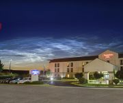
Hampton Inn Cullman
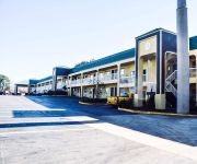
BEST WESTERN FAIRWINDS INN
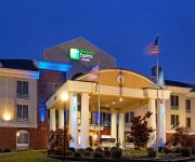
Holiday Inn Express & Suites CULLMAN
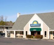
DAYS INN CULLMAN
Sleep Inn & Suites
Super 8 Cullman
Videos from this area
These are videos related to the place based on their proximity to this place.
1984 Pontiac Fiero #00623D in Cullman - Birmingham, AL
http://www.autotrader.com/ida/billsmithpontiacbuickgmc If you are looking for real value on a great used car, Bill Smith Automotive invites you to come in and test drive this 1984 Pontiac Fiero,...
2013 Chrysler Town & Country Used Cars Cullman AL
http://www.billsmithbuickgmc.net This 2013 Chrysler Town & Country is available from Bill Smith Buick GMC Preowned. For details, call us at 256-595-2133.
264 Sherrill Street, Cullman AL
For more details click here: http://www.visualtour.com/showvt.asp?t=3021158 264 Sherrill Street Cullman, AL 35058 $225000, 4 bed, 3.0 bath, 3900 SF, MLS# 4...
CSX Q647-30 climbs the grade at Vinemont, AL - December 31, 2011
CSX Q647-30 grinds up the grade at Vinemont, AL with a single pusher locomotive on the rear. Running at not much more than a fast walking speed, the train grinds towards the summit which is...
Crooked Creek Civil War Museum Cabin
Fred Wise Owner of Crooked Creek Civil War Museum takes us on a quick tour of a cabin from the 1820`s.
Videos provided by Youtube are under the copyright of their owners.
Attractions and noteworthy things
Distances are based on the centre of the city/town and sightseeing location. This list contains brief abstracts about monuments, holiday activities, national parcs, museums, organisations and more from the area as well as interesting facts about the region itself. Where available, you'll find the corresponding homepage. Otherwise the related wikipedia article.
West Point, Alabama
West Point is a town in Cullman County, Alabama, United States. At the 2000 census the population was 295.
Clarkson–Legg Covered Bridge
The Clarkson–Legg Covered Bridge is a county-owned wooden covered bridge that spans Crooked Creek in Cullman County, Alabama, United States. It is located at Clarkson Covered Bridge Park on Central Road (CR 1043) off U.S. Route 278 near the community of Bethel, about 15 miles (24 km) west of Cullman. Coordinates are {{#invoke:Coordinates|coord}}{{#coordinates:34|12|27.08|N|86|59|27.35|W|type:city | |name= }}, or 34.207522, -86.990931.


