Safety Score: 2,7 of 5.0 based on data from 9 authorites. Meaning we advice caution when travelling to United States.
Travel warnings are updated daily. Source: Travel Warning United States. Last Update: 2024-08-13 08:21:03
Explore Hendrix
Hendrix in Blount County (Alabama) is a city in United States about 621 mi (or 1,000 km) south-west of Washington DC, the country's capital.
Local time in Hendrix is now 05:29 AM (Thursday). The local timezone is named America / Chicago with an UTC offset of -6 hours. We know of 8 airports in the vicinity of Hendrix, of which 4 are larger airports. The closest airport in United States is Birmingham-Shuttlesworth International Airport in a distance of 37 mi (or 60 km), South-West. Besides the airports, there are other travel options available (check left side).
Also, if you like golfing, there are multiple options in driving distance. We found 4 points of interest in the vicinity of this place. If you need a place to sleep, we compiled a list of available hotels close to the map centre further down the page.
Depending on your travel schedule, you might want to pay a visit to some of the following locations: Oneonta, Guntersville, Cullman, Gadsden and Birmingham. To further explore this place, just scroll down and browse the available info.
Local weather forecast
Todays Local Weather Conditions & Forecast: 10°C / 50 °F
| Morning Temperature | 4°C / 39 °F |
| Evening Temperature | 7°C / 44 °F |
| Night Temperature | 4°C / 40 °F |
| Chance of rainfall | 0% |
| Air Humidity | 34% |
| Air Pressure | 1015 hPa |
| Wind Speed | Fresh Breeze with 14 km/h (9 mph) from South-East |
| Cloud Conditions | Clear sky, covering 0% of sky |
| General Conditions | Sky is clear |
Thursday, 21st of November 2024
8°C (46 °F)
4°C (40 °F)
Sky is clear, moderate breeze, few clouds.
Friday, 22nd of November 2024
11°C (53 °F)
6°C (43 °F)
Broken clouds, gentle breeze.
Saturday, 23rd of November 2024
16°C (61 °F)
10°C (49 °F)
Sky is clear, gentle breeze, clear sky.
Hotels and Places to Stay
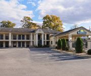
DAYS INN - ONEONTA AL
Videos from this area
These are videos related to the place based on their proximity to this place.
Dump Trailer in Action
Unloading 37 Sq of shingles at the landfill, using a hydraulic 14 Ft long goose neck trailer. Was a little bit over 8000 pounds of debris.
My new coupon binder
I just transferred over from a coupon/check file to a 3 ring binder. So far it's been awesome. You can visit my frugalicious blog at http://fabulouslyfrugalicious.blogspot.com.
Alabama is on a boat
Local crack head explaining how the state of Alabama is actually a boat and he is the captain of this ship. Waiting for the right time to send the illegal im...
Boaz Offense Tries to Get Going
The offense of the Pirates tries to head down the field. Lincolns defense allows a reception by Joel Dixon, but Boaz eventually punts.
2002 Dodge Caravan Used Cars Snead AL
http://www.brownskar3.com This 2002 Dodge Caravan is available from Browns Kar Mart. For details, call us at 205-466-7111.
2002 Ford F-150 Used Cars Snead AL
http://www.brownskar3.com This 2002 Ford F-150 is available from Browns Kar Mart. For details, call us at 205-466-7111.
Horton Mill Covered Bridge
It was a cloudy, overcast day, but I did have some luck. As I was using the DJI Phantom to do some video of Horton Mill Covered Bridge, three couples drove u...
Videos provided by Youtube are under the copyright of their owners.
Attractions and noteworthy things
Distances are based on the centre of the city/town and sightseeing location. This list contains brief abstracts about monuments, holiday activities, national parcs, museums, organisations and more from the area as well as interesting facts about the region itself. Where available, you'll find the corresponding homepage. Otherwise the related wikipedia article.
Horton Mill Covered Bridge
The Horton Mill Covered Bridge is a state owned wooden covered bridge that spans the Calvert Prong of the Little Warrior River in Blount County, Alabama, United States. It is located on a river crossover (Horton Mill Road) to Ebell Road and Covered Bridge Circle off State Route 75 about 5 miles (8 kilometers) north of the city of Oneonta. Coordinates are {{#invoke:Coordinates|coord}}{{#coordinates:34|00|27.52|N|86|26|55.05|W|type:city | |name= }} (34.007644, -86.448625).


