Address & Contact
Contact Information:
Wikipedia page
GPS Coordinates:
Longitude: -96,765°
Latitude: 39,055°
Summary
Marshall Army Air Field is a large airport in United States, serving the region of Fort Riley(Junction City). The longest runway is 4.500 feet or 1.372 meters long.
Facts:
Airport size: medium airport Serving area: Fort Riley(Junction City) Longest runway: 4500 (ft)
Codes:
IATA: FRI,
ICAO: KFRI
Flight information:
Departure times (FlightStats)
Flight times (FlightRadar24)
Location on map
Show bigger map on Openstreetmap
About the airport
Marshall Army Air Field (FRI), with the IATA code "FRI" and the ICAO code "KFRI," is a military airport located in the United States. Situated in Marshall, Missouri, this airport serves as a vital hub for military operations and training exercises. While primarily used by the United States Army, it also supports limited civilian air traffic.
FRI boasts a single asphalt runway, capable of accommodating various aircraft sizes. The airport offers essential facilities and services, including a passenger terminal, aircraft maintenance facilities, and fueling stations. However, it is important to note that FRI does not provide commercial passenger services, making it inaccessible for regular travelers.
For those planning a trip, it is crucial to consider alternative nearby airports that cater to civilian air travel. The closest options include Kansas City International Airport (MCI), approximately 100 miles west of Marshall, and Columbia Regional Airport (COU), located around 70 miles east. These airports offer a wide range of domestic and international flights, ensuring convenient travel options for your journey.
Hotels and places to stay
Courtyard Junction City
Address
Distance: 4,0 mi
310 Hammons Dr.
66441 Junction City
United States
Time Information
Checkout: 12:00 - Checkin: 15:00
Reception
Weekday: -
Weekend:
closed
Grand View Plaza Inn & Suites
Address
Distance: 2,6 mi
110 East Flint Hills Boulevard
66441 Junction City
United States
Time Information
Checkout: 11:00 - Checkin: 15:00
Reception
Weekday: -
Weekend:
closed
Rodeway Inn
Address
Distance: 3,3 mi
1001 E 6st
66441 Junction City
United States
Time Information
Checkout: - Checkin:
Reception
Weekday: -
Weekend:
closed
Candlewood Suites JUNCTION CITY/FT. RILEY
Address
Distance: 3,9 mi
100 S. Hammons Dr.
66441 JUNCTION CITY
United States
Time Information
Checkout: 12:00 - Checkin: 15:00
Reception
Weekday: -
Weekend:
closed
WOODSPRING SUITES JUNCTION CIT
Address
Distance: 4,3 mi
311 EAST ASH
66441 Junction City
United States
Time Information
Checkout: 11:00 - Checkin: 15:00
Reception
Weekday: -
Weekend:
closed
GREAT WESTERN INN
Address
Distance: 2,6 mi
201 CONTINENTAL DRIVE
66441 Junction City
United States
Time Information
Checkout: 11:00 - Checkin: 13:00
Reception
Weekday: -
Weekend:
closed
Econo Lodge Junction City
Address
Distance: 2,8 mi
211 W Flint Hills Blvd
66441-4349 Junction City
United States
Time Information
Checkout: - Checkin: 15:00
Reception
Weekday: -
Weekend:
closed
BEST WESTERN J C INN
Address
Distance: 3,9 mi
604 EAST CHESTNUT STREET
66441 Junction City
United States
Time Information
Checkout: 11:00 - Checkin: 15:00
Reception
Weekday: -
Weekend:
closed
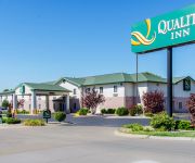
Quality Inn Near Fort Riley
Address
Distance: 4,0 mi
305 East Chestnut
66441 Junction City
United States
Time Information
Checkout: 11:00 - Checkin: 15:00
Reception
Weekday: -
Weekend:
closed
Comfort Inn & Suites Junction City
Address
Distance: 4,3 mi
221 East Ash Street
66441 Junction City
United States
Time Information
Checkout: 11:00 - Checkin: 14:00
Reception
Weekday: -
Weekend:
closed


