Safety Score: 3,0 of 5.0 based on data from 9 authorites. Meaning we advice caution when travelling to United Kingdom.
Travel warnings are updated daily. Source: Travel Warning United Kingdom. Last Update: 2024-08-13 08:21:03
Discover Gyfelia
Gyfelia in Wrexham (Wales) is a town in United Kingdom about 159 mi (or 257 km) north-west of London, the country's capital city.
Current time in Gyfelia is now 09:29 PM (Sunday). The local timezone is named Europe / London with an UTC offset of zero hours. We know of 8 airports near Gyfelia, of which 3 are larger airports. The closest airport in United Kingdom is Hawarden Airport in a distance of 12 mi (or 20 km), North. Besides the airports, there are other travel options available (check left side).
There are several Unesco world heritage sites nearby. The closest heritage site in United Kingdom is Pontcysyllte Aqueduct and Canal in a distance of 4 mi (or 7 km), South-East. Also, if you like playing golf, there are a few options in driving distance. Looking for a place to stay? we compiled a list of available hotels close to the map centre further down the page.
When in this area, you might want to pay a visit to some of the following locations: Wrexham, Overton, Brymbo, Hope and Whittington. To further explore this place, just scroll down and browse the available info.
Local weather forecast
Todays Local Weather Conditions & Forecast: 8°C / 47 °F
| Morning Temperature | 7°C / 44 °F |
| Evening Temperature | 7°C / 44 °F |
| Night Temperature | 7°C / 45 °F |
| Chance of rainfall | 2% |
| Air Humidity | 81% |
| Air Pressure | 1015 hPa |
| Wind Speed | Moderate breeze with 10 km/h (6 mph) from South-East |
| Cloud Conditions | Broken clouds, covering 76% of sky |
| General Conditions | Light rain |
Monday, 18th of November 2024
7°C (44 °F)
1°C (35 °F)
Moderate rain, gentle breeze, overcast clouds.
Tuesday, 19th of November 2024
2°C (35 °F)
-1°C (30 °F)
Snow, gentle breeze, broken clouds.
Wednesday, 20th of November 2024
3°C (38 °F)
1°C (33 °F)
Rain and snow, gentle breeze, few clouds.
Hotels and Places to Stay
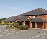
Moreton Park
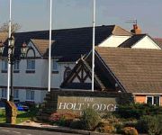
Holt Lodge
TRAVELODGE WREXHAM
Lemon Tree
Wrexham North (A483)
Wrexham Town Centre
Videos from this area
These are videos related to the place based on their proximity to this place.
Welcome To Wrexham 1989 | Wrexham.com
Wrexham.com has been working with local DVD & video production company Knew Productions to revive a selection of historic community videos of Wrexham and the surrounding area. To discuss this.
Wrexham TV interviews Arfon Jones on Fracking
Arfon Jones, Wrexham County Borough Councillor, spoke to Wrexham TV recently about the plans in Wrexham for unconventional gas extraction. He covers a brief timeline of events in the area,...
Oliver Knott Aquascaping Demo at the Green Machine - Wrexham (17/9/2009)
A quick step by step run through of Oliver Knotts demo on a 120cm tank at the Green Machine in Wrexham, UK on 17th September 2009 Full write up of the event can be found on the ukaps.org...
Wrexham Council Call In Plas Madoc Decision (Historic First Video!)
Wrexham.com requested permission to video record todays meeting at the Guildhall - for the first time a chairman said yes! Councillor Steve Wilson of Rhosddu representing the Grosvenor ward...
Olympic Torch 2012 at Wrexham 30th May - Tom dancing
Tom (Thomas Hughes Lloyd) dancing at the Olympic Torch 2012 Relay at Llwyn Isaf, Wrexham whilst the torch was at Wrexham.
Fingerprint Jewellery | Fingerprint Jewellery, Wrexham.
Fingerprint Jewellery is available from http://www.woollywhale.co.uk Fingerprint jewellery is your loved ones fingerprint captured using food grade, child safe silicone putty then cast into...
The Chirk Aqueduct, Chirk, Wrexham - Royal Commission Animation
Traphont Ddŵr y Waun, Y Waun, Wrecsam - Animeiddiad gan y Comisiwn Brenhinol Model 3D hedfan-o-gwmpas o ran o Draphont Ddŵr y Waun ar Gamlas Llangollen sy'n esbonio'r adeiladwaith.
Jodie Marie - What Would It Take live at St. Giles' Church, Wrexham 19-04-12
Jodie Marie plays What Would It Take live at St.Giles' Parish Church Wrexham on 19th April 2012 as part of Focus Wales 2012 http://jodiemarie.co.uk/ http://www.youtube.com/user/JodieMarieVEVO.
Chester City Fans singing at Wrexham train station
Chester fans singing at Wrexham train station whilst getting off the train/ walking out the station waiting for the police escort.
Videos provided by Youtube are under the copyright of their owners.
Attractions and noteworthy things
Distances are based on the centre of the city/town and sightseeing location. This list contains brief abstracts about monuments, holiday activities, national parcs, museums, organisations and more from the area as well as interesting facts about the region itself. Where available, you'll find the corresponding homepage. Otherwise the related wikipedia article.
Wrexham Maelor
Wrexham Maelor was one of six local government districts of the county of Clwyd, north-east Wales, from 1974 to 1996. It was formed from parts of the administrative counties of Denbighshire and Flintshire. From Denbighshire came the municipal borough of Wrexham and Wrexham Rural District. From Flintshire came Maelor Rural District and the parish of Marford and Hoseley from Hawarden Rural District. The Flintshire areas had been exclaves, separated from the rest of the county by Denbighshire.
St Joseph's Catholic & Anglican High School
St Joseph's is a secondary school in Wrexham, Wales, located on Sontley Road.
Erddig
Erddig Hall is a National Trust property on the outskirts of Wrexham, Wales. Located 2 miles south of Wrexham town centre, it was built in 1684–1687 for Joshua Edisbury, the High Sheriff of Denbighshire; it was designed in 1683 by Thomas Webb (- 1699), 'freemason', of Middlewich, Cheshire. Erddig is one of the country's finest stately homes - in September 2007 it was voted the UK's "favourite Historic House" and the "8th most popular historic site" in the UK by Britain's Best.
Wat's Dyke
Wat's Dyke is a 40 mile (64 km) earthwork running through the northern Welsh Marches from Basingwerk Abbey on the River Dee estuary, passing to the east of Oswestry and onto Maesbury in Shropshire, England. It runs generally parallel to Offa's Dyke, sometimes within a few yards but never more than three miles away.
Wynnville Halt railway station
Wynnville Halt was a small railway station located on the Shrewsbury to Chester Line less than a mile north of Ruabon in Wales. It was opened by the Great Western Railway in the nineteen thirties as part of its programme of opening halts to combat emerging competition from bus services.
Johnstown and Hafod railway station
Johnstown & Hafod was a minor station on the Great Western Railway's London to Birkenhead main line. Although the station is gone the railway is still open today as part of the Shrewsbury to Chester Line. The station was situated on the extreme east side of Johnstown and served both there and the adjoining settlement of Rhosllanerchrugog in Wales.
Bersham Colliery
Bersham Colliery was a large coal mine located near Rhostyllen in Wrexham County Borough, Wales. The mine accessed seams found in the Denbighshire Coalfield.
Marchwiel Hall
Marchwiel Hall is a Grade II listed building in the village of Marchwiel, Denbighshire in North Wales.


