Safety Score: 3,0 of 5.0 based on data from 9 authorites. Meaning we advice caution when travelling to United Kingdom.
Travel warnings are updated daily. Source: Travel Warning United Kingdom. Last Update: 2024-08-13 08:21:03
Discover Llangan
Llangan in Vale of Glamorgan (Wales) is a place in United Kingdom about 145 mi (or 234 km) west of London, the country's capital city.
Current time in Llangan is now 09:06 AM (Friday). The local timezone is named Europe / London with an UTC offset of zero hours. We know of 8 airports near Llangan, of which 3 are larger airports. The closest airport in United Kingdom is MOD St. Athan in a distance of 6 mi (or 10 km), South-East. Besides the airports, there are other travel options available (check left side).
There are several Unesco world heritage sites nearby. The closest heritage site in United Kingdom is Blaenavon Industrial Landscape in a distance of 32 mi (or 52 km), North-East. Also, if you like playing golf, there is an option about 18 mi (or 29 km). away. We encountered 1 points of interest in the vicinity of this place. If you need a hotel, we compiled a list of available hotels close to the map centre further down the page.
While being here, you might want to pay a visit to some of the following locations: Penllyn, Wick, Bridgend, Merthyr Mawr and Llantrisant. To further explore this place, just scroll down and browse the available info.
Local weather forecast
Todays Local Weather Conditions & Forecast: 9°C / 48 °F
| Morning Temperature | 5°C / 41 °F |
| Evening Temperature | 7°C / 45 °F |
| Night Temperature | 6°C / 44 °F |
| Chance of rainfall | 0% |
| Air Humidity | 79% |
| Air Pressure | 1028 hPa |
| Wind Speed | Light breeze with 4 km/h (2 mph) from South-East |
| Cloud Conditions | Few clouds, covering 14% of sky |
| General Conditions | Few clouds |
Saturday, 16th of November 2024
10°C (51 °F)
8°C (46 °F)
Light rain, moderate breeze, overcast clouds.
Sunday, 17th of November 2024
9°C (48 °F)
6°C (43 °F)
Light rain, moderate breeze, broken clouds.
Monday, 18th of November 2024
6°C (42 °F)
12°C (53 °F)
Moderate rain, fresh breeze, overcast clouds.
Hotels and Places to Stay
Ewenny Farm Guesthouse
Coed-Y-Mwstwr
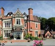
Best Western Heronston Hotel & Spa
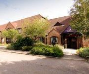
TRAVELODGE BRIDGEND PENCOED
Days Inn Bridgend Cardiff Welcome Break Service Area
J35) Bridgend (M4
The Bear Hotel Cowbridge
La Grisa
Bridgend Central
Videos from this area
These are videos related to the place based on their proximity to this place.
Cardiff Morris dance Y Goron in Penllyn, 29th May 2012.
Y Goron - The Crown. A crown is a kind of collective noun for a group of sonnets, only it's a little more complicated than that. To be considered a crown the...
PAINT BAILING; TASK FORCE COWBRIDGE
I THINK MY GO PRO FELL DOWN AS I WAS RUNNING PLEASE SUBSCRIBE AND LEAVE A LIKE ;)
Minecraft Xbox360 City of Ruin Hunger Games w/Download
Hope you enjoy this amazing map and please give a like and a subscribe. Download Link:http://www.mediafire.com/?9bs1ydmgnjveikw Submit a Map: http://mcdn360.com/map-submission/
Minecraft Xbox360 City Of Life Hunger Games w/Download
Hope you like this awesome map and please leave a like and a subscribe. Download Link: http://www.mediafire.com/?b4b70amnhx3uehm Submit a Map: http://mcdn360.com/map-submission/
Minecraft Xbox360 Trinity City V.2 Hunger Games w/Download
This is a map made by Halo Pyromaniac and his mod team so hope you enjoy this map and give a like and a subscribe. Download Link: http://www.mediafire.com/?5pym239iwulxp63 Submit a Map: ...
Videos provided by Youtube are under the copyright of their owners.
Attractions and noteworthy things
Distances are based on the centre of the city/town and sightseeing location. This list contains brief abstracts about monuments, holiday activities, national parcs, museums, organisations and more from the area as well as interesting facts about the region itself. Where available, you'll find the corresponding homepage. Otherwise the related wikipedia article.
Pencoed railway station
Pencoed railway station is a minor railway station in Pencoed, Bridgend county borough, south Wales. The station is located at street level at The Square in Pencoed. It is a stop on the South Wales Main Line, served by trains on the Maesteg Line, and occasionally by the Swanline Cardiff to Swansea regional services. All trains are operated by Arriva Trains Wales.
Pencoed College
Pencoed College was founded in 1925 to serve sons and daughters of farmers. Its main building is the old Tregroes House and was originally known as Pencoed College of Agriculture, Horticulture and Environmental Studies. It was locally known as “The Demonstration Farm”. In the 1970s it was renamed the Mid Glamorgan College of Agriculture and Horticulture and became an Associate of the Royal Agricultural Society in 1996 for its contribution to education and training in land-based disciplines.
City, Vale of Glamorgan
City is a small village in the Vale of Glamorgan, Wales, United Kingdom.
Llangan
Llangan may also refer to Llangain, Carmarthenshire Llangan is a small village in the Vale of Glamorgan, South Wales. It is located approximately 4 miles outside the market town of Cowbridge.
Ford Bridgend Engine Plant
The Ford Bridgend Engine Plant is a manufacturing facility of Ford of Europe, located in Bridgend, Wales in the United Kingdom. After signing an investment deal with the Welsh Development Agency, construction was started on the greenfield site in 1977. The 1,525,270 square feet plant began production in 1980, and specialises in producing petrol engines. Its first product was the CVH engine used in the then new third generation European Escort of that year.
Penllyn Castle
Penllyn Castle is a Norman architecture castle, located in Cowbridge, 4 miles south-east of Bridgend, South Wales. Built by Robert Fitzhamon in 1135, the sheriff Earl of Gloucester, it shares an oblong tower like contemporary Ogmore Castle. The high-location was chosen as it gave clear-view over both the River Thaw and Ewenny River valleys. Reportedly attacked by Owain Glyndŵr, today the two surviving main walls of the original castle stand on the edge of a low cliff above the River Thaw.


