Safety Score: 3,0 of 5.0 based on data from 9 authorites. Meaning we advice caution when travelling to United Kingdom.
Travel warnings are updated daily. Source: Travel Warning United Kingdom. Last Update: 2024-08-13 08:21:03
Delve into Cwmavon
Cwmavon in Torfaen County Borough (Wales) is located in United Kingdom about 128 mi (or 206 km) west of London, the country's capital town.
Current time in Cwmavon is now 12:39 PM (Friday). The local timezone is named Europe / London with an UTC offset of zero hours. We know of 9 airports close to Cwmavon, of which 4 are larger airports. The closest airport in United Kingdom is Bristol Filton Airport in a distance of 27 mi (or 44 km), South-East. Besides the airports, there are other travel options available (check left side).
There are several Unesco world heritage sites nearby. The closest heritage site in United Kingdom is Blaenavon Industrial Landscape in a distance of 7 mi (or 12 km), East. Also, if you like playing golf, there are some options within driving distance. If you need a hotel, we compiled a list of available hotels close to the map centre further down the page.
While being here, you might want to pay a visit to some of the following locations: Pontypool, Cwm, Crumlin, Brynmawr and New Inn. To further explore this place, just scroll down and browse the available info.
Local weather forecast
Todays Local Weather Conditions & Forecast: 7°C / 45 °F
| Morning Temperature | 4°C / 39 °F |
| Evening Temperature | 6°C / 42 °F |
| Night Temperature | 4°C / 39 °F |
| Chance of rainfall | 0% |
| Air Humidity | 77% |
| Air Pressure | 1028 hPa |
| Wind Speed | Light breeze with 4 km/h (2 mph) from North-East |
| Cloud Conditions | Broken clouds, covering 54% of sky |
| General Conditions | Broken clouds |
Saturday, 16th of November 2024
8°C (46 °F)
6°C (42 °F)
Overcast clouds, light breeze.
Sunday, 17th of November 2024
6°C (43 °F)
3°C (37 °F)
Light rain, moderate breeze, overcast clouds.
Monday, 18th of November 2024
4°C (39 °F)
10°C (50 °F)
Moderate rain, fresh breeze, overcast clouds.
Hotels and Places to Stay
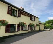
The Angel Hotel Abergavenny
BW PONTYPOOL METRO HOTEL
Llanwenarth Hotel
Pontypool
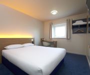
TRAVELODGE PONTYPOOL
Videos from this area
These are videos related to the place based on their proximity to this place.
Blaenavon heritage railway
Blaenavon Heritage Railway is a visitor attraction run on a charitable basis by a dedicated team of volunteers who give up their free-time to keep a piece of living history alive. Running...
Darren Graceland Jones - See See Rider
Elvis Tribute Double Bill: Darren Jones + Ricky Rivers Recorded at Blaenavon Workman's Hall.
Bunkers Row, Blaenavon, Torfaen - Royal Commission Animation
An animation produced by RCAHMW and See3D Ltd showing the reconstruction and evolution of workers' housing at Bunkers Row, Blaenavon. The animation was carried out as part of the European ...
Darren Graceland Jones - Bridge Over Troubled Water
Elvis Tribute Double Bill: Darren Jones + Ricky Rivers Recorded at Blaenavon Workman's Hall.
Elgam & District Workingmen's Club. Blaenavon 2015
Elgam & District Workingmen's Club, Blaenavon. 3rd January 2015.
Flying Elephants Aerial Solutions: Blaenavon World Heritage Site using Drones / UAV
www.flyingelephants.co.uk | facebook.com/aerialelephants | twitter.com/flyelephants.
Linesides at Pontypool and Blaenavon Railway 15.10.11
Sorry if this vid is recorded over a year ago but I'll be uploading last year's PBR vids as I'll be going for this year's gala. Anyway, these shots are recorded at various linesides. Locos...
SOUND OF STEAM TRAINS AT PONTYPOOL & BLAENAVON RAILWAY 7
The Pontypool and Blaenavon Railway is a volunteer-run heritage railway just outside Blaenavon in South Wales, the line is the highest preserved standard-gauge line in the United Kingdom (PART...
Bunkers Row, Blaenafon, Torfaen - Animeiddiad gan y Comisiwn Brenhinol
Animeiddiad a gynhyrchwyd gan CBHC a See3D Ltd sy'n ail-greu tai gweithwyr yn Bunkers Row, Blaenafon ac yn dangos sut y datblygodd y rhes. Cafodd yr animeiddiad ei wneud fel rhan o Atlanterra,.
Pontypool and Blaenavon Railway Barclay Bash 13/09/14
Pontypool and Blaenavon Railway "Barclay Bash" 13/09/14 Another superb day of steam and a delightful end with all four Barclay 0-4-0s on the mk1's Sadly for a reason unknown to me the goods...
Videos provided by Youtube are under the copyright of their owners.
Attractions and noteworthy things
Distances are based on the centre of the city/town and sightseeing location. This list contains brief abstracts about monuments, holiday activities, national parcs, museums, organisations and more from the area as well as interesting facts about the region itself. Where available, you'll find the corresponding homepage. Otherwise the related wikipedia article.
Varteg
Varteg (Welsh: Farteg or Y Farteg) is a village in the county borough of Torfaen in Wales.
Ogof Draenen
Ogof Draenen (Welsh for Hawthorn Cave) is, at 66 km (official figure; the true length of passage is still being revised upward, with a rough modern approximation at it being 70 km), the longest cave system in Wales and the second longest in Great Britain behind the Easegill System, Lost Johns and Notts 2 system in North Yorkshire. The cave was known only as a small entrance on a steep hillside until several years of digging broke through into major passage development in October 1994.
Forge Side
Forge Side (Welsh: Ger yr Efail) is a small village of tightly packed rows of iron workers' cottages on the hillside to the west of Blaenavon in the north of Torfaen county borough, South Wales. Some of the rows retain the original naming system of 'C Row', 'D Row' 'E Row' etc. The Welsh name (a direct translation of the English) is fairly modern. Forgeside has a rugby team which play in the Welsh league division 6 East.
Coity Mountain
Coity Mountain is a flat-topped mountain in the South Wales Valleys, between Blaenavon and Abertillery. The highest points of both Torfaen and Blaenau Gwent unitary authorities are at the summit of Coity Mountain. The summit is also known as Twyn Ffynhonnau Goerion. Some 2km to the southeast lies a major subsidiary top of the hill, Mynydd Varteg Fawr (549m) at the southeastern end of whose broad ridge is a trig point at 544m.
Blaenavon Hospital
Blaenavon Hospital, located in Blaenavon, is a small community hospital of 9 beds which provides intermediate care for both female and male patients from a local population of approximately 6,500 individuals. There is a Minor Injuries Unit and numerous community clinics are held on the upper floor of the building.
Stack Square
Stack Square is a small group of cottages in the coal mining town of Blaenavon in South Wales, originally used as miners' cottages. Stack Square was featured in the BBC Wales television series Coal House and Coal House at War. The miners' cottages in Stack Square have been restored to their original design and form part of the Blaenavon Ironworks site.
Varteg railway station
Varteg railway station was a railway station which served the village of Varteg, in the county of Monmouthshire, on the Brynmawr and Blaenavon Railway. Built by the London and North Western Railway (LNWR) as an expansion to meet the Great Western Railway (GWR) at Abersychan and Talywain. It was sometimes referred to on old Ordnance Survey and British Railway Clearing House (RCH) as 'Varteg Halt', despite it having an extensive station building.
Garndiffaith Viaduct
Garndiffaith Viaduct is a brickwork railway viaduct that formerly carried the Brynmawr and Blaenavon Railway over the valley at Abersychan in South Wales. It was built by the engineer John Gardiner between 1871 and 1874 to extend the London and North Western Railway line that principally carried coal from Brynmawr and Blaenavon to meet the Great Western Railway at Abersychan and Talywain.


