Safety Score: 3,0 of 5.0 based on data from 9 authorites. Meaning we advice caution when travelling to United Kingdom.
Travel warnings are updated daily. Source: Travel Warning United Kingdom. Last Update: 2024-08-13 08:21:03
Discover Llananno
Llananno in Powys (Wales) is a city in United Kingdom about 149 mi (or 239 km) north-west of London, the country's capital city.
Local time in Llananno is now 04:03 AM (Tuesday). The local timezone is named Europe / London with an UTC offset of zero hours. We know of 9 airports in the vicinity of Llananno, of which 4 are larger airports. The closest airport in United Kingdom is Hawarden Airport in a distance of 58 mi (or 94 km), North. Besides the airports, there are other travel options available (check left side).
There are several Unesco world heritage sites nearby. The closest heritage site in United Kingdom is Blaenavon Industrial Landscape in a distance of 44 mi (or 71 km), South-East. Looking for a place to stay? we compiled a list of available hotels close to the map centre further down the page.
When in this area, you might want to pay a visit to some of the following locations: Penybont, Mochdre, Llandrindod Wells, Whitton and Mainstone. To further explore this place, just scroll down and browse the available info.
Local weather forecast
Todays Local Weather Conditions & Forecast: 7°C / 45 °F
| Morning Temperature | 3°C / 38 °F |
| Evening Temperature | 3°C / 38 °F |
| Night Temperature | 3°C / 38 °F |
| Chance of rainfall | 0% |
| Air Humidity | 79% |
| Air Pressure | 1015 hPa |
| Wind Speed | Gentle Breeze with 8 km/h (5 mph) from North-East |
| Cloud Conditions | Clear sky, covering 2% of sky |
| General Conditions | Sky is clear |
Wednesday, 27th of November 2024
5°C (41 °F)
1°C (34 °F)
Broken clouds, light breeze.
Thursday, 28th of November 2024
4°C (38 °F)
4°C (39 °F)
Overcast clouds, gentle breeze.
Friday, 29th of November 2024
7°C (44 °F)
4°C (38 °F)
Overcast clouds, moderate breeze.
Hotels and Places to Stay
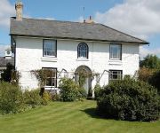
Guidfa House
Videos from this area
These are videos related to the place based on their proximity to this place.
penybont cwl steam 44871 and 45407 lms steam
return run llandridod to shrewsbury rtc steam run filmed near penybont tunnel on 1 in 74 climb on 12 april 2014 this is my first film clip on my return to filming the main line steam thank...
Mockingjay trailer- Hunger Games animation
The Hunger Games Mockingjay animation- this is a fan made trailer that I animated using lego digital designer, I hope you enjoy and for maximum quality watch on full volume and full HD.
iPad parts for iPad 2 Repair in Nottingham - left antenna 3G version
http://www.thepersonalcomputerservice.co.uk - 0115 972 1120 Serving Nottingham Derby and Leicester with computer service for pc and mac. This is showing a left antenna for the 3G version...
Dolau Station - The Cathedrals Exporer 12 May 2011
Steam Hauled Charter Train - "The Cathedrals Exporer". 12 May 2011 - The two steam locomotives, owned by Riley & Son (E) Ltd. of Bury, Lancashire, are the LMS Stanier 'Black Five ' 4-6-0...
RZR Racing UK round 6, at Neuadd Farm 2013
RZR Racing UK is home to the British National SXS championships, and home to a rapidly expanding sport! if you want to become part of the action, go to www.rzrracing.co.uk!
Central Wales Rambler at Llandrindod Wells, 14th April 2007
The Stock of nenta's Central Wales Rambler is propelled in to the platform at Llandrindod Wells.
Videos provided by Youtube are under the copyright of their owners.
Attractions and noteworthy things
Distances are based on the centre of the city/town and sightseeing location. This list contains brief abstracts about monuments, holiday activities, national parcs, museums, organisations and more from the area as well as interesting facts about the region itself. Where available, you'll find the corresponding homepage. Otherwise the related wikipedia article.
Rhwng Gwy a Hafren
Rhwng Gwy a Hafren (English: Between Wye and Severn) was a region of medieval Wales, located in the Welsh Marches between Powys to the north and Brycheiniog to the south. It was bounded by the rivers Wye (Gwy) and Severn (Hafren). It covered about the same territory as Radnorshire, now part of the county of Powys. The region first came into its own in the 9th or 10th centuries, when it was ruled by leaders who operated independently of the surrounding kingdoms.


