Safety Score: 3,0 of 5.0 based on data from 9 authorites. Meaning we advice caution when travelling to United Kingdom.
Travel warnings are updated daily. Source: Travel Warning United Kingdom. Last Update: 2024-08-13 08:21:03
Discover Saint Dogwells
Saint Dogwells in Pembrokeshire (Wales) is a town in United Kingdom about 208 mi (or 334 km) west of London, the country's capital city.
Current time in Saint Dogwells is now 09:51 AM (Friday). The local timezone is named Europe / London with an UTC offset of zero hours. We know of 12 airports near Saint Dogwells, of which 5 are larger airports. The closest airport in United Kingdom is Haverfordwest Airport in a distance of 6 mi (or 9 km), South. Besides the airports, there are other travel options available (check left side).
There is one Unesco world heritage site nearby. It's Castles and Town Walls of King Edward in Gwynedd in a distance of 99 mi (or 159 km), North-East. Also, if you like playing golf, there is an option about 8 mi (or 13 km). away. Looking for a place to stay? we compiled a list of available hotels close to the map centre further down the page.
When in this area, you might want to pay a visit to some of the following locations: Ambleston, Spittal, Scleddau, Camrose and Wiston. To further explore this place, just scroll down and browse the available info.
Local weather forecast
Todays Local Weather Conditions & Forecast: 10°C / 51 °F
| Morning Temperature | 8°C / 46 °F |
| Evening Temperature | 8°C / 47 °F |
| Night Temperature | 9°C / 48 °F |
| Chance of rainfall | 0% |
| Air Humidity | 80% |
| Air Pressure | 1027 hPa |
| Wind Speed | Gentle Breeze with 6 km/h (4 mph) from North-East |
| Cloud Conditions | Scattered clouds, covering 34% of sky |
| General Conditions | Scattered clouds |
Saturday, 16th of November 2024
12°C (53 °F)
8°C (47 °F)
Light rain, moderate breeze, overcast clouds.
Sunday, 17th of November 2024
9°C (49 °F)
8°C (47 °F)
Light rain, fresh breeze, overcast clouds.
Monday, 18th of November 2024
6°C (43 °F)
8°C (47 °F)
Light rain, strong breeze, overcast clouds.
Hotels and Places to Stay
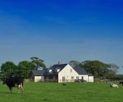
The Paddock
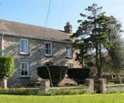
Llysyfran Farm B&B
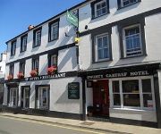
The Cartref Hotel
Videos from this area
These are videos related to the place based on their proximity to this place.
Haverfordwest Shooting - America Match
http://www.haverfordwestshootingclub.org.uk/ A freezing cold November morning for an America Match at Haverfordwest Target Shooting Club.
Pembrokeshire County Run 2014 Part 1 - Goodwick and Fishguard
Video of vehicles taking part in the annual Pembrokeshire County Run, which is a 92 mile trip around Pembrokeshire starting and finishing at the County Showground in Haverfordwest. Here we...
Sea Kayaking From Fishguard (Pembroke, S.Wales) with Kayak-King
Brilliant afternoon sea kayaking with Kayak-King Tours guiding the way. Saw a Sea lion, kept popping up randomly around us, I kept missing him but he stayed with his head above water long enough...
Welsh Shore Walk
Made as part of Fishguard Art Society's 'Shore Move' with artist Jacob Whittaker. http://www.fishguardartssociety.org.uk/ http://www.jacobwhittaker.co.uk.
Kids kayaking on the Pembrokeshire coast!
The best days in Wales are the wet ones - A FANTASTIC family tour viewing the marine life and kayaking into caves...Awesome kids... awesome times! Hope you enjoy our little film... :-) Check...
Gwenno sings Piaf
Great night in Ffwrn. Gwenno Dafydd with accompanist, Sue Howley brought to life the songs of Edith Piaf in this treasure of a venue in Fishguard.
The Big Draw: (Not quite) The Last Invasion
Video and animation from Fishguard's Big Draw event, 2007. http://www.fishguardartssociety.org.uk/ http://www.jacobwhittaker.co.uk.
Bluestone Holiday
Franglaise Family holiday in Bluestone National Park, Pembrokeshire, Wales in June 2014. For all blog posts about our stay at Bluestone National Park, go to www.FranglaiseMummy.com and tap...
Videos provided by Youtube are under the copyright of their owners.
Attractions and noteworthy things
Distances are based on the centre of the city/town and sightseeing location. This list contains brief abstracts about monuments, holiday activities, national parcs, museums, organisations and more from the area as well as interesting facts about the region itself. Where available, you'll find the corresponding homepage. Otherwise the related wikipedia article.
Preseli Pembrokeshire
Preseli Pembrokeshire (Welsh: Preseli Sir Benfro) was one of six local government districts of Dyfed in West Wales from 1974 to 1996. Until 1987 the name of the district was Preseli. The district took its name from the Preseli Hills.
Preseli Pembrokeshire (Assembly constituency)
Preseli Pembrokeshire is a constituency of the National Assembly for Wales. It elects one Assembly Member by the first past the post method of election. Also, however, it is one of eight constituencies in the Mid and West Wales electoral region, which elects four additional members, in addition to eight constituency members, to produce a degree of proportional representation for the region as a whole.
Puncheston
Puncheston is a village in Pembrokeshire, South West Wales. There is a nearby mountain known as Castly Bythe, or in english Cow Castle mountain.
RNAD Trecwn
RNAD Trecwn is a decommissioned Royal Navy Armaments Depot, located south of Fishguard in Pembrokeshire, West Wales. Built in 1938 to store and supply naval mines and munitions ordance to the Royal Navy, at its height during the cold war 400 permanent workers were deployed at the site, housed in an MoD built town infrastructure. The site had an onsite narrow gauge 30 railway, built using copper to reduce sparks.


!['[HD]搭巨大渡輪到愛爾蘭' preview picture of video '[HD]搭巨大渡輪到愛爾蘭'](https://img.youtube.com/vi/umoMMBbyDf8/mqdefault.jpg)
