Safety Score: 3,0 of 5.0 based on data from 9 authorites. Meaning we advice caution when travelling to United Kingdom.
Travel warnings are updated daily. Source: Travel Warning United Kingdom. Last Update: 2024-08-13 08:21:03
Touring Llandarcy
Llandarcy in Neath Port Talbot (Wales) is a town located in United Kingdom about 160 mi (or 258 km) west of London, the country's capital place.
Time in Llandarcy is now 05:36 PM (Friday). The local timezone is named Europe / London with an UTC offset of zero hours. We know of 8 airports nearby Llandarcy, of which 3 are larger airports. The closest airport in United Kingdom is Swansea Airport in a distance of 9 mi (or 15 km), West. Besides the airports, there are other travel options available (check left side).
There are several Unesco world heritage sites nearby. The closest heritage site in United Kingdom is Blaenavon Industrial Landscape in a distance of 41 mi (or 67 km), East. Also, if you like the game of golf, there are several options within driving distance. Need some hints on where to stay? We compiled a list of available hotels close to the map centre further down the page.
Being here already, you might want to pay a visit to some of the following locations: Clydach, Morriston, Landore, Swansea and Port Talbot. To further explore this place, just scroll down and browse the available info.
Local weather forecast
Todays Local Weather Conditions & Forecast: 12°C / 53 °F
| Morning Temperature | 7°C / 44 °F |
| Evening Temperature | 9°C / 48 °F |
| Night Temperature | 8°C / 46 °F |
| Chance of rainfall | 0% |
| Air Humidity | 77% |
| Air Pressure | 1028 hPa |
| Wind Speed | Light breeze with 4 km/h (3 mph) from South-East |
| Cloud Conditions | Overcast clouds, covering 99% of sky |
| General Conditions | Overcast clouds |
Saturday, 16th of November 2024
12°C (53 °F)
9°C (48 °F)
Light rain, gentle breeze, overcast clouds.
Sunday, 17th of November 2024
10°C (49 °F)
6°C (44 °F)
Overcast clouds, moderate breeze.
Monday, 18th of November 2024
11°C (52 °F)
11°C (52 °F)
Moderate rain, fresh breeze, overcast clouds.
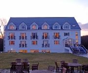
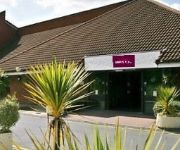
Hotels and Places to Stay
Towers Hotel and Spa
Morgans Hotel
Holiday Inn Express SWANSEA - EAST
Castle
Mercure Swansea
Best Western Aberavon Beach
VILLAGE SWANSEA
Blanco's Hotel and Restaurant
Grand Hotel
TRAVELODGE SWANSEA CENTRAL
Videos from this area
These are videos related to the place based on their proximity to this place.
Exquisite Bridal Cars
Wedding car hire in the Swansea and Neath Port Talbot Area. Exquisite Bridal Cars is a small, family run wedding car business operating in the Swansea,Neath and Port Talbot area. We offer...
Dji Phantom Bird Strike in Slow Motion.
Minding my business filming Neath abbey, and these tree rats attack my Phantom.
Jiro Nakazono Sensei
Aikido course filmed in Manhattan, USA. 2006. This is a short clip showing aspects of Munatsuki attacks.(Kaitennage) Jiro Nakazono Sensei,will be the principle Instructor on the Nakazono Aikido...
Fitted Kitchen Doors | Swansea Fitted Kitchen Doors
Fitted kitchen doors by http://www.celticheritage-kitchens.co.uk IHugh Davies of Celtic Heritage Kitchens explains the difference between 'kitchen doors' supplied by many of the production...
Testing the Mycro 720 cam on a Dji Phantom + Fi-Li-Fi (No Jello or VGE dampers)
Testing a Mycro 720 cam on my Dji Phantom at 9pm in the evening, I had no jello with it held to the base using Velcro in front of my Fi-Li-Fi. http://www.mycrocam.de/ I also use a FiLi-Fi...
Positioning - Briton Ferry Roundabout - turning right 3rd
Google map - http://g.co/maps/dvcwh Video tutorial for learner drivers taking their test in Swansea. In this video we look at lane positioning on the Briton Ferry roundabout, turning...
Olympic Torch Handover - Briton Ferry at Cwrt Sart
The 2012 Olympic torch handover in Briton Ferry on Saturday 26th May 2012.
Right turn at Junction 42 towards Briton Ferry A48.wmv
Google map : http://g.co/maps/a3cve Video tutorial for learner drivers taking their test in Swansea. This episode looks at lane positioning at junction 42, when making a right turn over the...
Positioning - Briton Ferry roundabout - A48 to Old road
Google map : http://g.co/maps/gzrgy Video tutorial for learner drivers taking their test in Swansea. This episode focuses on lane position. We'll follow the road ahead at the Briton...
Oliver Cromwell steam train
I took my grandson Kieran to the local railway station today the 28 June 2009, the steam train Oliver Cromwell was passing through Briton-Ferry, we were told it was due to come at about 4-30...
Videos provided by Youtube are under the copyright of their owners.
Attractions and noteworthy things
Distances are based on the centre of the city/town and sightseeing location. This list contains brief abstracts about monuments, holiday activities, national parcs, museums, organisations and more from the area as well as interesting facts about the region itself. Where available, you'll find the corresponding homepage. Otherwise the related wikipedia article.
A465 road
The A465 is a major road in south Wales. It is more commonly known as the Heads of the Valleys Road because it joins together the northern ends (or 'heads') of the South Wales Valleys. It approximately follows the southern boundary of the Brecon Beacons National Park, and an Ordnance Survey Pathfinder Guide describes it as the unofficial border between rural and industrial South Wales.
Briton Ferry West
Briton Ferry West is an electoral ward of Neath Port Talbot county borough, Wales. Briton Ferry West falls within the parish of Briton Ferry. Briton Ferry West consists of some or all of the districts of Brynhyfryd, Giant's Grave, Shelone and Warren Hill in the parliamentary constituency of Aberavon. It is bounded by the wards of Coedffranc West to the west; Neath East to the northeast; Briton Ferry East to the east and Baglan to the south.
Coedffranc
Coedffranc is a village in the county borough of Neath Port Talbot, Wales. Today it has merged into an enlarged Skewen, occupying the central regions of the village of Skewen. Coedffranc is also a community and encompasses the electoral wards of Coedffranc Central, Coedffranc North and Coedffranc West.
Coedffranc West
Coedffranc West is an electoral ward of Neath Port Talbot county borough, Wales. Coedffranc West is bounded by the wards of Llansamlet and Bonymaen of Swansea to the west; Coedffranc Central and Coedffranc North to the north; and Briton Ferry West to the east. It is bounded to the south by Swansea Bay. Coedffranc West consists of some or all of the following areas: Coed Darcy, Crymlyn Bog, Crymlyn Burrows, Jersey Marine, Llandarcy and Skewen.
Coedffranc Central
Coedffranc Central is an electoral ward of Neath Port Talbot county borough, Wales. Coedffranc Central is a part of the Coedffranc community and falls within the parliamentary constituency of Aberavon. Coedffranc Central is bounded by the wards of Coedffranc West to the southwest; Coedffranc North to the north; Dyffryn to the east; and Neath East and Briton Ferry West to the south east.
Llandarcy
Llandarcy is a village near Neath in Neath Port Talbot county borough, southwest Wales, and formerly the site of the UK's first oil refinery. The village, which lies near the Junction 43 of the M4 Motorway, was originally designed as a garden village to house the workers for the refinery, built by BP Oil between 1918-22.
Swansea Urban Area
The Swansea Urban Area is an area of land in south Wales, defined by the Office for National Statistics for population monitoring purposes. It is an urban conurbation and is not coterminous with the City and County of Swansea.
BP Oil Refinery Ltd Ground
BP Oil Refinery Ltd Ground is a cricket ground in Llandarcy, Glamorgan. The first recorded match on the ground was in 1950, when the Glamorgan Second XI played the Gloucestershire Second XI in the 1950 Minor Counties Championship. The ground has held a further 19 Second XI fixtures for the Glamorgan Second XI in both the Second XI Championship and Second XI Trophy. Glamorgan played Oxford University in a first-class match in 1971, the only first-class match that the ground has held.


