Safety Score: 3,0 of 5.0 based on data from 9 authorites. Meaning we advice caution when travelling to United Kingdom.
Travel warnings are updated daily. Source: Travel Warning United Kingdom. Last Update: 2024-08-13 08:21:03
Discover Llanvihangel Crucorney
Llanvihangel Crucorney in Monmouthshire (Wales) is a place in United Kingdom about 125 mi (or 201 km) west of London, the country's capital city.
Current time in Llanvihangel Crucorney is now 10:54 AM (Friday). The local timezone is named Europe / London with an UTC offset of zero hours. We know of 11 airports near Llanvihangel Crucorney, of which 5 are larger airports. The closest airport in United Kingdom is Bristol Filton Airport in a distance of 30 mi (or 49 km), South-East. Besides the airports, there are other travel options available (check left side).
There are several Unesco world heritage sites nearby. The closest heritage site in United Kingdom is Blaenavon Industrial Landscape in a distance of 8 mi (or 13 km), South-East. Also, if you like playing golf, there are a few options in driving distance. If you need a hotel, we compiled a list of available hotels close to the map centre further down the page.
While being here, you might want to pay a visit to some of the following locations: Llancillo, Longtown, Rowlstone, Llanveynoe and Abbey Dore. To further explore this place, just scroll down and browse the available info.
Local weather forecast
Todays Local Weather Conditions & Forecast: 9°C / 48 °F
| Morning Temperature | 4°C / 39 °F |
| Evening Temperature | 6°C / 43 °F |
| Night Temperature | 5°C / 40 °F |
| Chance of rainfall | 0% |
| Air Humidity | 75% |
| Air Pressure | 1028 hPa |
| Wind Speed | Calm with 2 km/h (1 mph) from South-East |
| Cloud Conditions | Broken clouds, covering 77% of sky |
| General Conditions | Broken clouds |
Saturday, 16th of November 2024
9°C (48 °F)
6°C (43 °F)
Overcast clouds, light breeze.
Sunday, 17th of November 2024
7°C (44 °F)
4°C (39 °F)
Light rain, moderate breeze, overcast clouds.
Monday, 18th of November 2024
4°C (40 °F)
7°C (45 °F)
Moderate rain, gentle breeze, overcast clouds.
Hotels and Places to Stay
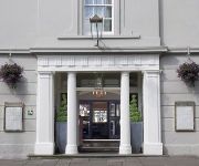
The Angel Hotel Abergavenny
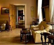
The Park Hotel
Videos from this area
These are videos related to the place based on their proximity to this place.
Abergavenny Livestock market, June 2012
Wednesday's are a busy day in Abergavenny at the Livestock market, located in the heart of the town.
Starlings over Abergavenny
These starlings were doing their amazing flying display 'murmuration' over Bailey Park as I walked to town.
A Ride Through Abergavenny in Monmouthshire
Subscribe for the love of motorcycles and the great outdoors: http://www.youtube.com/subscription_center?add_user=wiltshirebyways Please click 'S H O W M O R E' for route info: ↓↓↓↓↓↓...
37425 Abergavenny 6M82
With the light drizzle catching out the driver, 425 thrashes through Abergavenny on 16/05/05 with 6M82 1958 Newport ADJ to Crewe BH engineers.
Club Practice (Abergavenny) - Tai-otoshi_2
Thought we'd have a go at video analysis of a technique. These are our tai-otoshi efforts.
British Cyclocross Championships 2015 Elite Men
British Cyclocross Championships at Abergavenny on 11th January 2015 Elite Men.
Judo - Tai-otoshi Richard Nash
Tai-otoshi demonstrated by Richard Nash at Abergavenny Judo club on 5th September 2014. Apologies for the filming, camera started steaming up so we switched to a mobile.
Videos provided by Youtube are under the copyright of their owners.
Attractions and noteworthy things
Distances are based on the centre of the city/town and sightseeing location. This list contains brief abstracts about monuments, holiday activities, national parcs, museums, organisations and more from the area as well as interesting facts about the region itself. Where available, you'll find the corresponding homepage. Otherwise the related wikipedia article.
Ysgyryd Fawr
Ysgyryd Fawr is the most easterly of the Black Mountains in Wales, part of the Brecon Beacons National Park. The name is often anglicised to The Skirrid or Skirrid Fawr, and the mountain is also known as Holy Mountain or Sacred Hill. The spelling Skyrrid is also encountered in older literature. The lower hill of Ysgyryd Fach or 'Little Skirrid' (270m) lies about 4.5 km / 2.5 mi to the south. It is 486 m high and lies just outside Abergavenny http://www. geograph. org.
The Skirrid Mountain Inn
The Skirrid Mountain Inn http://www. geograph. org. uk/photo/216735 is a public house in the small village of Llanfihangel Crucorney, just a few miles north of Abergavenny, Monmouthshire, Wales. Perhaps the oldest pub in Wales, listed in chronicles from 1100. Owain Glyndŵr is said to have rallied his forces in the cobbled courtyard in the early 15th century before raiding nearby settlements sympathetic to the English king, Henry IV.
Oldcastle, Monmouthshire
Oldcastle is a small village in Monmouthshire, south east Wales, United Kingdom.
Beacons Way
The Beacons Way http://www. geograph. org. uk/photo/476809 is a waymarked long distance footpath in the Brecon Beacons National Park in south Wales, United Kingdom.
Bryn Arw
Bryn Arw is a hill in the Black Mountains of the Brecon Beacons National Park in Monmouthshire, south Wales. It lies 4 km north of the town of Abergavenny and 1.5 miles west of the village of Llanvihangel Crucorney. Its summit at 384m above sea level is the more northerly of two tops which lie on the crest of a slightly arcuate north-south ridge which drops away to the south at first gently and then sharply.
Pen y Clawdd Castle
Pen y Clawdd Castle was a Norman-era motte and bailey style castle protected by a double moat, near Abergavenny, Monmouthshire, in southern Wales. The exact origins of the castle are unknown, but some believe it may have been constructed by Roger de Hastings during the 11th century.
Llanvihangel Court
Llanvihangel (or Llanfihangel) Court, Llanvihangel Crucorney, is a Tudor country house in Monmouthshire, Wales, described as "the most impressive and richly decorated house of around 1600 in Monmouthshire". The court has a "complicated building history" stretching from the mid-16th century to the early 20th century. It is a Grade I listed building. The court was originally constructed by the Morgan family in 1559, although earlier medieval elements were incorporated.
St. Michael and All Angels, Llanvihangel Crucorney
The Church of St Michael and All Angels, stands in the centre of the village of Llanvihangel Crucorney, Monmouthshire, Wales. It is a Grade II listed building as of 1 September 1956.


