Safety Score: 3,0 of 5.0 based on data from 9 authorites. Meaning we advice caution when travelling to United Kingdom.
Travel warnings are updated daily. Source: Travel Warning United Kingdom. Last Update: 2024-08-13 08:21:03
Discover Clydach
Clydach in Monmouthshire (Wales) with it's 692 citizens is a town in United Kingdom about 130 mi (or 209 km) west of London, the country's capital city.
Current time in Clydach is now 01:07 PM (Friday). The local timezone is named Europe / London with an UTC offset of zero hours. We know of 9 airports near Clydach, of which 4 are larger airports. The closest airport in United Kingdom is Cardiff International Airport in a distance of 30 mi (or 48 km), South. Besides the airports, there are other travel options available (check left side).
There are several Unesco world heritage sites nearby. The closest heritage site in United Kingdom is Blaenavon Industrial Landscape in a distance of 9 mi (or 15 km), East. Also, if you like playing golf, there are a few options in driving distance. Looking for a place to stay? we compiled a list of available hotels close to the map centre further down the page.
When in this area, you might want to pay a visit to some of the following locations: Brynmawr, Cwm, Ebbw Vale, Crumlin and Pontypool. To further explore this place, just scroll down and browse the available info.
Local weather forecast
Todays Local Weather Conditions & Forecast: 9°C / 48 °F
| Morning Temperature | 4°C / 39 °F |
| Evening Temperature | 6°C / 43 °F |
| Night Temperature | 5°C / 40 °F |
| Chance of rainfall | 0% |
| Air Humidity | 75% |
| Air Pressure | 1028 hPa |
| Wind Speed | Calm with 2 km/h (1 mph) from South-East |
| Cloud Conditions | Broken clouds, covering 77% of sky |
| General Conditions | Broken clouds |
Saturday, 16th of November 2024
9°C (48 °F)
6°C (43 °F)
Overcast clouds, light breeze.
Sunday, 17th of November 2024
7°C (44 °F)
4°C (39 °F)
Light rain, moderate breeze, overcast clouds.
Monday, 18th of November 2024
4°C (40 °F)
7°C (45 °F)
Moderate rain, gentle breeze, overcast clouds.
Hotels and Places to Stay
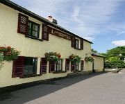
Dragon Inn Crickhowell
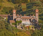
Gliffaes Country House Hotel
Llanwenarth Hotel
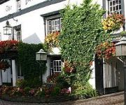
Bear Crickhowell
Manor
Ebbw Vale
Gliffaes Hotel
Videos from this area
These are videos related to the place based on their proximity to this place.
Caveman of Wales
Caveman of Wales WATCH IN 480 OR 720 HD - CLICK SETTINGS WHEEL BELOW RIGHT OF VIDEO Meeting Jason the 'Caveman of Wales' who was explaining the underground caving system near ...
Caving Video: Ogof Craig A Ffynnon
A Dudley Caving Club trip on Saturday 20th November 2010 to the Hall of the Mountain Kings.
Caving Video: Return to Ogof Craig A Ffynnon
It's always a high risk strategy taking a journalist caving, but caving's not without its risks anyway. This is the story of one such journalist's introduction to caving with Dudley Caving...
Cave Diving - White Lady Cave, Nedd Fechan Valley, South Wales
A few snippets from the 2nd day of Martyn Farr's PSAi "Intro Cave" course. We dived White Lady Cave in the Nedd Fechan Valley. This really was an excellent course and a taster for the full...
Transformers Dark of the Moon Extras unlockables and movies - Xbox 360
Transformers Dark of the Moon Extras unlockables and movies - Xbox 360.
GoPro Time Lapse
Timelapse taken with GoPro Hero 3 Black Edition, Canon 30D and iPhone 4S (Lapse It) Taken from Sugar Loaf Mountain, Skirrid, White Castle and my back garden.
Videos provided by Youtube are under the copyright of their owners.
Attractions and noteworthy things
Distances are based on the centre of the city/town and sightseeing location. This list contains brief abstracts about monuments, holiday activities, national parcs, museums, organisations and more from the area as well as interesting facts about the region itself. Where available, you'll find the corresponding homepage. Otherwise the related wikipedia article.
Llanelly
Llanelly is the name of both a village and its respective parish in Monmouthshire principal area, within the historic boundaries of Brecknockshire, south-east Wales.
Ogof Craig a Ffynnon
Ogof Craig a Ffynnon (Welsh for "Rock and Fountain Cave") is a cave in Wales. The cave is about 7 km in length (but often claimed to be about 13 km in length because someone thought it was 7 miles long and wrongly converted to kilometers without looking at the survey). The cave is renowned as one of the most well-decorated caves in Britain.
Clydach Gorge
The Clydach Gorge (also known as Cwm Clydach) is a steep-sided valley in south-east Wales down which the River Clydach flows to the River Usk. It runs for 5.6 km from the vicinity of Brynmawr in Blaenau Gwent eastwards and northeastwards to Gilwern in Monmouthshire. The Gorge was one of the first locations in the region to be industrialised though it still retains spectacular natural beauty.
Caves of Aruba
Of the several caves of Aruba, three Aruban caves are well known, seen in deep crevices on the windward face of the island. All three of the caves are located in the Arikok National Park. The most prominent are Guadirikiri Cave, the Fontein Cave and the Huliba Cave. Nocturnal bats nestle in all these caves.
Gilwern Hill, Monmouthshire
Not to be confused with Gilwern Hill, Powys east of Llandrindod Wells. Gilwern Hill {{#invoke:InfoboxImage|InfoboxImage|image=Downhill towards The Tumble - geograph. org. uk - 470317.
Cwm Clydach National Nature Reserve
For the Cwm Clydach reserve near Swansea, administered by the RSPB see Cwm Clydach RSPB Reserve. 40x40pxThis article may require cleanup to meet Wikipedia's quality standards. The specific problem is: no sections. Please help improve this article if you can.
Waunavon railway station
Waunavon railway station, also known as "Waunafon", was a station that served as a junction for Milfraen Pit colliery, south east Wales. Build by the London and North Western Railway (LNWR) as an expansion for the Brynmawr and Blaenavon Railway to meet Blaenavon. At an altitude of 1401 ft above sea level, Waunavon was the highest railway station on a standard gauge line in England and Wales.
Abergavenny transmitting station
The Abergavenny transmitting station was originally built by the IBA in 1969 as a relay for BBC and ITV VHF 405-line analogue television. It consists of a 46 m guyed lattice mast carrying the aerials at the top. This structure was built on a 440 m hill known as Gilwern Hill overlooking the towns of Gilwern and Abergavenny in Monmouthshire, South Wales. The band III VHF television feeds were provided off-air from St. Hilary and Wenvoe, both near Cardiff.


