Safety Score: 3,0 of 5.0 based on data from 9 authorites. Meaning we advice caution when travelling to United Kingdom.
Travel warnings are updated daily. Source: Travel Warning United Kingdom. Last Update: 2024-08-13 08:21:03
Explore Lower Clapton
The district Lower Clapton of Duffryn in City of Newport (Wales) is located in United Kingdom about 124 mi west of London, the country's capital.
If you need a place to sleep, we compiled a list of available hotels close to the map centre further down the page.
Depending on your travel schedule, you might want to pay a visit to some of the following locations: Newport, Nash, Marshfield, Goldcliff and Ponthir. To further explore this place, just scroll down and browse the available info.
Local weather forecast
Todays Local Weather Conditions & Forecast: 4°C / 39 °F
| Morning Temperature | 3°C / 38 °F |
| Evening Temperature | 4°C / 39 °F |
| Night Temperature | 3°C / 38 °F |
| Chance of rainfall | 0% |
| Air Humidity | 63% |
| Air Pressure | 999 hPa |
| Wind Speed | Moderate breeze with 11 km/h (7 mph) from South-West |
| Cloud Conditions | Overcast clouds, covering 100% of sky |
| General Conditions | Overcast clouds |
Friday, 22nd of November 2024
6°C (43 °F)
6°C (42 °F)
Scattered clouds, fresh breeze.
Saturday, 23rd of November 2024
10°C (51 °F)
14°C (58 °F)
Moderate rain, high wind, near gale, overcast clouds.
Sunday, 24th of November 2024
15°C (58 °F)
12°C (53 °F)
Moderate rain, gale, overcast clouds.
Hotels and Places to Stay
Celtic Manor Resort
The Manor House At Celtic Manor
COLDRA COURT HOTEL BY CELTIC MANOR
The Knoll Guesthouse
Holiday Inn NEWPORT
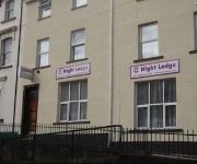
Night Lodge
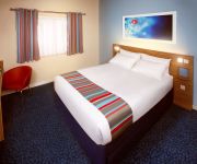
TRAVELODGE NEWPORT CENTRAL
Holiday Inn Express NEWPORT
Premier Inn Newport City Centre (Wales)
ibis budget Newport
Videos from this area
These are videos related to the place based on their proximity to this place.
Newport Half Marathon 2015
The Admiral City of Newport Half Marathon.was up early this morning ..was a cold start but all went well...well done all... i like to say thanks to my friends and subscribers.
Newport Transporter Bridge in 1952
Newport Transporter Bridge Film taken on April 12th 1952 on 9.5mm gauge film. Transfered to video using Pathescope 200B projector. (The fluff is in the camera)
Olympic torch comes to Maesglas Newport - HD
Little video showing the procession for the Olympic torch rolling through Maesglas Newport on the 25th May 2012 The only time I've seen the Police cheered by the locals ;)
Daredevil Escapology Stunt from the Newport Bridge 2011
Chris Cross the Globetrotting Geordie Contortionist & Escapologist Launched the Big Splash 2011 Festival in Newport, Wales on the 7th October 2011. An Upside Down Straitjacket Escape Suspended.
St Brides Bangers - 04-06-12 in-car RODS class
1st race in the RODS class, on-board with Dan Bendall.
Videos provided by Youtube are under the copyright of their owners.
Attractions and noteworthy things
Distances are based on the centre of the city/town and sightseeing location. This list contains brief abstracts about monuments, holiday activities, national parcs, museums, organisations and more from the area as well as interesting facts about the region itself. Where available, you'll find the corresponding homepage. Otherwise the related wikipedia article.
Newport Cathedral
Newport Cathedral in the city of Newport in South Wales is the cathedral of the Diocese of Monmouth, in the Church in Wales, and seat of the Bishop of Monmouth. The full title is Newport Cathedral, Woolos, King & Confessor. The Bishop of Monmouth is the Right Reverend Dominic Walker OGS, who has been in post since 2003, when the former bishop, Rowan Williams, was appointed as Archbishop of Canterbury.
Tredegar House Country Park
Tredegar Park is a large municipal park located near the housing estates of Duffryn, Maesglas, and Gaer in the city of Newport in South Wales.
Newport Transporter Bridge
The Newport Transporter Bridge is a transporter bridge that crosses the River Usk in Newport, South Wales. It is a Grade I listed structure. Designed by French engineer Ferdinand Arnodin, it was built in 1906 and opened by Godfrey Charles Morgan, 1st Viscount Tredegar on 12 September 1906. The span is an example of the very rare transporter bridge concept, of which only eight remain in use worldwide. The bridge is the lowest crossing on the River Usk.
Ebbw River
The Ebbw River is a river in South Wales. The main Ebbw River is formed by the confluence of the two minor Ebbw rivers, Ebbw Fach, and Ebbw Fawr (the latter of which gives its name to Ebbw Vale). The Sirhowy River flows into the Ebbw at Crosskeys, then the river continues flowing south east, through the town of Risca, then through the western suburbs of Newport, alongside Tredegar Park. The Ebbw then in turn joins with the River Usk, before flowing into the Severn Estuary.
Belle Vue Park
Belle Vue Park is a large Victorian public park in the west side of the city of Newport in South Wales. It was awarded a prestigious Green Flag Award on July 17, 2008
Maesglas
Maesglas is a neighbourhood in the south west of the city of Newport, South Wales. In the 16th century it was known as Greenfield but in later years the Welsh language Maesglas has come to be more widely used. It is located in the Gaer ward directly north of the A48 Southern Distributor Road, south of Cardiff Road and south west of the South Wales Main Line railway. The Newport-born author Leslie Thomas wrote of Maesglas: “ Maesglas was a penniless place everybody called Moscow.
Duffryn
Duffryn is a large housing estate http://www. geograph. org. uk/photo/612479 in the southwest of the city of Newport, south Wales comprising a large portion of the Tredegar Park electoral district (ward). Built on land belonging to Tredegar House http://www. geograph. org. uk/photo/634481, it was completed in 1978 and at the time won several awards for its design. The layout of the estate, as viewed from above, is that of large terraces undulating around a central wooded area.
Kingsway Shopping Centre
The Kingsway Shopping Centre is the principal under-cover shopping centre in the city of Newport, Wales. It has several levels and includes a range of high street shops and privately owned boutiques. It is also home to the city's museum, art gallery and Newport Central library. The northern entrance is on John Frost Square, a Germanic-style town square shopping square.
Newport Museum
Newport Museum (known locally as the City Museum) is a museum, library and art gallery in the city of Newport, South Wales. It is located in Newport city centre on John Frost Square and is adjoined to the Kingsway Shopping Centre.
Friars Walk, Newport
Friars Walk is a projected shopping centre in Newport city centre. The original £222m scheme was intended to cover an area bounded by Kingsway, Upper Dock Street and the existing Kingsway Shopping Centre, including parts of John Frost Square and the bus station. A key feature of the development was to bring together Newport's riverfront and commercial centre, allowing people to walk easily between the two areas, extending to the east bank of the river by means of the Newport City footbridge.
St. Brides Wentloog
St. Bride's or St. Bride's Wentloog is a small hamlet to the south west of the city of Newport in South Wales.
Level of Mendalgief
The Level of Mendalgief is a small area to the south west of the city centre of the city of Newport in the Pill ward. The level is bounded by Cardiff Road to the north, Mendalgief Road to the east, Docks Way to the south and the Great Western Main Line to the west. The area formerly contained the Monmouthshire Bank sidings, but it is due to be regenerated into a new residential area. The etymology of the name Mendalgief is unknown.
Newport Docks
Newport Docks is the collective name for a series of docks in the city of Newport, south-east Wales.
Southern Distributor Road
The Southern Distributor Road (SDR) is a principal distributor road in Newport that runs from the Coldra roundabout in the east of Newport to Tredegar Park M4 Junction 28) in the west of Newport and includes City Bridge, a bow-string arch bridge spanning the River Usk. Combined with the M4 in the north, the SDR forms the southern part of a ring road for the city. The new road encompassed Ringland Way, Spytty Road, East Dock Road, Usk Way and Docks Way.
Newport Centre
The Newport Centre is the biggest leisure centre in the city of Newport in the South Wales. The Newport Centre is located in Newport city centre on the west bank of the River Usk adjacent to the Kingsway Shopping Centre. It holds events such as concerts, conferences and exhibitions. The centre hosts the Welsh Open snooker tournament as well as international business conferences and exhibitions.
Pill Harriers RFC
Pill Harriers RFC are a Welsh rugby union club based in Newport in South Wales. The club is a member of the Welsh Rugby Union and is a feeder club for the Newport Gwent Dragons.
St Woolos Hospital
Saint Woolos Hospital is a community and mental health hospital serving the city of Newport, South Wales and surrounding areas. It is located in the Stow Hill area and is named after Saint Gwynllyw. The buildings at St Woolos were originally opened as a workhouse by the Newport Poor Law Union. The main Royal Gwent Hospital is close by.
St. Joseph's RC High School, Newport
St. Joseph's RC High School is a comprehensive school on the western outskirts of Newport, South Wales. It is in the suburb of Duffryn, and has something of a rivalry with Duffryn High School, just a few hundred yards up the road. The school has around 1,400 pupils. The school recently underwent an Estyn inspection getting all grade ones (the highest mark). The school has a significant ethnic minority community, with over 30 pupils from the Philippines.
Newport Dock Street railway station
Newport Dock Street railway station was one of three stations in central Newport, Monmouthshire. It was opened in 4 August 1852 as the terminus of Monmouthshire western valleys line to Blaina and Ebbw Vale. The line itself had opened on 21 December 1850 with a temporary terminus at Courtybella. By May 1855 the Western Valley line was connected to the Eastern Valley line at Mill Street station, although Dock Street station continued to act as a terminus.
Newport West railway station
Newport West railway station is a proposed station to serve the western suburbs of the city of Newport, Wales. The Newport City Council unitary development plan sets aside an area in Coedkernew adjacent to the Great Western Main Line for the station. As of May 2008 three parcels of land have been acquired by the urban regeneration company Newport Unlimited at the site of the station.
Mansion House, Newport
The Mansion House was the official residence of the Mayor of Newport, South Wales until 2009. In addition to being the Mayor's official residence, it also offered hospitality and accommodation to official visitors to the city from overseas. In 2010 plans were approved to convert the Mansion House for use as a Register office and it duly opened in July 2011 after a major refurbishment.
Inmos microprocessor factory
The Inmos microprocessor factory, also known as the Inmos factory, is a building in Newport, Wales, UK which was originally built as a microprocessor fabrication plant for Inmos and is now occupied by International Rectifier. The architects of the award-winning high-tech building were the Richard Rogers Partnership. Construction began in 1980 and was completed by 1982. The factory was the first building to be designed by Richard Rogers in Wales.
Newport West Central railway station
Newport West Central railway station is a proposed station on the Ebbw Valley Railway in the city of Newport, Wales. The station is proposed in SEWTA's Rail Strategy to serve the Monmouthshire Bank redevelopment area. The site for the station is on Bideford Road, adjacent to the Harlech Retail Park. Access to the Monmouthshire Bank redevelopment area will be via the original Western Valley Line bridge over the South Wales Main Line.
Newport rail accident
The Newport rail accident occurred on Saturday night, 28 September 1907. A mineral train from Rogerstone to Cardiff and a passenger train from Cardiff collided near the Ebbw Junction, killing 1 and injuring at least 12. The passenger train left Cardiff at 19:42. The one fatality was Albert Workman - the driver of the mineral train - a married man with two children. Also injured was Ernest Day, aged 24, of Cardiff, fireman on the mineral engine.
St Woolos Cemetery
St Woolos Cemetery (officially named Newport and St Woolos new Cemetery) is the main cemetery in the city of Newport, Wales situated one mile to the west of the Church in Wales cathedral known by the same name. It contains four chapels, and various ornate memorials dating back to the early Victorian period, and was the first municipally constructed cemetery in England and Wales.


