Safety Score: 3,0 of 5.0 based on data from 9 authorites. Meaning we advice caution when travelling to United Kingdom.
Travel warnings are updated daily. Source: Travel Warning United Kingdom. Last Update: 2024-08-13 08:21:03
Discover Rhyd-y-felin
Rhyd-y-felin in Ceredigion (Wales) is a city in United Kingdom about 178 mi (or 287 km) west of London, the country's capital city.
Local time in Rhyd-y-felin is now 01:26 AM (Wednesday). The local timezone is named Europe / London with an UTC offset of zero hours. We know of 10 airports in the vicinity of Rhyd-y-felin, of which 5 are larger airports. The closest airport in United Kingdom is Haverfordwest Airport in a distance of 54 mi (or 86 km), South-West. Besides the airports, there are other travel options available (check left side).
There are several Unesco world heritage sites nearby. The closest heritage site in United Kingdom is Castles and Town Walls of King Edward in Gwynedd in a distance of 54 mi (or 87 km), North. Also, if you like golfing, there is an option about 11 mi (or 18 km). away. We discovered 1 points of interest in the vicinity of this place. Looking for a place to stay? we compiled a list of available hotels close to the map centre further down the page.
When in this area, you might want to pay a visit to some of the following locations: Aberystwyth, Lledrod, Tywyn, Llangybi and Aberaeron. To further explore this place, just scroll down and browse the available info.
Local weather forecast
Todays Local Weather Conditions & Forecast: 15°C / 59 °F
| Morning Temperature | 12°C / 53 °F |
| Evening Temperature | 14°C / 58 °F |
| Night Temperature | 12°C / 54 °F |
| Chance of rainfall | 0% |
| Air Humidity | 80% |
| Air Pressure | 1029 hPa |
| Wind Speed | Light breeze with 5 km/h (3 mph) from North-West |
| Cloud Conditions | Broken clouds, covering 54% of sky |
| General Conditions | Broken clouds |
Thursday, 7th of November 2024
16°C (60 °F)
11°C (51 °F)
Sky is clear, gentle breeze, clear sky.
Friday, 8th of November 2024
13°C (56 °F)
11°C (51 °F)
Overcast clouds, gentle breeze.
Saturday, 9th of November 2024
15°C (59 °F)
12°C (53 °F)
Broken clouds, light breeze.
Hotels and Places to Stay
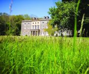
Nanteos Mansion Country House Hotel
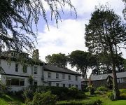
Conrah Country House
Harry's
Four Seasons
Aberystwyth
Videos from this area
These are videos related to the place based on their proximity to this place.
Vale of Rheidol Railway Spring Bank Holiday 2014 Part 2
Part 2 of our Train ride to Devils Bridge on Number 9, Prine of Wales.
Surfing The Trap At Aberystwyth Mid Wales (GoPro Hero 3 Black Edition)
First ever attempt at a short surfing video at Aberystwyth South beach, in the trap at the end of Janurary. Filmed using a GoPro Hero 3 Black Edition on a GoPole with a floaty backdoor. This...
Vale of Rheidol Railway Spring Bank Holiday 2014
As we arrive at Aberystwyth Station early morning number nine "Prince of Wales" is being made ready for her official re-launch in Invisible Green before we board the train for a ride to Devils...
No. 8 Llywelyn and No. 9 Prince of Wales leave Aberystwyth on 19th June '14
Vale of Rheidol locos 8 and 9 leave Aberystwyth with musical accompaniment on a breezy June morning in Ceredigion. Aberffrwd station was officially reopened by Edwina Hart.
Aberystwyth Harbour Silent Movie
Go to: http://www.aberystwyth-online.co.uk Silent harbour movie of Aberystwyth harbour. Produced by: http://www.aberystwyth-online.co.uk Harbour Books http://astore.amazon.co.uk/aberystwyt...
Aberystwyth, HMS Biter and HMS Smiter, June 2010
Two Archer class patrol training vessels arrive in Aberystwyth Harbour, Wales. University Royal Navy Units, P270 "Biter" and P272 "Smiter". Kodak Zx1 pocket video camera, 16 June 2010.
Vale of Rheidol Railway Aberystwyth to Devils Bridge Short Version
RIDING ON THE VALE OF RHEIDOL RAILWAY FROM ABERYSTWYTH TO DEVILS BRIDGE.. VIEWS OF VALE OF RHEIDOL AND DEVILS BRIDGE.
Beth sy’n gwneud Aberystwyth yn le arbennig?
Am fwy o wybodaeth, ewch i: http://www.aber.ac.uk/cy/ Dilynwch ni ar: Facebook: http://www.aber.ac.uk/cy/social-media/fb-community/ Twitter: http://www.aber.ac.uk/cy/social-media/twitter/
Videos provided by Youtube are under the copyright of their owners.
Attractions and noteworthy things
Distances are based on the centre of the city/town and sightseeing location. This list contains brief abstracts about monuments, holiday activities, national parcs, museums, organisations and more from the area as well as interesting facts about the region itself. Where available, you'll find the corresponding homepage. Otherwise the related wikipedia article.
Pen Dinas
Pen Dinas is the name of a hill south of Aberystwyth on the coast of Ceredigion, Wales, upon which an extensive Iron Age hill fort is situated. The name is more correctly 'Dinas Maelor', this could be translated into English as 'Maelor's Fort' or 'Maelor's City'. Tradition refers to it as being the fort of the giant Maelor Gawr. Pen Dinas strictly speaking only refers to the highest point, 'Pen y Dinas' or 'Head of the Citadel', (upon which the Wellington Monument now stands).
Tan-y-Bwlch, Aberystwyth
Tan-y-Bwlch (Welsh for Under the pass/gap) is located near Penparcau village on the outskirts of Aberystwyth, in Wales, and consists of a fairly new nature reserve. It was designated in 1999 following a public meeting which attracted more than 100 local people. Owned by Ceredigion County Council, the 100-acre site has two distinct features - the old hill fort of Pendinas and the shingle beach at Tan-y-bwlch.
St Padarn's Church, Llanbadarn Fawr
Saint Padarn's Church is a Church in Wales parish church at Llanbadarn Fawr, near Aberystwyth, in Ceredigion, Wales, SY23 3QZ. The site has been used for Christian worship since it was founded by Saint Padarn, after whom it was named, in the early sixth century. It was rebuilt in the thirteenth century after a fire, and is a fine large aisleless cruciform church with transepts and a substantial central tower, some 163 feet long.
Coleg Ceredigion
Coleg Ceredigion is a bilingual further education college in Ceredigion. It has two campuses in the two largest towns in Ceredigion, namely Aberystwyth and Cardigan . The college's principal is Jacqui Weatherburn. The college's logo is a blue man with an orange scarf. It was founded in 1967. Coleg Ceredigion’s Mission is to contribute to the educational, social and economic development of the community through the provision of a wide range of high quality learning opportunities.
Ysgol Gyfun Gymunedol Penweddig
Penweddig Community Secondary School (Welsh: Ysgol Gyfun Gymunedol Penweddig) is a successful Welsh-language secondary school in Aberystwyth, Wales. The school was established in 1973 and now educates girls and boys between the ages of 11 and 18 through the medium of Welsh. The school was the first Welsh language secondary school in Ceredigion and is named after the cantref of Penweddig, the northern part of the Kingdom of Ceredigion, between the rivers Dyfi and Ystwyth.
Ysgol Gymraeg Aberystwyth
Ysgol Gymraeg Aberystwyth is a Welsh language primary school in the university town of Aberystwyth in Ceredigion, Wales. It was established as a private school in 1939 by Sir Ifan ab Owen Edwards and was originally named Ysgol Gymraeg yr Urdd. The school was the first Welsh school in Wales. The school originally had seven pupils, but has grown significantly since then and now educates over 400 children.
Vicarage Field, Aberystwyth
Vicarage Field, Aberystwyth is a cricket ground in Aberystwyth, Wales used by Glamorgan for two Sunday League matches in 1977 and 1989. It will also be the host ground of the Olympic torch relay's 9th day Evening Celebrations featuring world class dance act Twist and Pulse The ground hosted 2 List A matches. Game Information: Game Statistics: one-day:
Thomas Parry Library
The Thomas Parry Library at Aberystwyth is part of the library of the University of Wales Aberystwyth, and serves the Department of Information and Library Studies. The University Library joined the University's Computing and Audio-visual Units in 1995 to form the Information Service, University of Wales Aberystwyth.


