Safety Score: 3,0 of 5.0 based on data from 9 authorites. Meaning we advice caution when travelling to United Kingdom.
Travel warnings are updated daily. Source: Travel Warning United Kingdom. Last Update: 2024-08-13 08:21:03
Touring Pontywaun
Pontywaun in Caerphilly County Borough (Wales) is a town located in United Kingdom about 129 mi (or 208 km) west of London, the country's capital place.
Time in Pontywaun is now 12:10 PM (Thursday). The local timezone is named Europe / London with an UTC offset of zero hours. We know of 9 airports nearby Pontywaun, of which 4 are larger airports. The closest airport in United Kingdom is Cardiff International Airport in a distance of 18 mi (or 29 km), South-West. Besides the airports, there are other travel options available (check left side).
There are several Unesco world heritage sites nearby. The closest heritage site in United Kingdom is Blaenavon Industrial Landscape in a distance of 14 mi (or 22 km), North-East. Also, if you like the game of golf, there are several options within driving distance. We collected 1 points of interest near this location. Need some hints on where to stay? We compiled a list of available hotels close to the map centre further down the page.
Being here already, you might want to pay a visit to some of the following locations: Crosskeys, Newbridge, Crumlin, Blackwood and Maesycwmmer. To further explore this place, just scroll down and browse the available info.
Local weather forecast
Todays Local Weather Conditions & Forecast: 2°C / 36 °F
| Morning Temperature | 1°C / 34 °F |
| Evening Temperature | 1°C / 34 °F |
| Night Temperature | 1°C / 33 °F |
| Chance of rainfall | 0% |
| Air Humidity | 64% |
| Air Pressure | 1000 hPa |
| Wind Speed | Moderate breeze with 9 km/h (6 mph) from East |
| Cloud Conditions | Overcast clouds, covering 100% of sky |
| General Conditions | Overcast clouds |
Friday, 22nd of November 2024
4°C (40 °F)
3°C (37 °F)
Few clouds, fresh breeze.
Saturday, 23rd of November 2024
9°C (48 °F)
14°C (56 °F)
Heavy intensity rain, strong breeze, overcast clouds.
Sunday, 24th of November 2024
14°C (57 °F)
10°C (50 °F)
Moderate rain, high wind, near gale, overcast clouds.
Hotels and Places to Stay
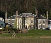
Hotel & Spa Bryn Meadows Golf
Maes Manor Country House
The New House Country Hotel
BW PONTYPOOL METRO HOTEL
ibis Cardiff Gate - International Business Park
Holiday Inn Express NEWPORT
Pontypool
Caerphilly Crossways
Videos from this area
These are videos related to the place based on their proximity to this place.
Cafall Trail, Cwmcarn. Mountain biking. 9th June 2014
Me and Steve doing the new(ish) Cafall trail for the first time, hence I missed the first dh section! Brutal climbing followed by some really nice descents. I'm on, as usual, my Santa Cruz...
Cwmcarn Twrch Trail - Part 3 - Mountain Biking 2013 GoPro Hero 3+
First light test of the new GoPro Hero 3+ at Cwmcarn Twrch Trail. Sun was close to sunset, so light wasn't too good, but the Hero 3+ managed just fine. Part 3 is the part Dragon's tongue and...
Intense M9 test ride @ Cwmcarn DH track 8th april 2012.wmv
Testing my new Intense M9 @ Cwmcarn DH track on 8th April 2012, I was riding with Al "Intense" & Matt "Gambler". Wicked days riding & the M9 was running so sweet thanks to Al, our team mechanic ;-)
Cwmcarn Twrch Trail Dragons Tongue through to Finish!
Dragons Tongue, Dragons Teeth, Angels Post to Finish!
England v Wales (6-0)
A scintilating display of attacking football from the boys. Wales were simply no match for England's fluid passing, clinical finishing and movement off the ball. A scrappy first goal settled...
MTB Cwmcarn Twrch Trail Part 2: Odin, Archie's Lift and Castle Valley
The Twrch Trail at Cwmcarn: Linking Airstream to Odin, Archie's Lift and Castle Valley.
Cwmcarn Twrch Downhill Section
Al & Dom finishing the xc loop "Twrch" downhill section. Both of us are riding Commencal Meta 5.5 Camera is a MD80 Clone on a MUVI pro bike mount, hence the shaky video.
Videos provided by Youtube are under the copyright of their owners.
Attractions and noteworthy things
Distances are based on the centre of the city/town and sightseeing location. This list contains brief abstracts about monuments, holiday activities, national parcs, museums, organisations and more from the area as well as interesting facts about the region itself. Where available, you'll find the corresponding homepage. Otherwise the related wikipedia article.
Crosskeys railway station
Crosskeys railway station is a halt station on the Ebbw Valley Railway in Wales. The station is situated near the former station site, behind houses on Risca Road and Carlton Terrace. The access to the station is via a one-way system off High Street exiting via Carlton Terrace. Crosskeys is a two-platform station and there is no car park. The station provides good access to the town and the local college as well as being near local bus links.
Cwmcarn High School
Cwmcarn High School is a school in the village of Cwmcarn, in South East Wales. The school (for school years 7-11) also has a sixth form where pupils can return to continue their education in a familiar environment. There are 900+ students attending CHS, a considerable increase in numbers since 1998, when there were 450 students attending the school.
Wattsville
Wattsville is a small South Wales Valleys village in the Sirhowy valley, 8 miles north west of Newport, the county capital, in south-east Wales, within the historic boundaries of Monmouthshire.
Crosskeys College
Coleg Gwent - Crosskeys (generally known as Crosskeys College) is the largest campus of Coleg Gwent. It is located next to Risca Road in Crosskeys, near Newport in Wales. The college was previously a technical college and a coal mining college. However, since the demise of heavy industry in the area over the past decades, the college has now become the leading further education establishment in the area.
St Mary and St Mercurius Coptic Orthodox Church
St Mary and St Mercurius Coptic Orthodox Church is the first Coptic Orthodox Church in Wales, at St Mary Street in Risca, Newport, Wales. It was consecrated in 1992 by H. H. Pope Shenouda III in the town of Risca, South Wales, under the official name of St Mary’s and St Abu Saifain’s Coptic Orthodox Church as a parish of the Coptic Orthodox Church. NB: St Abu Saifain meaning "the Double-sworded" in Arabic is another name of Saint Mercurius.
Nine Mile Point railway station
Nine Mile Point railway station was a halt on the Newport to Tredegar line of the Sirhowy Railway. It served the village of Wattsville. Marshalling yards to the north were for the Nine Mile Point Colliery. Nine Mile Point had two signal boxes, No 1 & 2 within short distance of each other. This was due to the very narrow valley allowing just an up and down line. Traffic between the marshalling yards and the colliery was considerable needing the use of two signal boxes.
A468 road
The A468 is a principal road from Newport to Nantgarw. The current route begins at the A467 in Bassaleg then passes through Rhiwderin, Machen, Trethomas, Bedwas and Caerphilly, terminating on the A470. Originally the easternmost end of the road began at the Handpost Pub at the junction of the original route of the A467 and proceeded along Bassaleg Road before reaching the current starting point.
Abercarn railway station
Abercarn railway station served the village of Abercarn, in the county of Monmouthshire. Opened by the Monmouthshire Railway, it became part of the Great Western Railway during the Grouping of 1923. Passing on to the Western Region of British Railways on nationalisation in 1948, it was closed by the British Transport Commission.


