Safety Score: 3,0 of 5.0 based on data from 9 authorites. Meaning we advice caution when travelling to United Kingdom.
Travel warnings are updated daily. Source: Travel Warning United Kingdom. Last Update: 2024-08-13 08:21:03
Delve into Nisbet
Nisbet in The Scottish Borders (Scotland) is a city located in United Kingdom about 294 mi (or 474 km) north of London, the country's capital town.
Current time in Nisbet is now 11:07 PM (Thursday). The local timezone is named Europe / London with an UTC offset of zero hours. We know of 11 airports closer to Nisbet, of which 5 are larger airports. The closest airport in United Kingdom is Carlisle Airport in a distance of 42 mi (or 68 km), South. Besides the airports, there are other travel options available (check left side).
There are several Unesco world heritage sites nearby. The closest heritage site in United Kingdom is New Lanark in a distance of 15 mi (or 24 km), North-East. In need of a room? We compiled a list of available hotels close to the map centre further down the page.
Since you are here already, you might want to pay a visit to some of the following locations: Newtown St Boswells, Rochester, Kirknewton, Otterburn and Ford. To further explore this place, just scroll down and browse the available info.
Local weather forecast
Todays Local Weather Conditions & Forecast: 10°C / 49 °F
| Morning Temperature | 7°C / 45 °F |
| Evening Temperature | 7°C / 45 °F |
| Night Temperature | 6°C / 43 °F |
| Chance of rainfall | 0% |
| Air Humidity | 83% |
| Air Pressure | 1033 hPa |
| Wind Speed | Light breeze with 5 km/h (3 mph) from North-East |
| Cloud Conditions | Scattered clouds, covering 37% of sky |
| General Conditions | Scattered clouds |
Friday, 15th of November 2024
12°C (54 °F)
11°C (52 °F)
Overcast clouds, fresh breeze.
Saturday, 16th of November 2024
8°C (46 °F)
4°C (40 °F)
Overcast clouds, moderate breeze.
Sunday, 17th of November 2024
5°C (40 °F)
1°C (34 °F)
Few clouds, moderate breeze.
Hotels and Places to Stay
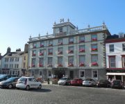
Cross Keys Hotel
Ednam House Hotel
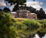
ROXBURGHE HOTEL AND GOLF COURSE
Videos from this area
These are videos related to the place based on their proximity to this place.
Kelso Ram Sales 2011.m2ts
Quick trip around the Kelso ram sales. A kind of beginner's guide. Not a report.
Accident Kelso Border Union Show Bolddog FMX Bike
Filmed at the Kelso Border Union Show on the 27th July 2013. The Bolddog FMX doing there show in the after noon with one the team having a little accident during the hands free landing. These...
Kelso Border Union Show Bolddog FMX Bikes 2013
The Bolddog FMX bike show at the Kelso Border Union Show,This is the first show they done earlier in the day. Filmed on the 27th July 2013.
Kelso 1. River Tweed Spawning Areas and Juvenile Surveys
The first of six presentations given at a public seminar in Kelso on 25th March 2015. It explains the important of juvenile fish surveys in the management of Salmon on the River Tweed.
Ripon City Morris in Kelso (NEX-5)
Clips from the Ripon City Morris performing in Kelso, Scotland. Filmed with Sony NEX-5.
Police bikes Riding the East March A699 Maxton to Kelso 7 of 10
Police bikes - Around The Corner presents "Riding The East March" Part of a series of routes by professional bikers for bikers, promoting bike routes and safe biking in the Scottish Borders....
Videos provided by Youtube are under the copyright of their owners.
Attractions and noteworthy things
Distances are based on the centre of the city/town and sightseeing location. This list contains brief abstracts about monuments, holiday activities, national parcs, museums, organisations and more from the area as well as interesting facts about the region itself. Where available, you'll find the corresponding homepage. Otherwise the related wikipedia article.
Roxburghshire
Roxburghshire or the County of Roxburgh is a registration county of Scotland. It borders Dumfries to the west, Selkirk to the north-west, and Berwick to the north. To the south-east it borders Cumbria and Northumberland in England. It was named after the Royal Burgh of Roxburgh. Roxburghshire is now within the Scottish Borders council area.
Roxburgh, Ettrick and Lauderdale
Roxburgh, Ettrick and Lauderdale (Rosbrog, Eadaraig agus Srath Labhdair in Scottish Gaelic) is a lieutenancy area of Scotland. It consists of the committee areas of Eildon, Cheviot and Teviot and Liddesdale (the former local government districts of Roxburgh and Ettrick and Lauderdale) within the Scottish Borders council area. It corresponds broadly to the counties of Roxburghshire and Selkirkshire and small parts of Midlothian and Berwickshire. Reference:
Nisbet, Scottish Borders
Nisbet is a small hamlet on the B6400, in Roxburghshire, along the River Teviot, in the Scottish Borders area of Scotland. It is located 5.5 kilometres north of Jedburgh and 5 kilometres south of Roxburgh. The village has several Nisbet location names: Nisbet, East Nisbet, West Nisbet, Nisbetmill, Upper Nisbet, and Upper Nisbet Moor. However, none of these are connected to the family of Nisbet of that Ilk, who built Nisbet House in Berwickshire.
Jed Water
The Jed Water is a river and a tributary of the River Teviot in the Borders region of Scotland. In total Jed Water is over 20 miles long, it flows into the Teviot near Jedfoot Bridge from a source in the Cheviot Hills. The river means a lot to the town as it gives it beauty and attracts tourists, but in past times it was the main source of water for the monks living in Jedburgh Abbey which sits behind the river.
Waterloo Monument
The Waterloo Monument near Ancrum in the Scottish Borders is a 150 foot tower, built between 1817 and 1824 to commemorate the Battle of Waterloo. It was designed by the architect Archibald Elliot, after the original monument designed by William Burn collapsed. The monument stands on Peniel Heugh, OS ref: NT 653263, a hill between Ancrum and Nisbet, Roxburghshire.
Bonjedward
Bonjedward is a hamlet in the Scottish Borders area of Scotland, two miles north of Jedburgh where the River Jed joins the River Teviot. The village stands on a ridge of land formed by the approach of the Teviot and Jed Water towards their junction. Nearby are Ancrum, Lanton, Monteviot House, Peniel Heugh, the Timpendean Tower and the Waterloo Monument.
Peniel Heugh
Peniel Heugh is a hill near Ancrum and Nisbet in the Scottish Borders area of Scotland. On it stands the Waterloo Monument. Places nearby include Bonjedward, Crailing, Jedburgh, Monteviot House, Roxburgh. The Roman Heritage Way and St. Cuthbert's Way pass by the heugh and the monument.
Crailing
Crailing is a village on the A698, in Teviotdale, 4m east of Jedburgh in the Scottish Borders area of Scotland, in the former Roxburghshire. Places nearby include Ancrum, Crailinghall, Eckford, Hownam, Kelso, Nisbet, Roxburghshire, the Oxnam Water, the River Teviot. Rory Bremner bought Crailing House near Jedburgh in September 2009.


