Safety Score: 3,0 of 5.0 based on data from 9 authorites. Meaning we advice caution when travelling to United Kingdom.
Travel warnings are updated daily. Source: Travel Warning United Kingdom. Last Update: 2024-08-13 08:21:03
Delve into Foulshiels
Foulshiels in The Scottish Borders (Scotland) is a town located in United Kingdom about 302 mi (or 486 km) north-west of London, the country's capital town.
Time in Foulshiels is now 08:35 AM (Saturday). The local timezone is named Europe / London with an UTC offset of zero hours. We know of 10 airports closer to Foulshiels, of which 5 are larger airports. The closest airport in United Kingdom is Edinburgh Airport in a distance of 33 mi (or 53 km), North-West. Besides the airports, there are other travel options available (check left side).
There are several Unesco world heritage sites nearby. The closest heritage site in United Kingdom is New Lanark in a distance of 28 mi (or 46 km), East. Also, if you like the game of golf, there are some options within driving distance. In need of a room? We compiled a list of available hotels close to the map centre further down the page.
Since you are here already, you might want to pay a visit to some of the following locations: Newtown St Boswells, Dalkeith, Haddington, Edinburgh and Carlisle. To further explore this place, just scroll down and browse the available info.
Local weather forecast
Todays Local Weather Conditions & Forecast: 8°C / 46 °F
| Morning Temperature | 6°C / 42 °F |
| Evening Temperature | 6°C / 42 °F |
| Night Temperature | 4°C / 39 °F |
| Chance of rainfall | 0% |
| Air Humidity | 73% |
| Air Pressure | 1015 hPa |
| Wind Speed | Moderate breeze with 12 km/h (8 mph) from East |
| Cloud Conditions | Overcast clouds, covering 87% of sky |
| General Conditions | Light rain |
Sunday, 17th of November 2024
4°C (40 °F)
-0°C (31 °F)
Few clouds, moderate breeze.
Monday, 18th of November 2024
2°C (35 °F)
-2°C (29 °F)
Overcast clouds, light breeze.
Tuesday, 19th of November 2024
2°C (36 °F)
-3°C (27 °F)
Few clouds, gentle breeze.
Hotels and Places to Stay
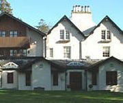
Best Western Plus Philipburn House Hotel
The Glen Hotel
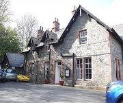
Clovenfords Hotel
Videos from this area
These are videos related to the place based on their proximity to this place.
A Winter's day in Galashiels, Scotland
Here's a wee film I made. In Scotland. In winter. BRRR! It made using a very old Mercury digital camera and a tripod, and edited with VirtualDub. Sorry about the gaps in the audio :(
CLOVENFORDS BY AIR
An aerial view of Clovenfords and the Caddon Water valley filmed from my Storm 6 Drone. my first real drone flight and hopefully the first in a series of aerial videos of locations in the Borders.
Interior Caddonfoot Church Scottish Borders Scotland
Tour Scotland video of the interior of Caddonfoot Church on ancestry visit to Scottish Borders. Built in 1860 and opened for worship in February 1861, this Scottish church was designed by Alexander...
Selkirk Common Riding 2013. Merchant Company Casting
Ian Main casts the Selkirk Merchant Company Flag in the Town Square.
Wheels in the Woods 2007 Elibank Forest Red Route 1
Wheels in the Woods 2007 Elibank Forest 1st red route. Scottish Off Road Club Event http://scottishoffroadclub.co.uk.
Wheels In The Woods 2006
An Off Roading Day In The Scottish Borders Organised By The Scottish Off Road club and the Foresty Commision.
Selkirk Common Riding 2012 /1 Gavin Henderson Casts the Royal Burgh Flag
Gavin Henderson casts the Royal Burgh of Selkirk flag at Selkirk Common Riding 15th June 2012 Please ask the Committee to announce and introduce the Standard Bearers in future.
Ayr 2nds Try against Selkirk A
Ayr 2nd team score a try against Selkirk A team at Philiphaugh on Saturday the 17th of November 2012. Had a little shot of the video on my camera and was lucky enough to catch this good try....
Selkirk Flood Protection Scheme gets underway
Sod cutting ceremony for £31.4 million project. The start of the Selkirk Flood Protection Scheme was marked today (Tuesday 24 June) with a sod-cutting ceremony. Scotland's Environment and...
Videos provided by Youtube are under the copyright of their owners.
Attractions and noteworthy things
Distances are based on the centre of the city/town and sightseeing location. This list contains brief abstracts about monuments, holiday activities, national parcs, museums, organisations and more from the area as well as interesting facts about the region itself. Where available, you'll find the corresponding homepage. Otherwise the related wikipedia article.
Battle of Philiphaugh
The Battle of Philiphaugh was fought on 13 September 1645 during the Civil War near Selkirk in the Scottish Borders. The Royalist army of the Marquess of Montrose was destroyed by the Covenanter army of Sir David Leslie, restoring the power of the Committee of Estates.
Newark Castle, Selkirkshire
Newark Castle is a large, ruined tower house standing in the grounds of Bowhill House, in the valley of the Yarrow Water three miles west of Selkirk in the Scottish Borders. In addition to the keep, sections of a gatehouse and wall survive. Newark Castle was granted to Archibald Douglas, Earl of Wigtown around 1423. It was incomplete at this time and work continued until about 1475.
Carterhaugh
Carterhaugh is a wood and farm near the confluence of the Yarrow Water and the Ettrick Water near Selkirk in the Scottish Borders. This real location is the fictional setting for the meeting between Tam Lin and Janet (sometimes Margaret) in the ballad "Tam Lin". Some researchers of the Tam Lin ballad equate Carterhaugh with Carter Bar in the Cheviot Hills on the border of Scotland and England.
Aikwood Tower
Aikwood Tower (also known as Oakwood Tower) is a 16th-century tower house in the Scottish Borders area of Scotland, 4 miles southwest of the town of Selkirk, on the Ettrick Water. The tower is a Category A listed building. The tower was built in 1535, but in the late 18th century it was abandoned as a dwelling and was used as a store on the adjoining farm.
Broadmeadows, Scottish Borders
Broadmeadows is a village in the Scottish Borders area of Scotland, on the A708 near Selkirk. Places nearby include Boleside, Bowhill, Caddonfoot, Ettrickbridge, Lindean, Philiphaugh, Sundhope, Yarrow Water and Yarrowford.
Bowhill House
Bowhill House is a historic house near Bowhill at Selkirk in the Scottish Borders area of Scotland. It is a member of the Historic Houses Association, and is one of the homes of the Duke of Buccleuch. The house is protected as a Category A listed building, and the grounds are listed on the Inventory of Gardens and Designed Landscapes in Scotland. Bowhill was built in 1708 by John, Lord Bowhill. His brother William Murray had bought the land earlier in 1690.
Bowhill, Scottish Borders
Bowhill is a village off the A708, in the Scottish Borders area of Scotland, near Selkirk, by the Yarrow Water Other places nearby include Bowhill House, Boleside, Broadmeadows, Ettrickbridge, Kirkhope.
Yarrowford
Yarrowford is a village on the A708, in the Scottish Borders area of Scotland, 4 miles north-west of Selkirk, in the Ettrick Forest. The Yarrow Water flows through the village and joins the Ettrick Water near Philiphaugh. Places nearby include Bowhill, Ettrickbridge, Newark Castle, the Yair Forest, Yarrow, Scottish Borders and Yarrow Feus.


