Safety Score: 3,0 of 5.0 based on data from 9 authorites. Meaning we advice caution when travelling to United Kingdom.
Travel warnings are updated daily. Source: Travel Warning United Kingdom. Last Update: 2024-08-13 08:21:03
Delve into Killearn
Killearn in Stirling (Scotland) with it's 1,670 habitants is located in United Kingdom about 358 mi (or 576 km) north-west of London, the country's capital town.
Current time in Killearn is now 03:39 AM (Saturday). The local timezone is named Europe / London with an UTC offset of zero hours. We know of 11 airports close to Killearn, of which 5 are larger airports. The closest airport in United Kingdom is Glasgow International Airport in a distance of 12 mi (or 19 km), South. Besides the airports, there are other travel options available (check left side).
There is one Unesco world heritage site nearby. It's Old and New Towns of Edinburgh in a distance of 62 mi (or 99 km), East. Also, if you like playing golf, there are some options within driving distance. If you need a hotel, we compiled a list of available hotels close to the map centre further down the page.
While being here, you might want to pay a visit to some of the following locations: Glasgow, Paisley, Dumbarton, Kirkintilloch and Giffnock. To further explore this place, just scroll down and browse the available info.
Local weather forecast
Todays Local Weather Conditions & Forecast: 8°C / 46 °F
| Morning Temperature | 7°C / 45 °F |
| Evening Temperature | 6°C / 43 °F |
| Night Temperature | 3°C / 37 °F |
| Chance of rainfall | 0% |
| Air Humidity | 67% |
| Air Pressure | 1015 hPa |
| Wind Speed | Moderate breeze with 10 km/h (6 mph) from East |
| Cloud Conditions | Overcast clouds, covering 100% of sky |
| General Conditions | Light rain |
Sunday, 17th of November 2024
5°C (41 °F)
-0°C (32 °F)
Few clouds, gentle breeze.
Monday, 18th of November 2024
2°C (36 °F)
-2°C (28 °F)
Overcast clouds, light breeze.
Tuesday, 19th of November 2024
2°C (36 °F)
-2°C (29 °F)
Few clouds, light breeze.
Hotels and Places to Stay
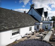
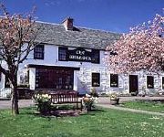
BW BUCHANAN ARMS HOTEL & SPA
Winnock
Videos from this area
These are videos related to the place based on their proximity to this place.
Mugdock
A sub 2 minute video of riding an MTB through Mugdock Country Park, to the north of Glasgow and Milngavie, Scotland, UK. A much more peaceful video compared to my usual efforts...
Shooting clout at Mugdock
An end of three arrows at a club meeting of Green Hollow Bowmen at Mudgock Country Park, near Glasgow.
A pack of Vizsla (k)
Viz Whizz met at Mugdock Country Park on Saturday for a walk - great fun! Lots of Vizslak!
Mugdock Castle and surrounding areas - Aerial Video from DJI Phantom 2 Vision+
An aerial view of Mugdock Castle, Glasgow, Scotland and the surrounding areas taken with a DJI Phantom 2 Vision+.
RC Bristol Blenhiem
This is a Bristol Blenhiem yet another old kit given to me to assemble, well, gota do something to past the time whilst awaiting the Grim Reaper. The gear is up with dummy wheels in the nacelles....
Night riding, dual carriageway and foggy back roads
Got a new camera mount today, couldn't wait till daylight to test it out so I thought a little night ride was called for. Started off nice and clear from Clydebank heading west along the A82...
Gorge Scrambling Finnich Gorge/The Devil`s Pulpit
Gorge walking/scrambling at Finnich Gorge. The Carnock Burn has cut through the soft sandstone forming a very narrow and deep gorge about a quarter mile in length and around 80 feet deep. The...
Dumgoyne Loop
Time lapse run around Dumgoyne Loop from Milngavie up the start of the the West Highland Way, a quick stop in The Beech Tree, past Glengoyne Distillery and down through Strathblane as the sun ...
Pots of Gartness River Endrick Scotland
Rocky ledge of 3m, river in spate, impressive flow and rate for such a small river, salmon normally jump - not today!
Open Canoe put in at Balfron River Endrick Scotland
Launching an open canoe is all about balance and judging the rivers flow.
Videos provided by Youtube are under the copyright of their owners.
Attractions and noteworthy things
Distances are based on the centre of the city/town and sightseeing location. This list contains brief abstracts about monuments, holiday activities, national parcs, museums, organisations and more from the area as well as interesting facts about the region itself. Where available, you'll find the corresponding homepage. Otherwise the related wikipedia article.
Dumgoyne
Dumgoyne is a hill prominent on the edge of the Campsie Fells and is a well known landmark visible from Glasgow. It is a volcanic plug and is 427 m high (1,402 feet). The plug is readily reached from a path beside Glengoyne Distillery or via a water-board track from the village of Strathblane three miles to the east or Killearn to the west. From Strathblane, the path begins at the entrance to a private road.
Glengoyne distillery
Glengoyne Distillery is a whisky distillery continuously in operation since its founding in 1833 at Dumgoyne, north of Glasgow, Scotland. Glengoyne is unique in producing Highland single malt whisky matured in the Highlands. Located upon the Highland Line, the division between the Highlands and Lowlands of Scotland, Glengoyne’s stills are in the Lowlands while maturing casks of whisky rest across the road in the Highlands.
A81 road
The A81 road is a trunk road in Scotland, United Kingdom, it runs from Glasgow to Callander, a total of 30 miles . The Collins 2012 Collins Big Road Atlas shows the A81 as one of the five most dangerous roads in Scotland based on serious and fatal accidents between 2007 and 2009 in proportion to traffic. {{#invoke: Navbox | navbox }} {{#invoke:Coordinates|coord}}{{#coordinates:56.05614|N|4.39687|W|type:landmark_region:GB_dim:30000|||| |primary |name= }}
Dumfoyn
Dumfoyn is a hill in the Campsie Fells of Scotland. It is a volcanic plug, and rises to 426 metres. It sits beside another hill, Dumgoyne which is a popular ascent for walkers due to its close proximity to Glasgow.
Balfron High School
Balfron High School is situated in the village of Balfron, approximately 18 miles from Glasgow and 20 miles from Stirling. The catchment area includes the larger villages of Killearn, Strathblane, Blanefield, Drymen and Kippen; the smaller villages of Buchlyvie, Fintry and Croftamie; along with the village of Balfron where the school is situated. The school also however has pupils attending from areas of Balloch as well as Milngavie, Bearsden and other areas of Glasgow.
Dualt Spout
Dualt Spout is a waterfall of Scotland.


