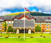
Safety Score: 3,0 of 5.0 based on data from 9 authorites. Meaning we advice caution when travelling to United Kingdom.
Travel warnings are updated daily. Source: Travel Warning United Kingdom. Last Update: 2024-08-13 08:21:03
Delve into Clifton
Clifton in Stirling (Scotland) is a city located in United Kingdom about 388 mi (or 625 km) north-west of London, the country's capital town.
Current time in Clifton is now 03:43 AM (Saturday). The local timezone is named Europe / London with an UTC offset of zero hours. We know of 12 airports closer to Clifton, of which 5 are larger airports. The closest airport in United Kingdom is Oban Airport in a distance of 26 mi (or 42 km), West. Besides the airports, there are other travel options available (check left side).
Also, if you like playing golf, there are some options within driving distance. In need of a room? We compiled a list of available hotels close to the map centre further down the page.
Since you are here already, you might want to pay a visit to some of the following locations: Greenock, Dumbarton, Paisley, Glasgow and Kirkintilloch. To further explore this place, just scroll down and browse the available info.
Local weather forecast
Todays Local Weather Conditions & Forecast: 6°C / 44 °F
| Morning Temperature | 6°C / 42 °F |
| Evening Temperature | 5°C / 40 °F |
| Night Temperature | 1°C / 34 °F |
| Chance of rainfall | 0% |
| Air Humidity | 71% |
| Air Pressure | 1015 hPa |
| Wind Speed | Moderate breeze with 10 km/h (6 mph) from East |
| Cloud Conditions | Overcast clouds, covering 100% of sky |
| General Conditions | Light rain |
Sunday, 17th of November 2024
3°C (38 °F)
-1°C (30 °F)
Sky is clear, gentle breeze, clear sky.
Monday, 18th of November 2024
1°C (34 °F)
-3°C (26 °F)
Overcast clouds, light breeze.
Tuesday, 19th of November 2024
1°C (34 °F)
-3°C (26 °F)
Sky is clear, light breeze, clear sky.
Hotels and Places to Stay
Bridge of Orchy Hotel
Muthu Ben Doran Hotel
Muthu Royal Hotel
Videos from this area
These are videos related to the place based on their proximity to this place.
Tyndrum and Cononish
Backpacking and Camped with my Son John at Cononish near Tyndrum. The weather was fair then it turned to snow but not too heavy. Had a walk in the hills and may have come across gold in a ...
The Great Marquess & 37516 @ Upper Tyndrum Station
The Great Marquess pulled out of Upper Tyndrum Station by 37516. A faulty boiler and leaking pipes sees the Great Marquess going back home to Carnforth for repairs. Mind you the class 37 had...
Tyndrum Lower Train Station
Train Service From Glasgow Queen Street To Oban Calling At Tyndrum Lower.
Road South To Tyndrum Scottish Highlands Scotland August 2nd
Tour Scotland video of a drive south on the A82 road South to Tyndrum in the Scottish Highlands.
Upper Tyndrum Train Station
Train Service From Glasgow Queen Street To Mallaig Calling At Upper Tyndrum.
Scottish Series (part 2) County March Summit
We now move to another new location, with stunning scenary. County March Summit near Tyndrum on the West Highland main line (Glasgow - Fort William) scenery west highland way walk Part...
Videos provided by Youtube are under the copyright of their owners.
Attractions and noteworthy things
Distances are based on the centre of the city/town and sightseeing location. This list contains brief abstracts about monuments, holiday activities, national parcs, museums, organisations and more from the area as well as interesting facts about the region itself. Where available, you'll find the corresponding homepage. Otherwise the related wikipedia article.
Battle of Dalrigh
The Battle of Dalrigh, also known as the Battle of Dail Righ, Battle of Dalry or Battle of Strathfillan, was fought in the summer of 1306 between the army of King Robert I of Scotland against the Clan MacDougall of Argyll who were allies of Clan Comyn and the English. It took place at the hamlet of Dalrigh (the "King's Field" in the Scottish Gaelic language) near Tyndrum in Argyll, Scotland (not to be confused with Dalry, Ayrshire).
Dalrigh
Dalrigh is a hamlet in Scotland near Tyndrum. The name means "The King's Field" in the Scottish Gaelic language. grid reference NN342291 The origin of the name stems specifically from the Battle of Dalrigh which was fought there in 1306, when King Robert I of Scotland (Bruce) was defeated by the Clan MacDougall.
Beinn Odhar
Beinn Odhar is a Scottish mountain situated at the northern extremity of the Loch Lomond and the Trossachs National Park. It stands four km (2.5 mi) north of Tyndrum, a location with which it has strong ties, being well seen from the village. The mountain lies on the border between Argyll and Bute and Stirling council areas within the Auch and Invermeran estate.
Meall Odhar
Meall Odhar is a mountain in the Scottish Highlands, situated about 3 km to the west of Tyndrum, close to the northern boundary of the Loch Lomond and the Trossachs National Park. Meall Odhar is part of the Tyndrum Hills. With a height of 656 m and a drop of 183 m, it is listed as a Marilyn and a Graham. The name Meall Odhar is from the Gaelic for "dun-coloured round hill".
Eas nam Beatach
Eas nam Beatach is a waterfall of Scotland.


