Safety Score: 3,0 of 5.0 based on data from 9 authorites. Meaning we advice caution when travelling to United Kingdom.
Travel warnings are updated daily. Source: Travel Warning United Kingdom. Last Update: 2024-08-13 08:21:03
Discover Moodiesburn
Moodiesburn in North Lanarkshire (Scotland) with it's 6,900 citizens is a town in United Kingdom about 345 mi (or 555 km) north-west of London, the country's capital city.
Current time in Moodiesburn is now 01:51 AM (Saturday). The local timezone is named Europe / London with an UTC offset of zero hours. We know of 11 airports near Moodiesburn, of which 5 are larger airports. The closest airport in United Kingdom is Glasgow International Airport in a distance of 14 mi (or 22 km), West. Besides the airports, there are other travel options available (check left side).
There is one Unesco world heritage site nearby. It's Old and New Towns of Edinburgh in a distance of 50 mi (or 81 km), East. Also, if you like playing golf, there are a few options in driving distance. Looking for a place to stay? we compiled a list of available hotels close to the map centre further down the page.
When in this area, you might want to pay a visit to some of the following locations: Kirkintilloch, Motherwell, Hamilton, Glasgow and Giffnock. To further explore this place, just scroll down and browse the available info.
Local weather forecast
Todays Local Weather Conditions & Forecast: 8°C / 47 °F
| Morning Temperature | 8°C / 46 °F |
| Evening Temperature | 7°C / 44 °F |
| Night Temperature | 4°C / 39 °F |
| Chance of rainfall | 0% |
| Air Humidity | 66% |
| Air Pressure | 1014 hPa |
| Wind Speed | Moderate breeze with 10 km/h (6 mph) from East |
| Cloud Conditions | Overcast clouds, covering 99% of sky |
| General Conditions | Light rain |
Sunday, 17th of November 2024
5°C (41 °F)
1°C (33 °F)
Scattered clouds, gentle breeze.
Monday, 18th of November 2024
3°C (37 °F)
-1°C (30 °F)
Overcast clouds, light breeze.
Tuesday, 19th of November 2024
2°C (36 °F)
-1°C (30 °F)
Few clouds, light breeze.
Hotels and Places to Stay
DoubleTree by Hilton Strathclyde
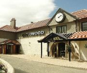
Crowwood Hotel
MONDO HOTEL
J3) Glasgow Stepps (M80
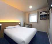
TRAVELODGE GLASGOW CUMBERNAULD
Glasgow East
Coachman Hotel
Videos from this area
These are videos related to the place based on their proximity to this place.
Watchtower Auld Aisle Cemetery Kirkintilloch East Dunbartonshire Scotland
Tour Scotland video of the watchtower in the Auld Aisle cemetery on visit to Kirkintilloch, East Dunbartonshire. The cemetery formed the grounds of St Ninian's Church, a pre-Reformation parish...
Alexander Dalrymple Gravestone Auld Aisle Cemetery Kirkintilloch East Dunbartonshire Scotland
Tour Scotland video of the Alexander Dalrymple gravestone in the Auld Aisle cemetery on visit to Kirkintilloch, East Dunbartonshire.
First Mini Album
This is my first chipboard Mini Album and I used First Edition paper block Up Up and Away. I loved these papers as soon as I saw them. You can view my other creations at http://bearykrafti.blogspot...
Aerial Demo Vol. 2 - Drumpellier Country Park
Filmed in mid April 2014 on a sunny day at Drumpellier Country Park in Coatbridge, Scotland.
D1015 Western Champion Passing Greenfoot Level Crossing
D1015 makes the first ever visit of a "Western" to Scotland. It it seen here passing Greenfoot level crossing, north of Coatbridge. 74 of these Type 4 C-C diesel-hydraulic locomotives were...
Scotland v Wales 1990 Monklands Canal Part 1 of 5
Video of the friendly International coarse fishing match between Scotland and Wales on the Monklands Canal in Coatbridge, Scotland in 1990. Part 1 of 5.
60051 Passing Heatherbell And Greenfoot Level Crossings
EWS (English Welsh & Scottish) Class 60 (Brush Type 5) "Tug" 051 running light engine northbound. It is seen passing Heatherbell level crossing (north of Coatbridge) first of all, as a Class...
Sheds Passing Heatherbell Level Crossing
Two Class 66 "Sheds" are seen passing Heatherbell level crossing north of Coatbridge, Scotland. The first is DRS 66411 in Stobart livery hauling containers for a well-known supermarket chain,...
Class 66 Coal Trains Through Heatherbell Level Crossing
Two DB Schenker Class 66 locomotives, 66154 and 66099, in EWS "heritage" ;) livery pass through Heatherbell level crossing (north of Coatbridge, Scotland) with coal trains. ;) - Deutsche...
Videos provided by Youtube are under the copyright of their owners.
Attractions and noteworthy things
Distances are based on the centre of the city/town and sightseeing location. This list contains brief abstracts about monuments, holiday activities, national parcs, museums, organisations and more from the area as well as interesting facts about the region itself. Where available, you'll find the corresponding homepage. Otherwise the related wikipedia article.
Coatbridge, Chryston and Bellshill (UK Parliament constituency)
Coatbridge, Chryston and Bellshill is a constituency of the House of Commons of the Parliament of the United Kingdom. It elects one Member of Parliament (MP) using the first-past-the-post voting system. It was created for the 2005 general election, covering the whole area of the Coatbridge and Chryston constituency and parts of the Hamilton North and Bellshill seat. A small area in the eastern side of Coatbridge lies within the Airdrie and Shotts constituency.
Chryston
Chryston is a village in the central belt of Scotland in the county of North Lanarkshire. Founded by James Burns Pollock, It is north of the main trunk road between Glasgow and Stirling. The village lies north of Muirhead, seven miles east of Glasgow - the exact boundary between the two villages is difficult to find.
Annathill
Annathill is a small village located near Coatbridge in North Lanarkshire, Scotland. It had a population of 237 in 1991. The name is thought to be derived from a patron saint's church.
Bedlay Castle
Bedlay Castle is a former defensive castle, dating from the late 16th and 17th centuries. It is located between Chryston and Moodiesburn in North Lanarkshire, Scotland. The castle is just off the A80 road, around 8 miles to the north-east of Glasgow, at NS692700.
Gartcosh
Gartcosh is a village in North Lanarkshire, Scotland. The village lies a few miles east of Glasgow, and about a mile northwest of the town of Coatbridge. The name Gartcosh is derived from the Gaelic 'Gart' meaning 'field' and 'Cos' meaning 'hollow'. According to 2001 census, there were 410 households with a population of 952. Recent expansion of the village including 300 homes in the Heathfield Park estate built by Redrow Homes has increased the population, which is now estimated at around 3000.
Muirhead
Muirhead is a small suburb approximately 7 miles North-East of Glasgow city centre. Nearby villages and towns include Chryston, Garnkirk, Gartcosh, Lenzie and Stepps. It is a commuter town to Glasgow with road links with the A80/M80 and frequent bus services the 36, x37, x39 and x3. Muirhead is located approximately two miles from Gartcosh, Lenzie and Stepps railway stations.
Chryston High School
Chryston High School is a six-year non-denominational secondary school situated in Chryston, North Lanarkshire, Scotland. The school plays an important role in the community with the students assisting with local organisations. The school was awarded the Charter Mark in September 2007, for excellence in customer service.
Mollinsburn
Mollinsburn is a settlement in the North Lanarkshire area of Scotland. It is situated on the A80 road between Condorrat to the east and Moodiesburn to the west. The population is around 100. The Mollinsburn interchange just west of the settlement currently links the A80 with the M73 motorway. The M80 extension, due for opening in 2011, will depart the present route of the A80 shortly before the current M73 interchange.


