Safety Score: 3,0 of 5.0 based on data from 9 authorites. Meaning we advice caution when travelling to United Kingdom.
Travel warnings are updated daily. Source: Travel Warning United Kingdom. Last Update: 2024-08-13 08:21:03
Delve into Mollinburn
Mollinburn in North Lanarkshire (Scotland) is located in United Kingdom about 344 mi (or 553 km) north-west of London, the country's capital town.
Current time in Mollinburn is now 01:24 AM (Saturday). The local timezone is named Europe / London with an UTC offset of zero hours. We know of 11 airports close to Mollinburn, of which 5 are larger airports. The closest airport in United Kingdom is Glasgow International Airport in a distance of 16 mi (or 25 km), West. Besides the airports, there are other travel options available (check left side).
There is one Unesco world heritage site nearby. It's Old and New Towns of Edinburgh in a distance of 48 mi (or 78 km), East. Also, if you like playing golf, there are some options within driving distance. If you need a hotel, we compiled a list of available hotels close to the map centre further down the page.
While being here, you might want to pay a visit to some of the following locations: Kirkintilloch, Motherwell, Hamilton, Stirling and Glasgow. To further explore this place, just scroll down and browse the available info.
Local weather forecast
Todays Local Weather Conditions & Forecast: 8°C / 46 °F
| Morning Temperature | 7°C / 45 °F |
| Evening Temperature | 7°C / 44 °F |
| Night Temperature | 3°C / 38 °F |
| Chance of rainfall | 0% |
| Air Humidity | 68% |
| Air Pressure | 1014 hPa |
| Wind Speed | Moderate breeze with 10 km/h (6 mph) from East |
| Cloud Conditions | Overcast clouds, covering 99% of sky |
| General Conditions | Light rain |
Sunday, 17th of November 2024
5°C (41 °F)
0°C (32 °F)
Few clouds, gentle breeze.
Monday, 18th of November 2024
2°C (36 °F)
-2°C (29 °F)
Overcast clouds, light breeze.
Tuesday, 19th of November 2024
2°C (36 °F)
-2°C (29 °F)
Few clouds, light breeze.
Hotels and Places to Stay
WESTERWOOD GOLF AND SPA
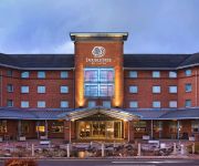
DoubleTree by Hilton Strathclyde
MONDO HOTEL
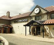
Crowwood Hotel
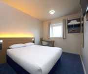
TRAVELODGE GLASGOW CUMBERNAULD
Glasgow (Cumbernauld)
Le Chene Hotel
J3) Glasgow Stepps (M80
Glasgow East
Coachman Hotel
Videos from this area
These are videos related to the place based on their proximity to this place.
Glenmavis Parade Airdrie Argyle Accoridions Prince Of Orange Coatbridge Airdrie Grenadiers Peter.3GP
D1015 Western Champion Passing Greenfoot Level Crossing
D1015 makes the first ever visit of a "Western" to Scotland. It it seen here passing Greenfoot level crossing, north of Coatbridge. 74 of these Type 4 C-C diesel-hydraulic locomotives were...
60051 Passing Heatherbell And Greenfoot Level Crossings
EWS (English Welsh & Scottish) Class 60 (Brush Type 5) "Tug" 051 running light engine northbound. It is seen passing Heatherbell level crossing (north of Coatbridge) first of all, as a Class...
Sheds Passing Heatherbell Level Crossing
Two Class 66 "Sheds" are seen passing Heatherbell level crossing north of Coatbridge, Scotland. The first is DRS 66411 in Stobart livery hauling containers for a well-known supermarket chain,...
Class 66 Coal Trains Through Heatherbell Level Crossing
Two DB Schenker Class 66 locomotives, 66154 and 66099, in EWS "heritage" ;) livery pass through Heatherbell level crossing (north of Coatbridge, Scotland) with coal trains. ;) - Deutsche...
EWS 67015 Passing Level Crossing
EWS Class 67 "Skip" heading southbound passes Heatherbell level crossing north of Coatbridge, Scotland. This video has been edited down to shorten the time between the barriers closing and...
Black Fives On The Great Britain II
A pair of ex-LMS Stanier "Black Five" 5MT steam locomotives, 45231 (Sherwood Forester) and 45407 (Lancashire Fuselier), haul the Great Britain II railtour up the gradient to Greenfoot level...
Sons of William FB (Glenmavis) Annual Band Parade - 2013 - Part 1
Footage from the Sons of William FB (Glenmavis) annual Band Parade held this year on Saturday the 1st June Bands Featured - Sons of William, Lily of The Valley, Drumgelloch Bible & Crown,...
Videos provided by Youtube are under the copyright of their owners.
Attractions and noteworthy things
Distances are based on the centre of the city/town and sightseeing location. This list contains brief abstracts about monuments, holiday activities, national parcs, museums, organisations and more from the area as well as interesting facts about the region itself. Where available, you'll find the corresponding homepage. Otherwise the related wikipedia article.
A80 road (Great Britain)
The A80 is a road in Scotland, running from the A8 to Moodiesburn, north east of Glasgow. Prior to the M80 opening, the A80 was one of Scotland's busiest trunk roads.
Greenfaulds
Greenfaulds is an area of the town of Cumbernauld in Scotland. Greenfaulds was a half council half private estate built in the late 1960s and early 1970s. The main road through the estate is a ring road with the private sector being on the outside of the road and the council side being in the inside. Although originally council houses, a large portion of the housing stock are now privately owned.
Annathill
Annathill is a small village located near Coatbridge in North Lanarkshire, Scotland. It had a population of 237 in 1991. The name is thought to be derived from a patron saint's church.
Balloch, North Lanarkshire
Balloch is an area of the new town of Cumbernauld. It is also known as 'Eastfield' or 'Balloch Eastfield' - the area which previously was covered by Balloch farm in the west side and Eastfield holdings and cemetery in the east side.
Westfield, Cumbernauld
Westfield is an area of the town of Cumbernauld in Scotland. Westfield is a popular residential area originally built by Cumbernauld Development Corporation in the late 1970s / early 1980s (construction began 1975). It is located near the village of Condorrat and Broadwood Stadium, home of Clyde FC. The area is notable for not having a public house. Historically, there were two local primary schools, St Francis of Assisi Primary School and Westfield Primary School. St.
Mollinsburn
Mollinsburn is a settlement in the North Lanarkshire area of Scotland. It is situated on the A80 road between Condorrat to the east and Moodiesburn to the west. The population is around 100. The Mollinsburn interchange just west of the settlement currently links the A80 with the M73 motorway. The M80 extension, due for opening in 2011, will depart the present route of the A80 shortly before the current M73 interchange.
Glenboig
Glenboig is a village formerly of East Dunbartonshire and now part of the North Lanarkshire area of Scotland lying north of Coatbridge and to the south east of Kirkintilloch. Historically the settlement formed the south eastern extremity of the ancient Gaelic province of the Lennox which lay roughly within the former county of Dunbartonshire. Glenboig's railway station closed in 1960 and the local coal mining and brick-making industries ceased by the 1980s.
Greenfaulds High School
Greenfaulds High School is a mixed, non-denominational six-year comprehensive secondary school, which was opened in 1971. Greenfaulds is situated in the west of Cumbernauld and provides a service to the Greenfaulds, Ravenswood, Condorrat, Westfield, Eastfield, Balloch areas and parts of Seafar. The head teacher is Dr John A May. Currently there are 1,350 pupils at the school, which has a maximum capacity of 1,450.


