Safety Score: 3,0 of 5.0 based on data from 9 authorites. Meaning we advice caution when travelling to United Kingdom.
Travel warnings are updated daily. Source: Travel Warning United Kingdom. Last Update: 2024-08-13 08:21:03
Touring Branderburgh
Branderburgh in Moray (Scotland) is a town located in United Kingdom about 447 mi (or 720 km) north of London, the country's capital place.
Time in Branderburgh is now 03:35 AM (Saturday). The local timezone is named Europe / London with an UTC offset of zero hours. We know of 10 airports nearby Branderburgh, of which 3 are larger airports. The closest airport in United Kingdom is RAF Lossiemouth in a distance of 2 mi (or 3 km), South-West. Besides the airports, there are other travel options available (check left side).
There is one Unesco world heritage site nearby. It's Heart of Neolithic Orkney in a distance of 90 mi (or 144 km), North. Also, if you like the game of golf, there are several options within driving distance. Need some hints on where to stay? We compiled a list of available hotels close to the map centre further down the page.
Being here already, you might want to pay a visit to some of the following locations: Elgin, Inverness, Highland, Forfar and Dundee. To further explore this place, just scroll down and browse the available info.
Local weather forecast
Todays Local Weather Conditions & Forecast: 7°C / 44 °F
| Morning Temperature | 6°C / 44 °F |
| Evening Temperature | 6°C / 43 °F |
| Night Temperature | 5°C / 40 °F |
| Chance of rainfall | 3% |
| Air Humidity | 75% |
| Air Pressure | 1010 hPa |
| Wind Speed | Strong breeze with 19 km/h (12 mph) from East |
| Cloud Conditions | Overcast clouds, covering 89% of sky |
| General Conditions | Light rain |
Sunday, 17th of November 2024
4°C (39 °F)
2°C (36 °F)
Rain and snow, fresh breeze, broken clouds.
Monday, 18th of November 2024
3°C (37 °F)
2°C (35 °F)
Snow, moderate breeze, broken clouds.
Tuesday, 19th of November 2024
3°C (37 °F)
1°C (34 °F)
Snow, moderate breeze, overcast clouds.
Hotels and Places to Stay
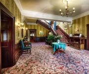
The Mansion House Hotel & Country Club
Stotfield
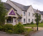
The Lodge Elgin
Eight Acres
Elgin
Videos from this area
These are videos related to the place based on their proximity to this place.
Lossiemouth, Scotland (1926)
A view of the harbour in the Highland fishing port of Lossiemouth. This extract comes from Claude Friese-Greene's 'The Open Road' - originally filmed in 1925/6 and now re-edited and digitally...
The Year at RAF Lossiemouth.wmv
A video showing some of the events that have taken place at RAF Lossiemouth during 2012.
Solar Eclipse Lossiemouth 2015 Timelapse
It was cloudy and grey, but we still saw it egetting dark and lots of folk were out and about in the towns hoping to get get a view of the sun . Heres 30mins sped yup to 1min 30secs.
tornado night time take off raf lossiemouth
a tornado gr4 takes off for a night sortie from a very wet raf lossiemouth in october 09 . footage was taken using the video capture mode on my camera rather than with a dedicated camcorder...
F-15 Eagles of USAF 57FIS from Keflavik at Lossiemouth c1994
F-15 Eagles from the USAF 57 FIS based at Keflavik in Iceland taxy and take off at Lossiemouth in Scotland around 1994 during an exercise at the base.
P3D - Blackburn Buccaneer - No. 12 Squadron RAF - RAF Lossiemouth - By JMCV 2013
Prepar3D (P3D) is a simulation platform developed by Lockheed Martin. * The Blackburn Buccaneer was a British low-level subsonic strike aircraft that served with the Royal Navy (RN) and later...
worlds 2014 city of St Andrews pipe band
sat 16th August 2014 at Glesgi' Green Worlds Pipe Band competitions on a dreich an weet day.
Videos provided by Youtube are under the copyright of their owners.
Attractions and noteworthy things
Distances are based on the centre of the city/town and sightseeing location. This list contains brief abstracts about monuments, holiday activities, national parcs, museums, organisations and more from the area as well as interesting facts about the region itself. Where available, you'll find the corresponding homepage. Otherwise the related wikipedia article.
River Lossie
The River Lossie is a river in north east Scotland. Ptolemy (c.90 – c.168), the Greco / Roman geographer, named it as ost. Loxa Fl. The river originates in the hills above Dallas, in Moray, and has its source 400 metres above sea-level. It enters the sea at Lossiemouth on the Moray Firth. By the time it moves through Elgin its rate of flow, in normal conditions, is best described as very slow.
Stotfield fishing disaster
The Stotfield fishing disaster was the first of several fishing disasters of the 19th century on the east coast of Scotland. A storm struck the Moray Firth on 25 December 1806. Compared to the Moray Firth fishing disaster of 1848 or the Eyemouth Disaster of 1881, the Stotfield disaster was small. However, although in those major disasters many more lives and boats were lost, the effect at Stotfield was arguably worse. There, the village lost its entire fleet of three fishing boats.
Moray Golf Club
Moray Golf Club is situated in Lossiemouth (on the south coast of the Moray Firth), Moray, Scotland. The club has two eighteen hole courses appropriately called the Old Course and the New Course. The club has played host to many championships, both amateur and professional. The old and new courses were designed by Old Tom Morris and Henry Cotton respectively.
Lossiemouth High School
Lossiemouth High School is a secondary school in the coastal town of Lossiemouth, Moray, Scotland. The school's catchment area includes the nearby villages of Burghead, Hopeman, Cummingston and Duffus. The feeder primaries are Hythehill, St. Gerardine's, Hopeman and Burghead. There are over 650 pupils, separated into four houses: Covesea, Kinnedar, Pitgaveny and Spynie. The school rector is Brenda Gifford. In 2005 the school was selected to be part of the Schools of Ambition programme.
Laich of Moray
The Laich of Moray is the rich agricultural coastal plain in Moray. Laich is a Scots word meaning Low-lying land. The generally accepted area covered by the term Laich of Moray is from Fochabers to Brodie and also includes the towns of Elgin, Forres, Lossiemouth, Burghead, Hopeman and Lhanbryde.
Spynie Canal
Spynie Canal is a canal in Moray, Scotland, which lies between Elgin and Lossiemouth. It drains into the River Lossie near its mouth at Lossiemouth.


