Safety Score: 3,0 of 5.0 based on data from 9 authorites. Meaning we advice caution when travelling to United Kingdom.
Travel warnings are updated daily. Source: Travel Warning United Kingdom. Last Update: 2024-08-13 08:21:03
Delve into Pathhead
Pathhead in Fife (Scotland) with it's 960 habitants is located in United Kingdom about 323 mi (or 520 km) north of London, the country's capital town.
Current time in Pathhead is now 06:08 PM (Tuesday). The local timezone is named Europe / London with an UTC offset of zero hours. We know of 9 airports close to Pathhead, of which 5 are larger airports. The closest airport in United Kingdom is Edinburgh Airport in a distance of 16 mi (or 26 km), West. Besides the airports, there are other travel options available (check left side).
There are several Unesco world heritage sites nearby. The closest heritage site in United Kingdom is Old and New Towns of Edinburgh in a distance of 9 mi (or 15 km), North-East. Also, if you like playing golf, there are some options within driving distance. We encountered 1 points of interest near this location. If you need a hotel, we compiled a list of available hotels close to the map centre further down the page.
While being here, you might want to pay a visit to some of the following locations: Dalkeith, Haddington, Edinburgh, Glenrothes and Newtown St Boswells. To further explore this place, just scroll down and browse the available info.
Local weather forecast
Todays Local Weather Conditions & Forecast: 5°C / 40 °F
| Morning Temperature | 3°C / 37 °F |
| Evening Temperature | 4°C / 40 °F |
| Night Temperature | 7°C / 45 °F |
| Chance of rainfall | 2% |
| Air Humidity | 79% |
| Air Pressure | 1022 hPa |
| Wind Speed | Fresh Breeze with 14 km/h (8 mph) from North-East |
| Cloud Conditions | Broken clouds, covering 64% of sky |
| General Conditions | Moderate rain |
Wednesday, 4th of December 2024
6°C (43 °F)
12°C (53 °F)
Light rain, strong breeze, overcast clouds.
Thursday, 5th of December 2024
9°C (49 °F)
8°C (46 °F)
Moderate rain, high wind, near gale, broken clouds.
Friday, 6th of December 2024
7°C (45 °F)
5°C (40 °F)
Light rain, moderate breeze, overcast clouds.
Hotels and Places to Stay
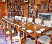
Carberry Tower Mansion House and Estate
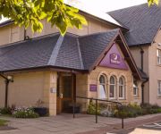
Edinburgh Lodges
Edinburgh A1 (Musselburgh)
Videos from this area
These are videos related to the place based on their proximity to this place.
Making of the Mayfield Mural: Evan and Cameron's video
This is one of four video clips made by an excellent team of S1 reporters, camera operators and editors in the video workshops at Newbattle High. These clips will be part of the documentary...
Making of the Mayfield Mural: Connie's video
This is one of four video clips made by an excellent team of S1 reporters, camera operators and editors in the video workshops at Newbattle High. These clips will be part of the documentary...
Victorian Tiled Floor Cleaning Tranent
http://www.floorcarerestorations.co.uk/victorian-tiled-floor-cleaning-tranent/ Victorian Tiled Floor Cleaning Tranent From Floorcare Restorations. For more info call 0800 068 0737 or fill out...
Tranent Juniors v Dunbar Utd
east league south division goals from the county derby between Tranent and Dunbar played at Foresters Park Tranent Saturday 20th September 2008.
Tranent Dentists | Bridge Dental Care | 01875 610352
http://www.bridgedentalcare.co.uk/ - Tranent Dentists Dentist Bridge Dental Care. We aim to make your visit as relaxed and enjoyable as Dentistry can be and hope to make it fun and interactive...
Videos provided by Youtube are under the copyright of their owners.
Attractions and noteworthy things
Distances are based on the centre of the city/town and sightseeing location. This list contains brief abstracts about monuments, holiday activities, national parcs, museums, organisations and more from the area as well as interesting facts about the region itself. Where available, you'll find the corresponding homepage. Otherwise the related wikipedia article.
Borthwick Castle
Borthwick Castle is one of the largest and best-preserved surviving medieval Scottish fortifications. It is located twelve miles (19 km) south-east of Edinburgh, to the east of the village of Borthwick, on a site protected on three sides by a steep fall in the ground. It was constructed in 1430 for Sir William Borthwick, from whom the castle takes its name,
Vogrie Country Park
Vogrie Country Park in Scotland is managed by Midlothian Council. It consists of a Woodland Estate surrounding the Victorian Vogrie House. It is located around 12 miles from Edinburgh between Pathhead and Gorebridge. Facilities in the parkland include a miniature railway, 9-hole golf course, children's play area and four miles of walks. The River Tyne flows through the park.
Vogrie House
Vogrie House forms the centrepiece of Vogrie Country Park in Midlothian. It is the former home of the Dewar family and was built in 1876 by Andrew Heiton, the town Architect for Perth. The house is an example of Victorian baronial splendour and is said to be one of the best surviving examples of Heiton's work. The house was a typical country house with a library, servants' quarters and many bedrooms.
Crichton Castle
Crichton Castle is a ruined castle situated at the head of the River Tyne, near the village of Crichton, Midlothian, Scotland. The castle lies two miles south of the village of Pathhead, and the same distance east of Gorebridge, at {{#invoke:Coordinates|coord}}{{#coordinates:55.8411|-2.9895||||||| | |name= }}. A mile to the south-west is Borthwick Castle.
Crichton, Midlothian
Crichton is a small village in Midlothian, Scotland, around 2 miles south of Pathhead and the same east of Gorebridge. The name is derived from the Gaelic word crioch, which means border, and the Old English word tune which means farm or settlement. To the west of the village is the 15th century parish church, formerly a collegiate church, established by William Crichton, 1st Lord Crichton, who served as Lord Chancellor of Scotland from 1439 to 1453.
Dewartown
Dewartown is a small hamlet in Midlothian, Scotland, UK, near Pathhead and Mayfield. Its name relates to the Dewar family who owned the nearby Vogrie House and Estate which is now in Vogrie Country Park. The village is reputed to have had five public houses during the 19th century, providing for the many farm workers, miners and house staff from the local community. Dewartown is still not listed on many maps, despite the fact a number of the cottages date back to the early 18th century.
Crichton Collegiate Church
Crichton Collegiate Church is situated about 0.6 miles south west of the hamlet of Crichton in Midlothian, Scotland. Crichton itself is 1.4 miles west of Pathhead and 7.5 miles south of Scotland's capital city, Edinburgh. The church is reached by leaving the A68 road at the north end of Pathhead and turning on to the B6367 minor road at Crichton on a single track lane signposted Crichton Castle. Before reaching the castle car park, on the left, is the church, situated at grid reference NT381616.


