Safety Score: 3,0 of 5.0 based on data from 9 authorites. Meaning we advice caution when travelling to United Kingdom.
Travel warnings are updated daily. Source: Travel Warning United Kingdom. Last Update: 2024-08-13 08:21:03
Delve into Queensferry
Queensferry in Edinburgh (Scotland) with it's 8,960 habitants is a town located in United Kingdom about 337 mi (or 543 km) north-west of London, the country's capital town.
Time in Queensferry is now 02:25 PM (Thursday). The local timezone is named Europe / London with an UTC offset of zero hours. We know of 9 airports closer to Queensferry, of which 3 are larger airports. The closest airport in United Kingdom is Edinburgh Airport in a distance of 3 mi (or 5 km), South. Besides the airports, there are other travel options available (check left side).
There are two Unesco world heritage sites nearby. The closest heritage site in United Kingdom is Old and New Towns of Edinburgh in a distance of 24 mi (or 39 km), East. Also, if you like the game of golf, there are some options within driving distance. We saw 1 points of interest near this location. In need of a room? We compiled a list of available hotels close to the map centre further down the page.
Since you are here already, you might want to pay a visit to some of the following locations: Livingston, Edinburgh, Glenrothes, Dalkeith and Falkirk. To further explore this place, just scroll down and browse the available info.
Local weather forecast
Todays Local Weather Conditions & Forecast: 2°C / 36 °F
| Morning Temperature | -2°C / 28 °F |
| Evening Temperature | 0°C / 33 °F |
| Night Temperature | -1°C / 31 °F |
| Chance of rainfall | 0% |
| Air Humidity | 63% |
| Air Pressure | 997 hPa |
| Wind Speed | Moderate breeze with 11 km/h (7 mph) from East |
| Cloud Conditions | Scattered clouds, covering 31% of sky |
| General Conditions | Scattered clouds |
Friday, 22nd of November 2024
2°C (36 °F)
-1°C (31 °F)
Few clouds, gentle breeze.
Saturday, 23rd of November 2024
2°C (35 °F)
2°C (36 °F)
Rain and snow, fresh breeze, overcast clouds.
Sunday, 24th of November 2024
8°C (47 °F)
7°C (45 °F)
Light rain, moderate breeze, overcast clouds.
Hotels and Places to Stay
DAKOTA EDINBURGH
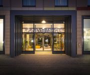
DoubleTree by Hilton Edinburgh Airport
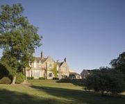
GARVOCK HOUSE HOTEL
Kellerstain Stables
Dalmahoy Hotel & Country Club
Parkhead House
KING MALCOLM HOTEL
Norton House
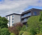
DoubleTree by Hilton Edinburgh - Queensferry Crossing
Courtyard Edinburgh West
Videos from this area
These are videos related to the place based on their proximity to this place.
South Queensferry Scotland
Old Tour Scotland video on visit to South Queensferry, which is part of the City of Edinburgh, Scotland. It is located some ten miles to the west of the city centre, on the shore of the Firth...
RNLI Queensferry Lifeboat Loony Dook South Queensferry Scotland
Tour Scotland video of the RNLI Queensferry inshore lifeboat and crew in the River Forth in the shadow of the world famous Forth Railway Bridge before the 2015 Loony Dook on visit to South...
Queensferry Crossing Replacement Forth Road Bridge Construction Firth Of Forth Scotland
Tour Scotland Autumn video of replacement Forth Road Bridge construction over the Firth Of Forth. Shot with a long lens on visit to South Queensferry near Edinburgh, This is Scotland's biggest...
Premier Inn Edinburgh South Queensferry
My review of Premier Inn Edinburgh South Queensferry: http://www.helpmetosave.com/2013/08/review-premier-inn-south-queensferry/
Loony Dook South Queensferry Forth Estuary By Edinburgh Scotland 2013
Tour Scotland video of The Loony Dook held on Tuesday, January 1st, 2013 in the Forth Estuary on visit to South Queensferry near Edinburgh. This New Year's Day swim takes place on the first...
Sea Kayaking - South Queensferry to Dalgety Bay.
My first real sea kayaking trip in some choppy seas. I left my happy place on the way back in those big waves. Great trip though. This is something I have always wanted to do. Original soundtrack.
South Queensferry Harbour, Scotland
A stroll around South Queensferry Harbour with superb views of the bridges.
Loony Dook in Queensferry, Edinburgh's Hogmanay (2012/2013)
Every year, crazy Scotsmen taking a bath at the first day of the year. They have to wear costumes and possibly are still drunken^^ New Year's tradition in the near of Edinburgh.
Sea Kayaking - South Queensferry to Inchcolm Island, Forth Estuary, Scotland
Kayaking in the Forth Estuary. Paddling from South Queensferry North under the Forth Rail Bridge and East, seeing Puffins, Seals and some strange gnomes on the way to Inchcolm Island. Returning...
Samagen leaving South Queensferry
The Sadler 26 "Samagen" leaving South Queensferry for it's trip back to it's mooring at Bo'ness.
Videos provided by Youtube are under the copyright of their owners.
Attractions and noteworthy things
Distances are based on the centre of the city/town and sightseeing location. This list contains brief abstracts about monuments, holiday activities, national parcs, museums, organisations and more from the area as well as interesting facts about the region itself. Where available, you'll find the corresponding homepage. Otherwise the related wikipedia article.
Forth Bridge
The Forth Bridge is a cantilever railway bridge over the Firth of Forth in the east of Scotland, to the east of the Forth Road Bridge, and 14 kilometres (9 mi) west of central Edinburgh. It was opened on 4 March 1890, and spans a total length of 2,528.7 metres .
Forth Road Bridge
The Forth Road Bridge is a suspension bridge in east central Scotland. The bridge, opened in 1964, spans the Firth of Forth, connecting the capital city Edinburgh, at South Queensferry, to Fife, at North Queensferry. It replaced a centuries-old ferry service to carry vehicular traffic, cyclists, and pedestrians across the Forth; rail crossings are made by the adjacent and historic Forth Bridge.
Inchgarvie
Inchgarvie (occasionally "Inch Garvie") is a small, uninhabited island in the Firth of Forth. Its name comes from Innis Garbhach which is Scottish Gaelic for "rough island". Local tradition has it that the island takes its name from the young herring, or "garvies" which sheltered in large shoals around its shores - this is however folk etymology as the first element is Gaelic. Although now uninhabited, Inchgarvie has been inhabited throughout various periods of history.
B800 road
The B800 is a short road in eastern Scotland, connecting the Forth Road Bridge to Kirkliston. It is a two-way single carriageway road. It was formerly known as the A8000, when it was the main road from the bridge to the M9 motorway and the M8 motorway. The A8000 was under the control of the City of Edinburgh Council, not a Trunk Road under the control of the Scottish Executive.
Port Edgar
Port Edgar is a marina situated on the south shore of the Firth of Forth immediately to the west of the southern end of the Forth Road Bridge in the town of South Queensferry, Scotland. In previous years it had been the site of HMS Lochinvar. In the inter war period Port Edgar was the a destroyer base. under the command of the then Captain Cunningham who later went on to become Admiral of the Fleet.
Jamestown Viaduct
The Jamestown Viaduct is part of the Forth Rail Bridge in Scotland. It crosses the Hamlet of Jamestown and the village of North Queensferry in Fife.
Dundas Castle
Dundas Castle is a 15th century castle, with substantial 19th century additions by William Burn, near South Queensferry, to the west of Edinburgh, Scotland. It was the home of the Dundas family, and remains in private hands.
Jubilee1
Jubilee FM was launched in 2002 as a local radio station operating under a Restricted Service Licence for one week to celebrate Ferry Fair week. It then continued to operate in this fashion until 2006 when it rebranded as Jubilee1 - part of the Jubilee MultiChannel package
Forth Replacement Crossing
The Forth Replacement Crossing is a road bridge under construction in Scotland. It is being built alongside the existing Forth Road Bridge across the Firth of Forth, and will connect Scotland's capital city Edinburgh, at South Queensferry, to Fife, at North Queensferry. Proposals for a second Forth crossing were first put forward in the 1990s, but it was not until the discovery of structural issues with the Forth Road Bridge in 2005 that plans were moved forward.
Priory Church, South Queensferry
The Priory Church of St Mary of Mount Carmel, commonly called the Priory Church or St Mary's Episcopal Church, is a congregation of the Scottish Episcopal Church located in South Queensferry, near Edinburgh, Scotland. The church building was constructed in the mid 15th century for the Carmelite Order. It served as the parish church in the 16th and 17th centuries, but subsequently fell into disrepair. In 1890 it was restored and reopened by the Scottish Episcopal Church.


