Safety Score: 3,0 of 5.0 based on data from 9 authorites. Meaning we advice caution when travelling to United Kingdom.
Travel warnings are updated daily. Source: Travel Warning United Kingdom. Last Update: 2024-08-13 08:21:03
Delve into Barrhead
Barrhead in East Renfrewshire (Scotland) with it's 17,620 habitants is a town located in United Kingdom about 344 mi (or 554 km) north-west of London, the country's capital town.
Time in Barrhead is now 01:50 AM (Saturday). The local timezone is named Europe / London with an UTC offset of zero hours. We know of 11 airports closer to Barrhead, of which 5 are larger airports. The closest airport in United Kingdom is Glasgow International Airport in a distance of 5 mi (or 8 km), North. Besides the airports, there are other travel options available (check left side).
There is one Unesco world heritage site nearby. It's Old and New Towns of Edinburgh in a distance of 63 mi (or 102 km), East. Also, if you like the game of golf, there are some options within driving distance. In need of a room? We compiled a list of available hotels close to the map centre further down the page.
Since you are here already, you might want to pay a visit to some of the following locations: Paisley, Giffnock, Glasgow, Kilmarnock and Dumbarton. To further explore this place, just scroll down and browse the available info.
Local weather forecast
Todays Local Weather Conditions & Forecast: 8°C / 46 °F
| Morning Temperature | 7°C / 44 °F |
| Evening Temperature | 6°C / 43 °F |
| Night Temperature | 3°C / 37 °F |
| Chance of rainfall | 0% |
| Air Humidity | 69% |
| Air Pressure | 1015 hPa |
| Wind Speed | Moderate breeze with 10 km/h (6 mph) from East |
| Cloud Conditions | Overcast clouds, covering 100% of sky |
| General Conditions | Light rain |
Sunday, 17th of November 2024
4°C (40 °F)
0°C (33 °F)
Scattered clouds, gentle breeze.
Monday, 18th of November 2024
2°C (36 °F)
-2°C (29 °F)
Overcast clouds, light breeze.
Tuesday, 19th of November 2024
2°C (36 °F)
-2°C (29 °F)
Sky is clear, light breeze, clear sky.
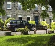
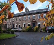
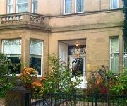
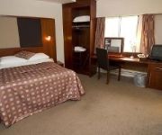
Hotels and Places to Stay
Dalmeny Park Country House Hotel and Gardens
ASHTREE HOUSE HOTEL
ASHTREE HOUSE HOTEL
Glynhill And Leisure Club
Courtyard Glasgow Airport
Holiday Inn GLASGOW AIRPORT
Manor Park Guest House
The Normandy Hotel
TRAVELODGE GLASGOW BRAEHEAD
TRAVELODGE GLASGOW AIRPORT
Videos from this area
These are videos related to the place based on their proximity to this place.
HP Velotechnik Streetmachine Recumbent Bike Ride in Paisley, Scotland
Kenny's first ride on his HPVelotechnik StreetMachine Gt recumbent bike. This is on the cycle route 75 on the outskirts of Paisley, Scotland, near Canal Street station.
Paisley Canal Train Station
Train service from Glasgow Central To Paisley Canal calling at Paisley Canal.
Paisley weaving musical threads
Some of the activities taking place in the Scottish town of Paisley during the Weaving Musical Threads Festival.
Border Collie Pups, Pilmuir, Newton Mearns August 2009
Pups finding there legs at last after opening there eyes a week ago. In this video are Kell the red and white collie pup(stepsister), Bree the tricolour collie(Mum) and Robbie the black and...
Border Collie pups at play, Pilmuir, Newton Mearns 2009
Kell playing with the pups September 2009. Kell is a 6 month old pup herself and loves playing with the pups.
Border collie pups, Pilmuir, Newton Mearns 2009
Bree and her six collie pups at 8 hours old. What a fantastic mother!
Videos provided by Youtube are under the copyright of their owners.
Attractions and noteworthy things
Distances are based on the centre of the city/town and sightseeing location. This list contains brief abstracts about monuments, holiday activities, national parcs, museums, organisations and more from the area as well as interesting facts about the region itself. Where available, you'll find the corresponding homepage. Otherwise the related wikipedia article.
Nitshill
Nitshill is a district on the south side of Glasgow. It is north of South Nitshill, south of Crookston, and southwest of Silverburn and Pollok. Nitshill was originally a coal mining village. The Nitshill Colliery was the scene of one of Scotland's worst mining disasters—on March 15, 1851 in which 61 men and boys died. The village fell within the county of Renfrewshire until about the 1920s, when it was incorporated into the City of Glasgow.
Neilston
Neilston is a village and parish in East Renfrewshire set in the west central Lowlands of Scotland. It lies in the Levern Valley, 2 miles southwest of Barrhead, 3.8 miles south of Paisley, and 5.7 miles south-southwest of Renfrew, at the southwestern fringe of the Greater Glasgow conurbation. Neilston is a dormitory village comprising a resident population of just over 5,000 people.
Hawkhead
Hawkhead is an area near Paisley in Renfrewshire, Scotland. It is the location of Hawkhead railway station on the Paisley Canal Line. It is near Dykebar. The former Hawkhead hospital for infectious diseases, which is now being converted to flats in a development called Hawkhead Village, was designed by the modernist architect Thomas S. Tait. The area's name is recorded as Halkhead in some older maps and in the historical title of Lord Ross of Halkhead
Dykebar
Dykebar is a small residential estate at the southernmost point of Paisley, Renfrewshire, Scotland. It is situated next to the Hawkhead area approximately one half kilometre from Barrhead, and is home to Paisley's secured mental hospital. Dykebar is a primarily residential area 1.8miles/3 km south east of Paisley off the A726. The area remained rural until after World War II. Map references to Dykebar date back from at least 1596 until after 1640.
Barrhead High School
Barrhead High School is a secondary school in Barrhead, East Renfrewshire. The school is over twenty-five years old. A Sinclair is the current headmaster, appointed in June 2010.
Auchenback
Auchenback is an area of Barrhead in East Renfrewshire, part of Greater Glasgow. It is notable for Barrhead's two high schools, St Luke's High School and Barrhead High School, as well as smaller primary schools.
St Luke's High School
St Luke's High School is a school situated in the Auchenback area of Barrhead, East Renfrewshire, in the Greater Glasgow area. In 2008, the school celebrated its 30th anniversary. The school focuses on its Catholic ethos in teaching, and its close relationship with the communities of Barrhead and Neilston, as well as areas further afield including Paisley, Pollok, Glenburn and Uplawmoor.
Dykebar railway station
Dykebar was a railway station in the Dykebar area to the south of Paisley, Renfrewshire, Scotland. The station was originally part of the Paisley and Barrhead District Railway . The line was opened in 1897 and used by coal trains until the 1960s but none of the stations including this one opened for passenger travel. It was situated on the east boundary of what are now the grounds of St Andrews school around 200 yards along Hawkhead Road from its junction with Barrhead Road.


