Safety Score: 3,0 of 5.0 based on data from 9 authorites. Meaning we advice caution when travelling to United Kingdom.
Travel warnings are updated daily. Source: Travel Warning United Kingdom. Last Update: 2024-08-13 08:21:03
Discover Toberonochy
Toberonochy in Argyll and Bute (Scotland) is a town in United Kingdom about 395 mi (or 636 km) north-west of London, the country's capital city.
Current time in Toberonochy is now 11:54 PM (Friday). The local timezone is named Europe / London with an UTC offset of zero hours. We know of 11 airports near Toberonochy, of which 4 are larger airports. The closest airport in United Kingdom is Oban Airport in a distance of 19 mi (or 31 km), North-East. Besides the airports, there are other travel options available (check left side).
Also, if you like playing golf, there are a few options in driving distance. We discovered 3 points of interest in the vicinity of this place. Looking for a place to stay? we compiled a list of available hotels close to the map centre further down the page.
When in this area, you might want to pay a visit to some of the following locations: Lochgilphead, Greenock, Dumbarton, Irvine and Ballycastle. To further explore this place, just scroll down and browse the available info.
Local weather forecast
Todays Local Weather Conditions & Forecast: 11°C / 52 °F
| Morning Temperature | 11°C / 52 °F |
| Evening Temperature | 12°C / 53 °F |
| Night Temperature | 9°C / 48 °F |
| Chance of rainfall | 4% |
| Air Humidity | 100% |
| Air Pressure | 1021 hPa |
| Wind Speed | Moderate breeze with 13 km/h (8 mph) from North-East |
| Cloud Conditions | Overcast clouds, covering 100% of sky |
| General Conditions | Light rain |
Saturday, 16th of November 2024
8°C (47 °F)
6°C (44 °F)
Light rain, fresh breeze, overcast clouds.
Sunday, 17th of November 2024
6°C (42 °F)
3°C (37 °F)
Light rain, moderate breeze, few clouds.
Monday, 18th of November 2024
3°C (38 °F)
1°C (34 °F)
Overcast clouds, light breeze.
Hotels and Places to Stay
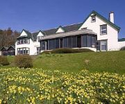
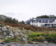
Loch Melfort
Loch Melfort Hotel
Videos from this area
These are videos related to the place based on their proximity to this place.
RFA Fort George passing through Corryvreckan Whirlpool
This is the British Ship "Royal Fleet Auxiliary Fort George" passing west through the Gulf of Corryvreckan, Scotland, August 2010. This was taken from a Bavaria 47 yacht "Amber" after a...
Corryvreckan Challenge
A group of five people attempt to swim across the notoriously dangerous Gulf of Corryvreckan, between the islands of Jura and Scarba, Argyll, West coast of Scotland.
Journey to the island of Easdale, from Seil.wmv
At the village of Ellanabeich on Seil, there is a small passenger only ferry, for the 3 minute crossing to Easdale. Easdale is a tiny island off the west coast of Scotland. Towards the end...
Things to do around Loch Melfort Hotel: Easdale Island Stone Skimming Championship (2)
Every September the Island of Easdlae hosts the World Stone Skimming Championships with the disused slate mining quarries a perfect arena. Each competitor is allowed 3 skims using specially...
Things to do around Loch Melfort Hotel: Easdale Island Stone Skimming Championship (3)
Every September the Island of Easdlae hosts the World Stone Skimming Championships with the disused slate mining quarries a perfect arena. Each competitor is allowed 3 skims using specially...
Kilbrandon Church and Lunga House Wedding Photography
NDK Wedding Photography with Carol & Stephen at Kilbrandon Church, Seil and Lunga House Argyll.
The Ostrich Tapes
The trailer for a short film. Set on the West Coast of Scotland, one man and his best bud try to come to terms with his wife's infidelity. A dark comedy with canoes, wet suits and cowboy boots...
Dado welcomes you to the Easdale Island
An amazing place with a million dollar view of the Atlantic.
The Easdale Wall, Seil Island.
A dive in unfortunately poor visibility conditions at Rubha Mhic Mharcuis (the Easdale Wall) on 14th September 2014, with Andrew Sinclair, John Kerr and Keith Waugh.
Videos provided by Youtube are under the copyright of their owners.
Attractions and noteworthy things
Distances are based on the centre of the city/town and sightseeing location. This list contains brief abstracts about monuments, holiday activities, national parcs, museums, organisations and more from the area as well as interesting facts about the region itself. Where available, you'll find the corresponding homepage. Otherwise the related wikipedia article.
Slate Islands
The Slate Islands are an island group in the Inner Hebrides, lying immediately off the west coast of Scotland, north of Jura and southwest of Oban. The main islands are Seil, Easdale, Luing, Lunga, Shuna, Torsa and Belnahua. Scarba and Kerrera which lie nearby, are not usually included. The underlying geology of the islands is Dalradian slate, which was quarried widely until the mid-twentieth century.
Luing
Luing is one of the Slate Islands, Firth of Lorn, in the west of Argyll in Scotland, about 16 miles south of Oban. It has a population of around 200 people, mostly living in Cullipool, Toberonochy (Tobar Dhonnchaidh), and Blackmillbay. A regular ferry service crosses the 200 m wide Cuan Sound which separates Luing from the neighbouring island of Seil, which is in turn connected by bridge to the mainland.
Torsa
Torsa (occasionally Torsay) is one of the Slate Islands in Argyll and Bute, Scotland. Lying east of Luing and south of Seil, the island was inhabited until the 1960s. There is now only one house on the island, which is used for holiday lets. Its main industry is farming, with cattle brought over from the neighbouring island of Luing. The Luing cattle were bred for their hardiness. The island is connected to its smaller partner, Torsa Beag (Gaelic for little Torsa).
Shuna, Slate Islands
Shuna is one of the Slate Islands lying east of Luing on the west coast of Scotland.


