Safety Score: 3,0 of 5.0 based on data from 9 authorites. Meaning we advice caution when travelling to United Kingdom.
Travel warnings are updated daily. Source: Travel Warning United Kingdom. Last Update: 2024-08-13 08:21:03
Discover Kintraw
Kintraw in Argyll and Bute (Scotland) is a town in United Kingdom about 390 mi (or 628 km) north-west of London, the country's capital city.
Current time in Kintraw is now 11:33 PM (Friday). The local timezone is named Europe / London with an UTC offset of zero hours. We know of 11 airports near Kintraw, of which 4 are larger airports. The closest airport in United Kingdom is Oban Airport in a distance of 20 mi (or 32 km), North. Besides the airports, there are other travel options available (check left side).
Also, if you like playing golf, there are a few options in driving distance. We discovered 3 points of interest in the vicinity of this place. Looking for a place to stay? we compiled a list of available hotels close to the map centre further down the page.
When in this area, you might want to pay a visit to some of the following locations: Lochgilphead, Greenock, Dumbarton, Irvine and Paisley. To further explore this place, just scroll down and browse the available info.
Local weather forecast
Todays Local Weather Conditions & Forecast: 11°C / 52 °F
| Morning Temperature | 11°C / 52 °F |
| Evening Temperature | 12°C / 53 °F |
| Night Temperature | 9°C / 48 °F |
| Chance of rainfall | 4% |
| Air Humidity | 100% |
| Air Pressure | 1021 hPa |
| Wind Speed | Moderate breeze with 13 km/h (8 mph) from North-East |
| Cloud Conditions | Overcast clouds, covering 100% of sky |
| General Conditions | Light rain |
Saturday, 16th of November 2024
8°C (47 °F)
6°C (44 °F)
Light rain, fresh breeze, overcast clouds.
Sunday, 17th of November 2024
6°C (42 °F)
3°C (37 °F)
Light rain, moderate breeze, few clouds.
Monday, 18th of November 2024
3°C (38 °F)
1°C (34 °F)
Overcast clouds, light breeze.
Hotels and Places to Stay
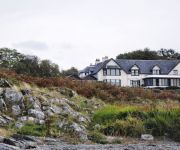
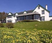
Loch Melfort Hotel
Loch Melfort
Videos from this area
These are videos related to the place based on their proximity to this place.
Cairnbaan Hotel - Quality Hotel Scotland
Cairnbann Hotel - Luxury hotel on the banks of the crinan canal.
Argyll Rally 2010, InCar with Nigel Feeney - Stage 7
The Rally of Argyll was a run through some very classic stages, unused since the old "Weldex Rally" days. This second running of the Inverleiver stage was the seventh and last test of the...
Kilmelford DH Track 2012 GoPro HD
Mike Wilkes Riding the Kilmlelford Downhill track on the 22/03/12. This is a track built by local riders to train on for races! Hope you like it ;-D.
Kilmartin Church
Kilmartin Parish Church, Scotland, was built in 1835. It houses two stone crosses which are displayed inside at the rear of the church. Kilmartin churchyard contains some of the oldest carved...
Scotland 2: Kilfinan and Kilmartin
This video features some ancient stone circles and obelisks, as well as some Knights Templar graves.
Kilbrandon Church and Lunga House Wedding Photography
NDK Wedding Photography with Carol & Stephen at Kilbrandon Church, Seil and Lunga House Argyll.
Videos provided by Youtube are under the copyright of their owners.
Attractions and noteworthy things
Distances are based on the centre of the city/town and sightseeing location. This list contains brief abstracts about monuments, holiday activities, national parcs, museums, organisations and more from the area as well as interesting facts about the region itself. Where available, you'll find the corresponding homepage. Otherwise the related wikipedia article.
Eilean Rìgh
Eilean Rìgh is an island in the Inner Hebrides of the west coast of Scotland. It lies in Loch Craignish, about 300 m off the Argyll coastline. The name is Gaelic for "King's Island", although which royal is not known.
Carnasserie Castle
Carnasserie Castle (also spelled Carnassarie) is a ruined 16th century tower house, noted for its unusual plan and renaissance detailing. It is located around 2km to the north of Kilmartin, in Argyll and Bute, western Scotland, at grid reference NM837009.
Ardfern
Ardfern is a village in Argyll and Bute, Scotland. It lies on the south coast of the Craignish peninsula, facing Loch Craignish. It has a small, close community, and features a church, fire station, primary school, craft centre with a tea room, a village shop, public house (The Galley of Lorne), and yacht centre. http://www. ardfernyacht. co. uk/. It lies between the towns of Oban to the North and Lochgilphead to the South. On the east side of the Craignish Peninsula is Nether Lorne, Argyll.
Eilean Mhic Chrion
Eilean Mhic Chrion is a tidal island sheltering Ardfern in Loch Craignish, Scotland. Eilean Mhic Chrion is one of 43 tidal islands that can be walked to from the mainland of Great Britain and one of 17 that can be walked to from the Scottish mainland. 30px This Argyll and Bute location article is a stub. You can help Wikipedia by expanding it. vte


