Safety Score: 3,0 of 5.0 based on data from 9 authorites. Meaning we advice caution when travelling to United Kingdom.
Travel warnings are updated daily. Source: Travel Warning United Kingdom. Last Update: 2024-08-13 08:21:03
Delve into Cardross
Cardross in Argyll and Bute (Scotland) with it's 2,130 habitants is located in United Kingdom about 359 mi (or 578 km) north-west of London, the country's capital town.
Current time in Cardross is now 11:38 PM (Friday). The local timezone is named Europe / London with an UTC offset of zero hours. We know of 11 airports close to Cardross, of which 5 are larger airports. The closest airport in United Kingdom is Glasgow International Airport in a distance of 11 mi (or 17 km), South-East. Besides the airports, there are other travel options available (check left side).
Also, if you like playing golf, there are some options within driving distance. We encountered 3 points of interest near this location. If you need a hotel, we compiled a list of available hotels close to the map centre further down the page.
While being here, you might want to pay a visit to some of the following locations: Dumbarton, Greenock, Paisley, Irvine and Kilmarnock. To further explore this place, just scroll down and browse the available info.
Local weather forecast
Todays Local Weather Conditions & Forecast: 11°C / 52 °F
| Morning Temperature | 10°C / 51 °F |
| Evening Temperature | 11°C / 52 °F |
| Night Temperature | 10°C / 50 °F |
| Chance of rainfall | 0% |
| Air Humidity | 86% |
| Air Pressure | 1021 hPa |
| Wind Speed | Moderate breeze with 12 km/h (7 mph) from East |
| Cloud Conditions | Broken clouds, covering 80% of sky |
| General Conditions | Light rain |
Saturday, 16th of November 2024
8°C (46 °F)
3°C (37 °F)
Light rain, moderate breeze, overcast clouds.
Sunday, 17th of November 2024
5°C (40 °F)
0°C (32 °F)
Few clouds, gentle breeze.
Monday, 18th of November 2024
2°C (36 °F)
-2°C (28 °F)
Overcast clouds, light breeze.
Hotels and Places to Stay
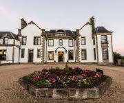
Gleddoch House Golf Hotel & Elemis Spa BW Premier Collection
Clutha View Holiday Apartment
The County Hotel
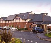
Lomond Park Hotel
Greenock
Videos from this area
These are videos related to the place based on their proximity to this place.
Quad Freestyle Madness - Plada Fields Port Glasgow
http://www.shugtech.co.uk Port Glasgow Plada Fields - Make the most of it while you can, before the builders come and destroy the place.. Marty G Shug Tech Marty W Paddy Mc Mick D.
Quad Freestyle - Port Glasgow Plada Fields
MishMash of the guys up Port Glasgow - Plada Fields Marty W - YFS Blaster 200 Marty G - YFS Blaster 200 Paddy - KLF300 Shugtech - KLF300 4x4.
Bouverie St Demolision..Port-Glasgow 1/07/214..The Longest Tenement In Britain n.
via YouTube Capture.
Port Glasgow Plada Fields Part 1 - 25th April 2010
Part 1 of our day up the Plada fields, plenty going on... Kawasaki 300 2wd Kawasaki 300 4x4 Suzuki LT250r 2x Yamaha Blaster 200cc fantastic day out on the Quads/Atv.
ZMR 250 Mini Quadcopter FPV Last Battery Of The Day!
Last battery of the day.. Kelburn Park - Port Glasgow.
Videos provided by Youtube are under the copyright of their owners.
Attractions and noteworthy things
Distances are based on the centre of the city/town and sightseeing location. This list contains brief abstracts about monuments, holiday activities, national parcs, museums, organisations and more from the area as well as interesting facts about the region itself. Where available, you'll find the corresponding homepage. Otherwise the related wikipedia article.
Boglestone
Boglestone (named after the Bogal Stone) is located around the top of the Clune Brae, Port Glasgow, Inverclyde, Scotland. The area includes housing, but also serves as an important 'hub' for upper Port Glasgow, offering amenities such as education, shopping, health centres, and leisure. The two schools previously situated here were Boglestone Primary a non-denominational school, and St Michael's a Roman Catholic primary School.
Cardross, Argyll
Cardross (Càrdainn Ros in Gaelic) is a large village with a population of 2,351 (2001) in Scotland, on the north side of the Firth of Clyde, situated halfway between Dumbarton and Helensburgh. Cardross is in the historic geographical county of Dunbartonshire but the modern political local authority of Argyll and Bute. Cardross is also the name of an historic parish where King Robert the Bruce once lived.
Park Farm, Port Glasgow
Park Farm is a housing scheme in the upper east area of Port Glasgow, Inverclyde, Scotland, built on the site of Park farm which stood near Parkhill Square. It consists of two distinct phases; the original phase stretches uphill from Parkhill Square to Mull Avenue and the second phase (Upper Park Farm) was built in the late 1960s and consists of the streets around Oronsay Avenue. All of the streets take their names from Scottish islands.
Newark Castle, Port Glasgow
Newark Castle is a well-preserved castle sited on the south shore of the estuary of the River Clyde in Port Glasgow, Inverclyde, Scotland, where the firth gradually narrows from the Firth of Clyde and navigation upriver is made difficult by shifting sandbanks. For centuries this location was used to offload seagoing ships, and led to the growth of Port Glasgow close to the castle on either side and to the south.
Bouverie, Port Glasgow
Bouverie is an area of the town of Port Glasgow, Inverclyde, Scotland. The Bouverie area was developed in the late nineteenth century as part of Port Glasgow's eastward expansion. Originally consisting of ancillary shipbuilding-related businesses, and workers' housing, it now mainly consists of residential buildings and a handful of small service industries. including bouverie motors the owner bought most of the lands of the disused ropeworks.
Kilmahew Castle
Kilmahew Castle is a ruined castle located just north of Cardross, in the council area of Argyll and Bute. Kilmahew is named for its patron saint, Mochta (Mahew).
Geilston Garden
Geilston Garden is a property of the National Trust for Scotland, north-west of Cardross, Argyll and Bute. Geilston Garden was developed more than two hundred years ago, combining several features (traditional walled garden, kitchen garden, wooded area). The walled garden has a dominating 100-foot Wellingtonia in the centre of the lawn. The Geilston burn wends its way through the north of the estate towards the River Clyde in Cardross. The kitchen garden is the most labour intensive area.
Woodhall, Port Glasgow
Woodhall is a housing scheme in the lower east end of Port Glasgow, Inverclyde in Scotland. It stands on land once occupied by Woodhall mansion and estate. The mansion stood where St Martin's church now stands on Mansion Avenue.


