Safety Score: 3,0 of 5.0 based on data from 9 authorites. Meaning we advice caution when travelling to United Kingdom.
Travel warnings are updated daily. Source: Travel Warning United Kingdom. Last Update: 2024-08-13 08:21:03
Touring Glasgoforest
Glasgoforest in Aberdeenshire (Scotland) is a town located in United Kingdom about 403 mi (or 649 km) north of London, the country's capital place.
Time in Glasgoforest is now 08:00 AM (Saturday). The local timezone is named Europe / London with an UTC offset of zero hours. We know of 10 airports nearby Glasgoforest, of which 4 are larger airports. The closest airport in United Kingdom is Aberdeen Dyce Airport in a distance of 4 mi (or 7 km), East. Besides the airports, there are other travel options available (check left side).
There are two Unesco world heritage sites nearby. The closest heritage site in United Kingdom is Old and New Towns of Edinburgh in a distance of 89 mi (or 142 km), South. Also, if you like the game of golf, there are several options within driving distance. Need some hints on where to stay? We compiled a list of available hotels close to the map centre further down the page.
Being here already, you might want to pay a visit to some of the following locations: Aberdeen, Forfar, Dundee, Elgin and Glenrothes. To further explore this place, just scroll down and browse the available info.
Local weather forecast
Todays Local Weather Conditions & Forecast: 7°C / 44 °F
| Morning Temperature | 5°C / 41 °F |
| Evening Temperature | 4°C / 40 °F |
| Night Temperature | 3°C / 38 °F |
| Chance of rainfall | 0% |
| Air Humidity | 71% |
| Air Pressure | 1011 hPa |
| Wind Speed | Fresh Breeze with 14 km/h (9 mph) from East |
| Cloud Conditions | Overcast clouds, covering 100% of sky |
| General Conditions | Light rain |
Sunday, 17th of November 2024
3°C (38 °F)
0°C (32 °F)
Light rain, fresh breeze, few clouds.
Monday, 18th of November 2024
2°C (36 °F)
-1°C (31 °F)
Few clouds, moderate breeze.
Tuesday, 19th of November 2024
2°C (36 °F)
-2°C (29 °F)
Light snow, moderate breeze, overcast clouds.
Hotels and Places to Stay
TOWN AND COUNTRY APARTMENTS MACKIE
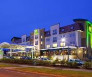
Holiday Inn ABERDEEN - WEST
TOWN AND COUNTRY APARTMENT PRIORY - INVE
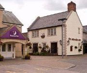
Hampton By Hilton Aberdeen Westhill
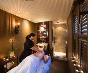
Thainstone House Hotel & Spa
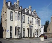
Kintore Arms Hotel
Aberdeen (Westhill)
Videos from this area
These are videos related to the place based on their proximity to this place.
GJ 54
Strat” style body in Poplar Maple neck with Maple fingerboard & dot inlays. Radius 12. Finished in 2 tone sunburst. KGS Alnico V pickups “Sss”. Master volum...
Rock Shox Tora 302 U-Turn Coil(85-130) with Go Pro HD
Riding down the trail in Kirkhill Forest, near Aberdeen. Video shows my Tora in bussiness. The 130mm setup of course.
Road closed due to flooding
http://www.eveningexpress.co.uk/Article.aspx/2743389 The B977 Fintray to Kintore road was shut today due to flooding, as the Scottish Environmental Protection Agency and the Met Office gave...
DJI Phantom 2 Vision Plus, flying over Kintore, Aberdeenshire.
DJI Phantom 2 Vision Plus. Aerial footage of Kintore, Aberdeenshire. January 13th 2015.
SV04PGX - Rammed at pinch point
Could hardly believe this one, I was within 10m of the pinch point and the wing of a car came right alongside me then just turned left and pushed me towards the pavement. I'm afraid I didn't...
SP58ZJZ left hook audi
On this occasion I was also going left, but I basically had no choice as this driver decides to pass me right at the junction with very little space.
Videos provided by Youtube are under the copyright of their owners.
Attractions and noteworthy things
Distances are based on the centre of the city/town and sightseeing location. This list contains brief abstracts about monuments, holiday activities, national parcs, museums, organisations and more from the area as well as interesting facts about the region itself. Where available, you'll find the corresponding homepage. Otherwise the related wikipedia article.
Kintore, Aberdeenshire
Kintore is a town and former royal burgh near Inverurie in Aberdeenshire, Scotland, now bypassed by the A96 road between Aberdeen and Inverness. The name Kintore comes from the Gaelic, Ceann Tòrr. Ceann means the head, or the end, and Tòrr means a round hill. So the name signifies that the town was at the head or end of a round hill. This probably refers to Tuach Hill to the south of the town.
Deers Den
Deers Den is an archaeological site at Kintore, Scotland in Aberdeenshire. The site has mesolithic remains, Iron Age artefacts and is a known Roman Camp. This 120-acre site is partially disturbed and developed by the western part of Kintore itself. The site is associated with the Severan invasion, ca 200 CE. Deers Den is one of a chain of Roman Camps generally strung in a north to south alignment to support the invasion and exploration of northern Scotland by the Romans.
NECR
NECR (North East Community Radio) is a broadcast radio station based in Kintore, Aberdeenshire, Scotland. NECR was awarded an Independent Local Radio Licence in 1993 and started broadcasting in 1994. The station is a totally independent radio station which is accountable to a small local board of directors. NECR broadcasts from a studio on School Road in Kintore (8 miles north west of Aberdeen) the studio is referred to on air and in the address as "the very nice shed" or "the shed".


