Safety Score: 3,0 of 5.0 based on data from 9 authorites. Meaning we advice caution when travelling to United Kingdom.
Travel warnings are updated daily. Source: Travel Warning United Kingdom. Last Update: 2024-08-13 08:21:03
Touring Lower Bodachra
The district Lower Bodachra of Dyce in Aberdeen City (Scotland) is a subburb located in United Kingdom about 402 mi north of London, the country's capital place.
Need some hints on where to stay? We compiled a list of available hotels close to the map centre further down the page.
Being here already, you might want to pay a visit to some of the following locations: Aberdeen, Forfar, Dundee, Elgin and Haddington. To further explore this place, just scroll down and browse the available info.
Local weather forecast
Todays Local Weather Conditions & Forecast: 7°C / 45 °F
| Morning Temperature | 6°C / 42 °F |
| Evening Temperature | 5°C / 41 °F |
| Night Temperature | 4°C / 39 °F |
| Chance of rainfall | 0% |
| Air Humidity | 69% |
| Air Pressure | 1011 hPa |
| Wind Speed | Fresh Breeze with 15 km/h (9 mph) from South-East |
| Cloud Conditions | Overcast clouds, covering 100% of sky |
| General Conditions | Overcast clouds |
Sunday, 17th of November 2024
4°C (39 °F)
1°C (34 °F)
Light rain, fresh breeze, few clouds.
Monday, 18th of November 2024
3°C (37 °F)
0°C (32 °F)
Few clouds, moderate breeze.
Tuesday, 19th of November 2024
3°C (37 °F)
-1°C (31 °F)
Light snow, fresh breeze, overcast clouds.
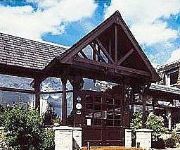
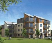
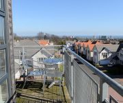
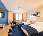
Hotels and Places to Stay
Shaw Crescent
Aberdeen Marriott Hotel
JURYS INN ABZ AIRPORT
Craighaar
Atholl Hotel
Parkhill Apartments Hilton Campus
Courtyard Aberdeen Airport
PARKHILL APARTMENTS
Speedbird Inn
MOXY Aberdeen Airport
Videos from this area
These are videos related to the place based on their proximity to this place.
Donside Ernan House Walk Through
A walk through the 'Ernan' type home at the Donside development in Aberdeen.
Sustainability Charter
Aberdeenshire Council's new Sustainability Charter was officially launched on Monday 8th September 2008. Artist, Matthew Wickham, set alight a small area of grass, at Haddo House, in the shape...
Tales Fae The Windae, Hogmanay Edition.
Here we have my long awaited personal Vlogs... Tales fae the Windae ! Hope you all enjoy. Video quality isn't great, but you get the gist of it. soundtrack: ...
Przejażdżka Autobusem nr 18 po Aberdeen
Od czasu do czasu możesz natrafić na autobus piętrowy. Przejażdżka jest o tyle ciekawa, że nie napotkasz na taką atrakcję w Polsce. Dla mnie był to podstawowy środek lokomocji po...
Grandholm Movie 1e
Filmed in early autumn, 2014 in Grandholm-Woodside, Aberdeen. Edited in Feb-Mar 2015 with MIDI tracks added using Ableton Live 8 with various instrument packs.
Blue audi Great Northern Road, Aberdeen
This driver shows a complete lack of driving ability, a whole 2nd empty lane to use and they choose to buzz me this close.
SK06YTF - WVM, Out my ****ing way!
This is part of national cycle route 1, on this uphill section on Mugiemoss Road in Aberdeen, there are always parked cars here. WVM forces his way down my lane then beeps me for the pleasure.
Videos provided by Youtube are under the copyright of their owners.
Attractions and noteworthy things
Distances are based on the centre of the city/town and sightseeing location. This list contains brief abstracts about monuments, holiday activities, national parcs, museums, organisations and more from the area as well as interesting facts about the region itself. Where available, you'll find the corresponding homepage. Otherwise the related wikipedia article.
Brig o' Balgownie
The Brig o' Balgownie (originally Bridge of Don) is a 13th-century bridge spanning the River Don in Old Aberdeen, Aberdeen, Scotland. Construction of the bridge was begun in the late 13th century by Richard Cementarius, although its completion was not until 1320 at the time of the Scottish War of Independence. After falling into disrepair in the mid 16th century it was extensively renovated in 1605. Throughout its history the bridge has been considered an important asset.
Aberdeen North (UK Parliament constituency)
Aberdeen North is a burgh constituency of the House of Commons of the Parliament of the United Kingdom, and it elects one Member of Parliament (MP) by the first past the post system of election. It was first used in the 1885 general election, but has undergone various boundary changes since that date. There is also an Aberdeen North Holyrood constituency, a constituency of the Scottish Parliament, created in 1999 with the boundaries of the Westminster constituency of at that time.
Cruickshank Botanic Garden
The Cruickshank Botanic Gardens in Aberdeen, Scotland, were built on land bequested by Miss Anne Cruickshank to commemorate her brother Dr. Alexander Cruickshank. The 11 acre (45,000 m²) garden is located in a low-lying and fairly sheltered area of Aberdeen, less than 1-mile from the North Sea. The Cruickshank Botanic Garden is partly owned and financed by the University of Aberdeen and partly by the Cruickshank Botanic Gardens Trust.
Bucks Burn
The Bucks Burn is a stream in Aberdeen which flows into the River Don. It lends its name to the former town of Bucksburn which is now part of Aberdeen City.
Aberdeen Royal Infirmary
Aberdeen Royal Infirmary (ARI) is a teaching hospital on the Foresterhill site in Aberdeen, Scotland. It is run by NHS Grampian and has around 900 beds. ARI is a tertiary referral hospital serving a population of over 600,000 across the North of Scotland. It offers all medical specialities with the exception of heart and liver transplants.
Royal Aberdeen Children's Hospital
The Royal Aberdeen Children's Hospital or RACH is a children's hospital in Aberdeen, Scotland. It is situated on the Foresterhill site, with the Aberdeen Royal Infirmary and Aberdeen Maternity Hospital. The hospital provides a comprehensive service of paediatric specialties to Grampian, Highlands and Islands and Tayside. The original RACH was built in 1929, and was replaced in 2004 by a modern hospital.
Aberdeen Maternity Hospital
Aberdeen Maternity Hospital or AMH is a specialist maternity hospital in Aberdeen, Scotland. The buildings date from the late 1940s but have been updated and modernised since. It is part of the Aberdeen Joint Hospitals Scheme, envisaged by Professor Matthew Hay in the early 20th century. Between 4,000 and 5,000 babies are born at the hospital each year. The hospital is located in the Foresterhill area of Aberdeen and serves the region of Grampian as well as the islands of Shetland and Orkney.
University of Aberdeen School of Medicine
Aberdeen University Medical School is a school of the College of Life Sciences and Medicine at the University of Aberdeen in Scotland. Medicine has been taught at the university since the founding of King's College in 1495. Indeed, the university has been described as the first medical school in Scotland and even the English speaking world. Nevertheless, this assertion has been called into question as medical teaching already existed at St.
Formartine and Buchan Way
The Formartine and Buchan Way is a long-distance footpath in Scotland, extending from Dyce north to Peterhead and Fraserburgh. It follows the track of a former railway line, the Formartine and Buchan Railway, and is open to walkers and cyclists. Horse riders are also welcome on parts of the track but may require a permit. The railway closed in 1979 (Fraserburgh) and 1970 (Maud-Peterhead). The walkway opened in the early 1990s.
University of Aberdeen, College of Life Sciences and Medicine
The College of Life Sciences and Medicine is one of three academic colleges at the University of Aberdeen. It consists of four schools plus the graduate school. The current head of the college is Professor Neva Haites, OBE, a clinical geneticist.
Dyce Academy
Dyce Academy is one of two state schools in Dyce, a small suburb of Aberdeen, Scotland with it serving as the sole provider of secondary education. Dyce Academy's catchment area includes Dyce and much of the surrounding country, including the village of Newmachar . The school's construction began in the late seventies and was completed in 1980. The building has typical architecture of state schools of the period, with concrete in abundance.
Summerhill, Aberdeen
Summerhill is an area of the city of Aberdeen, in the north-east of Scotland, United Kingdom.
Midstocket
Midstocket is an area of Aberdeen, Scotland. It is named after the Forest of Stocket, which was a gift from Robert the Bruce to the people of Aberdeen in 1319. The income from the forests land formed Aberdeen's Common Good Fund. Midstocket Road cuts through the area and is generally seen as the focal point of the Midstocket Area. The streets between Midstocket Road and Westburn Road from Mile-End School are considered to be in the Midstocket Area.
Seaton Park
Seaton Park is located in Aberdeen, Scotland and is one of the city's biggest parks. It was bought by the city for use as a public park in 1947 from Major Hay. The River Don passes along the edge of the park. There is a beautiful flower bed area that is maintained to a high standard with new flowers planted every year, and also a secluded set of walled gardens next to a small (private) housing mews called Seaton Stables.
Stewart Park, Aberdeen
Stewart Park is located in Aberdeen, Scotland. It is a 5-acre site owned by Aberdeen City Council. It was bought with funds bequeathed by the widow of Mr. John Taylor, a merchant in the city. The park was named after a former Lord Provost of the city, Sir David Stewart. The park contains whale jaw bones presented to the park in 1903 by the Captain of the Arctic whaler Benbow.
Bridge of Don Academy
Bridge of Don Academy is an Aberdeen City Council operated six-year secondary comprehensive school and community centre in Bridge of Don, Aberdeen, Scotland. The building was opened in 1979, originally designed to accommodate around 900 pupils. As a result of changes to the curriculum, the addition of new subjects and departments, as well as new educational initiatives, school capacities across the city were re-assessed by the local authority.
Scotstown Moor
Scotstown Moor in the north of Aberdeen, Scotland, was designated as a local nature reserve in 1994 because of its rich wildlife. Scotstown Moor Local Nature Reserve (LNR) is located four miles to the north of Aberdeen City Centre, near the residential areas of Dubford and Bridge of Don, at grid reference NJ 935116. The reserve covers roughly 34 hectares and is owned by Aberdeen City Council, who established it as a nature reserve in 1994.
Roxburgh House
Roxburghe House is a specialist palliative care unit. It has three consultants, several specialist nurses and an excellent team of trained and untrained nurses. It is currently situated near Foresterhill, Aberdeen, Scotland. Prior to this it occupied a site in Milltimber, Aberdeen. Roxburghe House provides many services, not just for oncology patients but for those requiring respite too. There is a large multi-disciplinary team involved in the care of patients of an every day basis.
Elphinstone Hall
Elphinstone Hall is a large hall belonging to the University of Aberdeen, located at their King's College campus in Old Aberdeen. It is a 20th-century building which replaced the "Common Hall" and is named after Bishop William Elphinstone, the founder of the University. An arcade dominates the front of the building, behind which lie a reception area and then the large, wood-panelled hall with hammerbeam roof.
Hilton, Aberdeen
Hilton is a former village, now a neighbourhood, located just north of Rosehill in Aberdeen. {{#invoke:Coordinates|coord}}{{#coordinates:57|10|00|N|2|08|30|W| |primary |name= }}
Oakbank School (Aberdeen)
Oakbank School is a school in Aberdeen (Scotland) offering residential education to young people with behavioural difficulties. Formerly categorised as an approved school, it is the main institution of this kind for the North of Scotland. In 2007 it celebrated its 125th anniversary.
Danestone Congregational Church
Danestone Congregational Church is a Congregational Christian Church located in the Danestone community of the Bridge of Don suburb in Aberdeen, Scotland. Originally established in 1986, the current church building was constructed in 1991. In addition to traditional Sunday services, the church operates a Sunday School, Youth Group, Boys’ Brigade, Men’s Group, Ladies’ Group, Good Afternoon Club and monthly services at Fairview Nursing Home. It is also supports missionary work.
Haudagain roundabout
The Haudagain Roundabout is a roundabout in Aberdeen that bisects the A90 and A96. As all traffic going northbound to Inverness via the A96 or southbound to Dundee via the A90 must pass through this roundabout it is a notoriously busy and hazardous junction with large queues approaching all directions to the roundabout, especially during rush hour. It has been referred to as 'Scotland's worst roundabout'. In May 2011 it was crowned Britain's worst roundabout in Roundabout Idol 2011.
Suttie Centre
The Suttie Centre is a purpose-built training centre on the Foresterhill hospital campus in Aberdeen.
Balgownie transmitting station
Balgownie transmitting station is a relay transmitter of Durris, situated in Bridge of Don, Aberdeen, and covering Tillydrone, Woodside, parts of Old Aberdeen and the Abbey Road area of Torry. It is owned and operated by Arqiva.


