Safety Score: 3,0 of 5.0 based on data from 9 authorites. Meaning we advice caution when travelling to United Kingdom.
Travel warnings are updated daily. Source: Travel Warning United Kingdom. Last Update: 2024-08-13 08:21:03
Discover Sherrigrim
Sherrigrim in Mid Ulster (Northern Ireland) is a place in United Kingdom about 347 mi (or 558 km) north-west of London, the country's capital city.
Current time in Sherrigrim is now 06:17 PM (Friday). The local timezone is named Europe / London with an UTC offset of zero hours. We know of 8 airports near Sherrigrim, of which 3 are larger airports. The closest airport in United Kingdom is Belfast International Airport in a distance of 22 mi (or 36 km), East. Besides the airports, there are other travel options available (check left side).
There is one Unesco world heritage site nearby. The closest heritage site is Brú na Bóinne - Archaeological Ensemble of the Bend of the Boyne in Ireland at a distance of 78 mi (or 125 km). If you need a hotel, we compiled a list of available hotels close to the map centre further down the page.
While being here, you might want to pay a visit to some of the following locations: Dungannon, Cookstown, Armagh, Magherafelt and Craigavon. To further explore this place, just scroll down and browse the available info.
Local weather forecast
Todays Local Weather Conditions & Forecast: 12°C / 54 °F
| Morning Temperature | 11°C / 52 °F |
| Evening Temperature | 12°C / 54 °F |
| Night Temperature | 11°C / 52 °F |
| Chance of rainfall | 0% |
| Air Humidity | 87% |
| Air Pressure | 1024 hPa |
| Wind Speed | Gentle Breeze with 8 km/h (5 mph) from North-East |
| Cloud Conditions | Overcast clouds, covering 93% of sky |
| General Conditions | Overcast clouds |
Saturday, 16th of November 2024
9°C (48 °F)
6°C (42 °F)
Light rain, gentle breeze, broken clouds.
Sunday, 17th of November 2024
7°C (45 °F)
4°C (39 °F)
Light rain, gentle breeze, broken clouds.
Monday, 18th of November 2024
3°C (37 °F)
-0°C (32 °F)
Rain and snow, moderate breeze, overcast clouds.
Hotels and Places to Stay
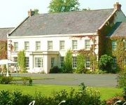
Tullylagan Country House
Glenavon House
Cohannon Inn
Videos from this area
These are videos related to the place based on their proximity to this place.
Fire Works Display @ Mid Ulster Sports Arena, Cookstown, Oct 30, 2014
MidUlster Arena Fire works displayed viewed from Castle Court Cropped version.
Skyrim Playthrough - Part 32 - Syric is Spiderman?
My Website!!: http://madgodmachinations.com/ Syric and Cass continue their adventure through skyrim Twitter: @Chris_DodgaM PSN: Chaotic_God.
Skyrim Playthrough - Part 28 - Field Trip!!
My New Website!!: http://madgodmachinations.com/ Syric and Cass continue their adventure through skyrim Twitter: @Chris_DodgaM PSN: Chaotic_God.
Owen Coyle point v Ballymacnab (Ulster I.F.C 2006)
Owen Coyle scores a point for Stewartstown Harps against Ballymacnab Round Towers (Armagh) in the Ulster I.F.C Semi-Final played at Casement Park on 19/11/2006.
Gareth Devlin goal v Owen Roes (Tyrone A.C.L 2005)
Gareth Devlin scores a goal for Stewartstown Harps against Owen Roes O'Neill's in the Tyrone A.C.L Division 2 played at Coalisland on 10/04/2005.
Gareth Devlin point (2) v Moy (Tyrone A.C.L 2008)
Gareth Devlin scores a point for Stewartstown Harps against Moy Tir na nog in the Tyrone A.C.L Division 2 played at Moy on 23/05/2008.
Owen Coyle goal v Killyman (Tyrone A.C.L 2009)
Owen Coyle scores a goal for Stewartstown Harps against Killyman St. Mary's in the Tyrone A.C.L Division 2 played at Mullaghmoyle on 30/08/2009.
Gareth Devlin goal v Moy (Tyrone A.C.L 2008)
Gareth Devlin scores a goal for Stewartstown Harps against Moy Tir na nog in the Tyrone A.C.L Division 2 played at Moy on 23/05/2008.
Owen Coyle goal v Dungannon (Tyrone A.C.L 2006)
Owen Coyle scores a goal for Stewartstown Harps against Dungannon Clarke's in the Tyrone A.C.L Division 2 played at Mullaghmoyle on 14/05/2006.
Paul Dillon point v Moy (Tyrone A.C.L 2007)
Paul Dillon scores a point for Stewartstown Harps against Moy Tir na nOg in the Tyrone A.C.L Division 1B played at Moy on 13/05/2007.
Videos provided by Youtube are under the copyright of their owners.
Attractions and noteworthy things
Distances are based on the centre of the city/town and sightseeing location. This list contains brief abstracts about monuments, holiday activities, national parcs, museums, organisations and more from the area as well as interesting facts about the region itself. Where available, you'll find the corresponding homepage. Otherwise the related wikipedia article.
Roughan Castle
Roughan Castle is a castle a mile outside Newmills, County Tyrone, Northern Ireland, on the Dungannon to Stewartstown road. It was built about 1618 by Sir Andrew Stewart (d.1639), 2nd Lord Castlestewart, eldest son of Andrew Stewart (1580-1629) the third Lord Ochiltree, 1st Lord Castlestewart who came from Scotland during the plantation and established the nearby town of Stewartstown.
St. Joseph's College, Coalisland
St Joseph's College is a Catholic secondary school located in Coalisland, County Tyrone, Northern Ireland. It is within the Southern Education and Library Board area. It provides the standard five years of secondary education consisting of Key Stage 3 from Year 8 until Year 10, and two-year GCSE courses from Year 11 until Year 12 in Key Stage 4. It also provides a Post 16 Qualification Enhancement Programme.
Brackaville Owen Roes GFC
Brackaville Owen Roes (Irish: Breac an Bhile Eoghain Rua) is a Gaelic Athletic Association club. The club is based in Brackaville, near Coalisland in County Tyrone, Northern Ireland. The club concentrates on Gaelic football, and the senior team in 2011 competed in Division 3 of the Tyrone All-County Football League and play in the Tyrone Junior Football Championship. In December 2012 the club became 2012 Tyrone Junior Football Champions after a 16 year gap.
Dukart's Canal
Dukart's Canal was built to provide transport for coal from the Drumglass Colleries to the Coalisland Canal, in Tyrone, Northern Ireland. It opened in 1777, and used three inclined planes, rather than locks, to cope with changes in level. There is little evidence that it was ever used, as the planes could not be made to work properly, and they were dismantled in 1787.
Newmills
Newmills is a small village in east County Tyrone, Northern Ireland, three miles from Dungannon and two miles from Coalisland. Newmills gets its name from a corn mill and kilns that formerly stood in the area. Local amenities include a primary school, a local shop and a number of churches. It currently has a population of approximately 400 people. The River Torrent flows through the village. The most prominent feature of the village is the war memorial in the centre of the village.
Desertcreat
Desertcreat is a parish and a townland in County Tyrone, Northern Ireland. The civil parish of Desertcreat is in the eastern part of County Tyrone in the barony Dungannon Upper, immediately south of the parish of Derryloran, which contains the town of Cookstown, and immediately north of the parish of Pomeroy. The parish has a Church of Ireland Church in the townland of Desertcreat .
Sandholes
Sandholes is a small, rural hamlet which is located at a crossroads approximately four kilometres south of Cookstown in County Tyrone. The village is small and compact with a locally significant range of services, community facilities and industry. Existing dwellings are located within the core of the village and in estates on the periphery.
Donaghey
Donaghey (from Irish: Domhnach Eich, meaning "church of the horse" or Dún Eachaidh) is a small village and townland roughly halfway between Cookstown and Dungannon, just off the A29, in County Tyrone, Northern Ireland. Donaghey has a range of facilities including a congregational church, a community hall, a primary school and a post office.


