Safety Score: 3,0 of 5.0 based on data from 9 authorites. Meaning we advice caution when travelling to United Kingdom.
Travel warnings are updated daily. Source: Travel Warning United Kingdom. Last Update: 2024-08-13 08:21:03
Explore Artrea
Artrea in Mid Ulster (Northern Ireland) is located in United Kingdom about 347 mi (or 559 km) north-west of London, the country's capital.
Local time in Artrea is now 06:14 PM (Friday). The local timezone is named Europe / London with an UTC offset of zero hours. We know of 8 airports in the wider vicinity of Artrea, of which 3 are larger airports. The closest airport in United Kingdom is Belfast International Airport in a distance of 19 mi (or 30 km), East. Besides the airports, there are other travel options available (check left side).
There is one Unesco world heritage site nearby. The closest heritage site is Brú na Bóinne - Archaeological Ensemble of the Bend of the Boyne in Ireland at a distance of 80 mi (or 128 km). If you need a place to sleep, we compiled a list of available hotels close to the map centre further down the page.
Depending on your travel schedule, you might want to pay a visit to some of the following locations: Cookstown, Magherafelt, Dungannon, Armagh and Craigavon. To further explore this place, just scroll down and browse the available info.
Local weather forecast
Todays Local Weather Conditions & Forecast: 12°C / 53 °F
| Morning Temperature | 9°C / 47 °F |
| Evening Temperature | 11°C / 52 °F |
| Night Temperature | 11°C / 52 °F |
| Chance of rainfall | 0% |
| Air Humidity | 86% |
| Air Pressure | 1023 hPa |
| Wind Speed | Gentle Breeze with 8 km/h (5 mph) from North-East |
| Cloud Conditions | Broken clouds, covering 81% of sky |
| General Conditions | Broken clouds |
Saturday, 16th of November 2024
9°C (48 °F)
7°C (45 °F)
Light rain, moderate breeze, overcast clouds.
Sunday, 17th of November 2024
6°C (44 °F)
3°C (38 °F)
Light rain, gentle breeze, few clouds.
Monday, 18th of November 2024
3°C (37 °F)
-1°C (30 °F)
Rain and snow, gentle breeze, overcast clouds.
Hotels and Places to Stay
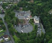
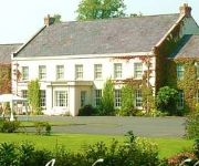
Glenavon House
Tullylagan Country House
Videos from this area
These are videos related to the place based on their proximity to this place.
Support Holy Trinity College Cookstown
Cookstown Forum for Education: Pupils from Holy Trinity College Cookstown show us why they deserve a new school. They need your support!
Dunloy Accordion Band @ Cookstown SOW 2012 (1)
Dunloy Accordion Band @ Cookstown SOW 2012 - Children's Love.
The Spanish Armada-Cookstown High School Year 9 (2006/7)
A Short film we made in Art using Apple iMac. Sorry about no sound, was unable to upload this as the DVD its ripped off was copyrighted to 'Stop Motion'
Dunloy Accordion Band @ Cookstown SOW 2012 (2)
Dunloy Accordion Band @ Cookstown SOW 2012 - Imperial Echoes.
Fire Works Display @ Mid Ulster Sports Arena, Cookstown, Oct 30, 2014
MidUlster Arena Fire works displayed viewed from Castle Court Cropped version.
Videos provided by Youtube are under the copyright of their owners.
Attractions and noteworthy things
Distances are based on the centre of the city/town and sightseeing location. This list contains brief abstracts about monuments, holiday activities, national parcs, museums, organisations and more from the area as well as interesting facts about the region itself. Where available, you'll find the corresponding homepage. Otherwise the related wikipedia article.
Tullyhogue Fort
Tullyhogue Fort, also spelt Tullaghoge or Tullahoge (from Middle Irish Tulach Óc meaning "hill of youth" or "mound of the young warriors"), is large mound on the outskirts of Tullyhogue village near Cookstown, County Tyrone, Northern Ireland. It has a depressed centre and is surrounded by trees. It is an ancient ceremonial site where chieftains of the O'Neill dynasty of Tyrone were inaugurated.
CLG Ógra Colmcille
CLG Ógra Colmcille is a Gaelic Athletic Association club based in Drummullan, County Londonderry, Northern Ireland. The club is a member of Derry GAA and currently caters for Gaelic football. The club has won the Derry Junior Football Championship once. Underage teams up to U-12's play in South Derry league and championships, from U-14 upwards teams compete in All-Derry competitions.
Mid-Ulster District
Mid-Ulster District is a proposed Northern Irish local government district. The district is to be created by merging Magherafelt District, Cookstown District, and the Borough of Dungannon and South Tyrone. The proposed district would have covered parts of counties Londonderry, Tyrone, and Armagh, taking in the entire western shore of Lough Neagh, and bordering County Monaghan in the Republic of Ireland. The district would have had an electorate of 86,591.
Elagh Fault
Elagh Fault is a geological fault in County Tyrone, Northern Ireland.
Andrew Robb and David McIlwaine killings
The Tandragee killings took place in the early hours of Saturday 19 February 2000 on an isolated country road outside Tandragee, County Armagh, Northern Ireland. Two young Protestant men, Andrew Robb and David McIlwaine, were beaten and repeatedly stabbed to death in what was part of a Loyalist feud between the loyalist Ulster Volunteer Force (UVF) and their rivals, the breakaway Loyalist Volunteer Force (LVF). The men were not members of any loyalist paramilitary organisation.
Tanderagee railway station
Tanderagee railway station opened on 6 January 1852 and finally closed on 4 January 1965. Tanderagee is also spelt as Tandragee named after the nearby village of Tandragee. Tanderagee and Gilford railway station was the original name upon opening of the station. Tandergee and Gilford station was built to serve the nearby Ulster villages of Tandragee, County Armagh and Gilford, County Down, Northern Ireland.


