Safety Score: 3,0 of 5.0 based on data from 9 authorites. Meaning we advice caution when travelling to United Kingdom.
Travel warnings are updated daily. Source: Travel Warning United Kingdom. Last Update: 2024-08-13 08:21:03
Touring Curr
Curr in Fermanagh and Omagh (Northern Ireland) is a town located in United Kingdom about 359 mi (or 577 km) north-west of London, the country's capital place.
Time in Curr is now 12:23 PM (Friday). The local timezone is named Europe / London with an UTC offset of zero hours. We know of 9 airports nearby Curr, of which 4 are larger airports. The closest airport in United Kingdom is St Angelo Airport in a distance of 20 mi (or 32 km), West. Besides the airports, there are other travel options available (check left side).
There is one Unesco world heritage site nearby. The closest heritage site is Brú na Bóinne - Archaeological Ensemble of the Bend of the Boyne in Ireland at a distance of 87 mi (or 139 km). Need some hints on where to stay? We compiled a list of available hotels close to the map centre further down the page.
Being here already, you might want to pay a visit to some of the following locations: Omagh, Dungannon, Strabane, Leifear and Cookstown. To further explore this place, just scroll down and browse the available info.
Local weather forecast
Todays Local Weather Conditions & Forecast: 12°C / 53 °F
| Morning Temperature | 10°C / 50 °F |
| Evening Temperature | 11°C / 52 °F |
| Night Temperature | 11°C / 52 °F |
| Chance of rainfall | 0% |
| Air Humidity | 86% |
| Air Pressure | 1024 hPa |
| Wind Speed | Gentle Breeze with 6 km/h (4 mph) from North-East |
| Cloud Conditions | Overcast clouds, covering 94% of sky |
| General Conditions | Overcast clouds |
Saturday, 16th of November 2024
8°C (47 °F)
7°C (45 °F)
Light rain, gentle breeze, overcast clouds.
Sunday, 17th of November 2024
7°C (45 °F)
3°C (37 °F)
Light rain, gentle breeze, overcast clouds.
Monday, 18th of November 2024
2°C (35 °F)
1°C (34 °F)
Snow, light breeze, overcast clouds.
Hotels and Places to Stay
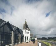
Kellys Inn
Videos from this area
These are videos related to the place based on their proximity to this place.
Cahill Quinn, Quinnspares NI at our International Online Marketplaces event in Omagh.
Cahill Quinn, Quinnspares NI at our International Online Marketplaces event in Omagh.
Omagh Thunder vs Strabane highlights
Highlights from the game's first half... Omagh thunder 75 - 64 Strabane.
The Grange Dental Care Review, The Grange Dental Care , TheGrangeDentalCare.co.uk review
http://thegrangedentalcare.co.uk/ The Grange Dental Care Review , 2 Crevenagh Road, Omagh ,County Tyrone where we review the best family dentist Omagh with modern, bright facilities and a...
Marty T - Escape From Nowhere
Marty T plays the title track from his forthcoming EP Escape From Nowhere at the second Omagh Community Open Mic Night on March 5th.
Videos provided by Youtube are under the copyright of their owners.
Attractions and noteworthy things
Distances are based on the centre of the city/town and sightseeing location. This list contains brief abstracts about monuments, holiday activities, national parcs, museums, organisations and more from the area as well as interesting facts about the region itself. Where available, you'll find the corresponding homepage. Otherwise the related wikipedia article.
Moylagh, County Tyrone
Moylagh is a townland near Gortaclare in County Tyrone, Northern Ireland. In the 2001 Census it had a population of 66 people. It lies within the Omagh District Council area.
Gortaclare
Gortaclare (from Irish: Gort a' Chláir) is a small village and townland in County Tyrone, Northern Ireland. In the 2001 Census it had a population of 66 people. It lies within the Omagh District Council area.
Eskra Emmetts GAC
Eskra Emmetts is a Gaelic Athletic Association club based in the hamlet of Eskra in County Tyrone, Northern Ireland.
Augher (Parliament of Ireland constituency)
Augher was a constituency represented in the Irish House of Commons until the Acts of Union 1800 came into force on January 1, 1801.
Ballygawley bus bombing
The Ballygawley bus bombing was a bomb attack by the Provisional Irish Republican Army (IRA) that targeted a bus carrying British Army soldiers in Northern Ireland. It occurred in the early hours of 20 August 1988 in the townland of Curr near Ballygawley, County Tyrone. The attack killed eight soldiers and wounded another 28.


