Safety Score: 3,0 of 5.0 based on data from 9 authorites. Meaning we advice caution when travelling to United Kingdom.
Travel warnings are updated daily. Source: Travel Warning United Kingdom. Last Update: 2024-08-13 08:21:03
Explore Clooney Park
The district Clooney Park of Londonderry in Derry City and Strabane (Northern Ireland) is located in United Kingdom about 382 mi north-west of London, the country's capital.
If you need a place to sleep, we compiled a list of available hotels close to the map centre further down the page.
Depending on your travel schedule, you might want to pay a visit to some of the following locations: Strabane, Leifear, Limavady, Omagh and Ballybofey-Stranorlar. To further explore this place, just scroll down and browse the available info.
Local weather forecast
Todays Local Weather Conditions & Forecast: 8°C / 46 °F
| Morning Temperature | 6°C / 43 °F |
| Evening Temperature | 6°C / 43 °F |
| Night Temperature | 5°C / 42 °F |
| Chance of rainfall | 4% |
| Air Humidity | 91% |
| Air Pressure | 1016 hPa |
| Wind Speed | Gentle Breeze with 6 km/h (4 mph) from South-East |
| Cloud Conditions | Broken clouds, covering 52% of sky |
| General Conditions | Moderate rain |
Monday, 18th of November 2024
5°C (41 °F)
2°C (36 °F)
Light snow, gentle breeze, overcast clouds.
Tuesday, 19th of November 2024
5°C (41 °F)
0°C (32 °F)
Rain and snow, gentle breeze, broken clouds.
Wednesday, 20th of November 2024
4°C (39 °F)
-1°C (31 °F)
Light snow, gentle breeze, overcast clouds.
Hotels and Places to Stay
Da Vinci's
City
Maldron Derry
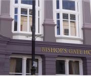
Bishop's Gate Hotel
Everglades Hastings
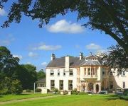
Beech Hill Country House Hotel
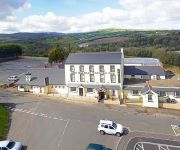
Belfray Country Inn
Best Western Plus White Horse
Travelodge Derry
Rose Park House Bed & Breakfast
Videos from this area
These are videos related to the place based on their proximity to this place.
HQ Fitness - Derry/Londonderry
http://hqfitnessacademy.com/ https://www.facebook.com/sam.conley.773 The HQ Fitness Academy is the brainchild of Sam Conley, who has transformed himself into an extremely healthy individual...
Lumiere Derry 2013 City of Culture
Beautiful Lumiere Effect projected on to Austin's Department Store in the Diamond in Derry UK City of Culture. Austin's is the oldest department store in the world. Uploaded by Seamus Donaghy...
Field Marshall Pipe Band at Derry 2013 - All Ireland Pipe Band Competition
Field Marshall Pipe Band at All Ireland Pipe Band competition held in Derry/Londonderry 2013.
Derry Time Lapse
Y HALO THAR KIND SIR/ MADAM, PLZ SUBSCRIBE 2 ME. IT FREE AN HELPS OUT. © 2013 AppliedTechnology Thanks for watching my latest video! Please consider subscribing if you enjoy the ...
HaLLoWeeN 09 in DeRRy
HALLOWEEN FESTIVAL IN DERRY NORTHERN IRELAND, LOTS OF FANCY DRESS COSTUME AND AMAZING FIREWORKS DISPLAY.
PRESENTATION - CALL TO ACTION, CITY OF DERRY (PART II)
Presentation of "Call to Action" by Marc McGerty, Derry City Council. Medi@Tic Public Workshop - City of Derry (Northern Ireland) The main aim of the Medi@TIC project is to transfer digital...
WILD Teenage Kicks Derry City Bound For Boston
WILD The UK's Ultimate Rock N Roll band .Playing Teenage kicks in Derry hometown of the Undertones @ Bound for Boston 2009 City of Derry Jazz Festival.
Videos provided by Youtube are under the copyright of their owners.
Attractions and noteworthy things
Distances are based on the centre of the city/town and sightseeing location. This list contains brief abstracts about monuments, holiday activities, national parcs, museums, organisations and more from the area as well as interesting facts about the region itself. Where available, you'll find the corresponding homepage. Otherwise the related wikipedia article.
Bloody Sunday (1972)
Bloody Sunday (Irish: Domhnach na Fola)—sometimes called the Bogside Massacre—was an incident on 30 January 1972 in the Bogside area of Derry, Northern Ireland, in which 26 unarmed civil-rights protesters and bystanders were shot by soldiers of the British Army. Thirteen males, seven of whom were teenagers, died immediately or soon after, while the death of another man four-and-a-half months later was attributed to the injuries he received on that day.
Magee College
Magee College is a campus of the University of Ulster located in Derry, Northern Ireland, and is named after the College founded by Martha Magee in 1845. The college was a Presbyterian Christian arts and theological college. In 1984, it became part of the University of Ulster. Located only a short walk along the River Foyle away from the city walls, the campus consists of a mixture of historical and new buildings and modern and traditional facilities.
St Columb's Cathedral
St Columb's Cathedral in the walled city of Derry, Northern Ireland is the mother church of the Church of Ireland Diocese of Derry and Raphoe and the parish church of Templemore. It is dedicated to Saint Columba, the Irish monk who established a Christian settlement in the area before being exiled from Ireland and introducing Christianity to Scotland and northern England.
Shantallow
Shantallow (Irish Seantalamh "old ground") is an ancient townland now almost totally with the City of Derry and lies in the Roman Catholic parish of Templemore, within the North-West Liberties of Derry. The townland is no longer a visible feature of Derry, being mainly built over with 20th-century housing estates, both public and private sector.
Craigavon Bridge
The Craigavon Bridge is one of three bridges in Derry, Northern Ireland. It crosses the River Foyle further south than the Foyle Bridge and Peace Bridge. It is one of only a few double-decker road bridges in Europe. It was named after Lord Craigavon, the first Prime Minister of Northern Ireland. The present bridge began construction in the late 1920s and was finished in 1933.
Foyle Bridge
The Foyle Bridge is a bridge in Derry in Northern Ireland. The central cantilever span of the bridge is the longest in Northern Ireland or the Republic of Ireland, at 234 metres (767 ft), and the whole suspended bridge structure including the approach spans is also the longest in Northern Ireland or the Republic of Ireland at 866 metres (2839 ft).
Foyleside Shopping Centre
Foyleside Shopping Centre is a shopping centre in Derry, Northern Ireland. Construction started in the early 1990s and the centre opened in 1995. The shopping centre's purpose was to offer a hub for shopping in the North West of Ireland. The shopping centre is built into the centre of the city and although it is not on the bank, it does overlook the river Foyle.
Lisneal College
Lisneal College is a controlled secondary school located in Derry, Northern Ireland. It is within the Western Education and Library Board area. At £12m, the school is the biggest investment in Derry's controlled sector in 40 years. Work started on the building of the state-of-the-art Lisneal College in June 2005 on a 22-acre site on Crescent Link. It was established as a result of the amalgamation of Clondermot High School and Faughan Valley High School.
Millennium Forum
The Millennium Forum is a theatre and conference centre in Newmarket Street, Derry, Northern Ireland. It was the first purpose built theatre in Derry and opened in 2001. It has a seating capacity of 1000 and the largest theatre stage in Ireland. It hosts entertainment of all kinds and can also be used as a meeting and conference venue. 40x40px Wikimedia Commons has media related to: Millennium Forum
North West Regional College
North West Regional College is a further education and higher education college in the north-west region of Northern Ireland. The college has three main campuses: Strand Road, Derry, Main Street, Limavady and Derry Road, Strabane.
Austins (department store)
Austins is a department store located in the Diamond area of Derry in Northern Ireland. The store was established in 1830 and remains standing as Ireland's oldest. It is the world's oldest independent department store. The domineering building measures 25,000 square feet and is five stories high with an Edwardian-style exterior.
Richmond Centre (Derry)
The Richmond Centre is a shopping centre in Derry, Northern Ireland. It is the second largest shopping centre in the city at 100,000 sq ft . The centre contains about 40 retail units, including some major high street names. It was completed in 1984 and was the first major regeneration project in the city, announced by British Minister Richard Needham, since the Troubles began. It now complements the larger Foyleside shopping centre (400,000 sq ft, completed 1995), located some 50 metres away.
Waterside, Derry
The Waterside generally refers to the part of Derry city on the east bank of the River Foyle. Traditionally, the Waterside ends at the Caw roundabout near the Foyle Bridge. Areas such as Eglinton and Limavady are not part of the Waterside. Historically, the Waterside had been a mainly Protestant and unionist area, while the rest of Derry has been mainly Irish Catholic and nationalist. However, recent census figures suggest that the two groups are roughly equal.
Immaculate Conception College
Immaculate Conception College is a Roman Catholic secondary school situated in Waterside, Derry, Northern Ireland, catering for students from the ages of 11-19. The current principal is Mr. Frank Orr.
CLG Doire Trasna
Na Piarsaigh CLG Doire Trasna is a Gaelic Athletic Association club based in the Waterside in Derry City, Northern Ireland. They play in the Derry league and championships. They currently cater for Gaelic football. Doire Trasna fields Gaelic football teams at U8, U10, U12, U14, U16, Minor, Reserve and Senior levels. Underage teams up to U-12's play in North Derry league and championships, from U-14 upwards teams compete in All-Derry competitions.
A515 road (Northern Ireland)
The A515 Skeoge Link is road which was designed to complete the route between Foyle Bridge and Donegal. It is part of a larger project to link County Donegal with Belfast. The total construction cost was £5 million.
HMS Ferret (shore establishment 1940)
HMS Ferret was a shore establishment and naval base of the Royal Navy during the Second World War, located in Derry. It was given a ship's name as a stone frigate.
Derry Workhouse
Derry Workhouse was a Workhouse in Derry, Northern Ireland. In the mid-1990s, numerous human remains were found at the Waterside Workhouse. These remains, believed to be of people who died in the mid-nineteenth century, were later interred in the local Ballyoan cemetery.
Guildhall, Derry
The Guildhall in Derry, County Londonderry, Northern Ireland, is a building in which the elected members of Derry City Council meet. It was built in 1890. The Guildhall houses a large hall where many events of social and political nature have been held. It has been home to the Feis Doire Colmcille – an event which celebrates Irish culture - and the now-discontinued Londonderry Feis. It was also home to the Saville Inquiry into the events of Bloody Sunday 30 January 1972 in Derry.
Beechgrove
Beechgrove is a cricket ground in Derry, Northern Ireland. The first recorded match on the ground was in 1963, when the ground hosted a first-class match between Ireland and Scotland. In local domestic cricket, the ground is the home of Brigade Cricket Club.
Crescent Link Retail Park
Crescent Link Retail Park is an out-of-town retail park located in the south eastern periphery of Derry, Northern Ireland. It is just off the A514, which itself is named Crescent Link; hence the retail park's name. The development is located 3 miles from the centre of Derry City. As the second largest retail park of its kind in Northern Ireland, with a large representation of multi-national retailers, such as Marks & Spencer, Tesco, Homebase, Currys, PC World and Toys R Us.
Foyle Valley Railway
The Foyle Valley Railway is a railway museum in Derry, Northern Ireland. The exhibition is a recreated railway station platform and within the displays visitors can find out about the various railway companies which once operated out of the city. The current museum opened in 1989 and trains used to be run along a three mile stretch of track along the riverbank.
Peace Bridge (Foyle)
The Peace Bridge is a cycle and footbridge bridge across the River Foyle in Derry, Northern Ireland. It opened on 25 June 2011, connecting Ebrington Square with the rest of the city centre. It is the newest of three bridges in the city, the others being the Craigavon Bridge and the Foyle Bridge.
Diamond War Memorial
Erected in 1927, the Diamond War Memorial is located on The Diamond in the center of Derry, County Londonderry, Northern Ireland. It is dedicated to the citizens of the city who lost their lives while in military service during World War I.
Londonderry Graving Dock railway station
Londonderry Graving Dock railway station served Derry in County Londonderry in Northern Ireland.


