Safety Score: 3,0 of 5.0 based on data from 9 authorites. Meaning we advice caution when travelling to United Kingdom.
Travel warnings are updated daily. Source: Travel Warning United Kingdom. Last Update: 2024-08-13 08:21:03
Discover Eglinton
Eglinton in Derry City and Strabane (Northern Ireland) with it's 3,818 citizens is a place in United Kingdom about 379 mi (or 610 km) north-west of London, the country's capital city.
Current time in Eglinton is now 04:21 PM (Friday). The local timezone is named Europe / London with an UTC offset of zero hours. We know of 10 airports near Eglinton, of which 4 are larger airports. The closest airport in United Kingdom is City of Derry Airport in a distance of 2 mi (or 3 km), North-East. Besides the airports, there are other travel options available (check left side).
There is one Unesco world heritage site nearby. The closest heritage site is Brú na Bóinne - Archaeological Ensemble of the Bend of the Boyne in Ireland at a distance of 113 mi (or 181 km). Also, if you like playing golf, there is an option about 4 mi (or 7 km). away. If you need a hotel, we compiled a list of available hotels close to the map centre further down the page.
While being here, you might want to pay a visit to some of the following locations: Londonderry, Limavady, Strabane, Leifear and Omagh. To further explore this place, just scroll down and browse the available info.
Local weather forecast
Todays Local Weather Conditions & Forecast: 13°C / 55 °F
| Morning Temperature | 8°C / 47 °F |
| Evening Temperature | 12°C / 54 °F |
| Night Temperature | 11°C / 52 °F |
| Chance of rainfall | 0% |
| Air Humidity | 88% |
| Air Pressure | 1023 hPa |
| Wind Speed | Gentle Breeze with 8 km/h (5 mph) from North-East |
| Cloud Conditions | Broken clouds, covering 75% of sky |
| General Conditions | Light rain |
Saturday, 16th of November 2024
9°C (48 °F)
8°C (46 °F)
Light rain, gentle breeze, overcast clouds.
Sunday, 17th of November 2024
7°C (45 °F)
4°C (38 °F)
Light rain, gentle breeze, broken clouds.
Monday, 18th of November 2024
3°C (37 °F)
0°C (33 °F)
Snow, gentle breeze, overcast clouds.
Hotels and Places to Stay
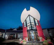
Best Western Plus White Horse
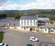
Belfray Country Inn
Videos from this area
These are videos related to the place based on their proximity to this place.
Derry City & County Donegal, Northern Ireland
Derry or Londnderry, is a vibrant walled city with spectacular views in Northern Ireland. Enjoy as Pauline and Rose take you on a tour through the city and then onto County Donegal.
HQ Fitness - Derry/Londonderry
http://hqfitnessacademy.com/ https://www.facebook.com/sam.conley.773 The HQ Fitness Academy is the brainchild of Sam Conley, who has transformed himself into an extremely healthy individual...
HaLLoWeeN 09 in DeRRy
HALLOWEEN FESTIVAL IN DERRY NORTHERN IRELAND, LOTS OF FANCY DRESS COSTUME AND AMAZING FIREWORKS DISPLAY.
WILD Teenage Kicks Derry City Bound For Boston
WILD The UK's Ultimate Rock N Roll band .Playing Teenage kicks in Derry hometown of the Undertones @ Bound for Boston 2009 City of Derry Jazz Festival.
Road Traffic Management Services Ltd.
www.rtmservices.ie Tel:086 2660624 RTM Services Ltd. was established in 2008 in response to the ever increasing need for temporary traffic management on our roads. We aim to provide...
soapbox derby Muff Festival 2010
just a short video of one of the entries in the soapbox derby at Muff festival...the A-team!
Rocket Day' - Harpoon Model Rocket
Scratch built model rocket based on the Harpoon Anti Ship Guided Missile. It was modelled using Roc Sim and made from old paper tubes and card found around the house. CG and CP where adjusted ...
Videos provided by Youtube are under the copyright of their owners.
Attractions and noteworthy things
Distances are based on the centre of the city/town and sightseeing location. This list contains brief abstracts about monuments, holiday activities, national parcs, museums, organisations and more from the area as well as interesting facts about the region itself. Where available, you'll find the corresponding homepage. Otherwise the related wikipedia article.
Lettershendoney
Lettershendoney or Lettershendony (from Irish: Leitir Seanduine, meaning "hillside of the old people" or Leitir Seandomhnaigh meaning "hillside of the old church") is a small village and townland in County Londonderry, Northern Ireland, close to Drumahoe. In the 2001 Census it had a population of 506 people.
Campsey
Campsey or Campsie (from Irish: Camsan or Camasaigh) is a small village in County Londonderry, Northern Ireland. In the 2001 Census it had a population of 195 people. It is near Derry city and within the Derry City Council area. Campsey is an industrial zone with a business park. 40x40px Wikimedia Commons has media related to: Campsey
Tamnaherin
Tamnaherin (possibly from the Irish: Tamhnach Caorthainn) is the name of a townland and small housing estate in County Londonderry, Northern Ireland. In the 2001 Census it had a population of 123 people. It is within the Derry City Council area.
Slaughtmanus GAC
Saint Mary's GAC Slaughtmanus (Irish: CLG Naomh Mhuire Leacht Mhanuis) is a Gaelic Athletic Association club based in Slaughtmanus on the outskirts of Derry, Northern Ireland. The club is a member of the Derry GAA and currently caters for Gaelic football and Camogie. The team serves for the parish of Tamnaherin, drawing players from places such as Lettershendoney, Strathfoyle and Eglinton as well as some players from the Waterside area of Derry.
Woodvale Road
Woodvale Road is a cricket ground in Eglinton, Northern Ireland which has staged two first-class matches and three List A (one-day) matches, a further two were abandoned without a ball bowled. It also staged a single match between Canada and the Netherlands at the 2005 ICC Trophy. It has a capacity of 7,000 The home team of the ground is Eglinton Cricket Club who were founded in 1936.
RNAS Eglinton (HMS Gannet)
Royal Naval Air Station Eglinton or RNAS Eglinton was a Royal Naval Air Station located 1.3 miles north east of Eglinton, County Londonderry and 7.1 miles of Londonderry, County Londonderry, Northern Ireland. The air station was operational between 1943 and 1959.


