Safety Score: 3,0 of 5.0 based on data from 9 authorites. Meaning we advice caution when travelling to United Kingdom.
Travel warnings are updated daily. Source: Travel Warning United Kingdom. Last Update: 2024-08-13 08:21:03
Delve into Mill Loughan
Mill Loughan in Causeway Coast and Glens (Northern Ireland) is a city located in United Kingdom about 365 mi (or 588 km) north-west of London, the country's capital town.
Current time in Mill Loughan is now 07:16 PM (Friday). The local timezone is named Europe / London with an UTC offset of zero hours. We know of 11 airports closer to Mill Loughan, of which 5 are larger airports. The closest airport in United Kingdom is Ballykelly Airport in a distance of 16 mi (or 25 km), West. Besides the airports, there are other travel options available (check left side).
There is one Unesco world heritage site nearby. The closest heritage site is Brú na Bóinne - Archaeological Ensemble of the Bend of the Boyne in Ireland at a distance of 107 mi (or 172 km). Also, if you like playing golf, there are some options within driving distance. In need of a room? We compiled a list of available hotels close to the map centre further down the page.
Since you are here already, you might want to pay a visit to some of the following locations: Coleraine, Ballymoney, Limavady, Magherafelt and Ballycastle. To further explore this place, just scroll down and browse the available info.
Local weather forecast
Todays Local Weather Conditions & Forecast: 13°C / 56 °F
| Morning Temperature | 9°C / 49 °F |
| Evening Temperature | 12°C / 54 °F |
| Night Temperature | 11°C / 51 °F |
| Chance of rainfall | 0% |
| Air Humidity | 99% |
| Air Pressure | 1023 hPa |
| Wind Speed | Moderate breeze with 11 km/h (7 mph) from East |
| Cloud Conditions | Broken clouds, covering 84% of sky |
| General Conditions | Light rain |
Saturday, 16th of November 2024
9°C (49 °F)
8°C (47 °F)
Light rain, fresh breeze, overcast clouds.
Sunday, 17th of November 2024
7°C (45 °F)
5°C (40 °F)
Light rain, moderate breeze, broken clouds.
Monday, 18th of November 2024
3°C (38 °F)
3°C (37 °F)
Rain and snow, gentle breeze, overcast clouds.
Hotels and Places to Stay
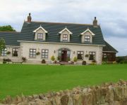
Coolmore House B&B
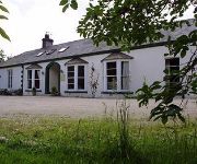
Harmony Hill Country House
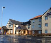
Brown Trout Golf & Country Inn
Coleraine
Videos from this area
These are videos related to the place based on their proximity to this place.
Barbour Jackets, Barbour Leather Bags, Smyths Country Attire, Coleraine, N.I.
http://www.smythscountryattire.com Smyths are a family-owned Barbour retail store located Northern Ireland . To say that we specialise in Barbour Clothing is an understatement, we absolutely...
Gems Jewellers - Coleraine / Ballymoney
http://www.gemsjewellers.com/ Gems Jewellers are the go-to store for fashion accessories, watches and rings in both Ballymoney and Coleraine. They also offer bespoke jewelry for those who...
Markus Jay. Version of Hurt. Busking in Coleraine.
Playing a version of Hurt in Coleraine. Listen closely near the end you will here cameraman singing along... www.markusjay.co.uk.
R118 Helicopter landing at Coleraine Causeway Hospital
Irish Coast Guard landing at Causeway hospital, Coleraine with 2 boys rescued along the North Coast.
BB Engineering | Specialists in Fabrication & Manufacturing | Coleraine
http://www.bbengineering-ni.com/ +442870329972 A progressive Engineering Company based in Coleraine, We are confident of providing products on time and on budget. We provide many structural.
TuS Altenberge beim Milkcup 2013 in Nordirland/Coleraine
Ein Fazit der Trainer und der Spieler der B1 des Tus Altenberge zum Milkcup 2013 in Coleraine in Nordirland.
P&H Services | Heating And Plumbing Services | Coleraine
http://phservicesmechanical.co.uk/ Tel: 02870352579 P&H Services offer a vast array of services at both commercial and domestic locations and can also completely design your heating and plumbing...
Videos provided by Youtube are under the copyright of their owners.
Attractions and noteworthy things
Distances are based on the centre of the city/town and sightseeing location. This list contains brief abstracts about monuments, holiday activities, national parcs, museums, organisations and more from the area as well as interesting facts about the region itself. Where available, you'll find the corresponding homepage. Otherwise the related wikipedia article.
County Coleraine
County Coleraine, called County of Colerain in the earliest documents was one of the counties of Ireland from 1585 to 1613. It was named after its intended county town, Coleraine. Of all the original counties of Ireland, the administration abolished only County Coleraine prior to reorganisations in the twentieth century.
Coleraine Borough Council
Coleraine Borough Council is a local council mainly in County Londonderry and partly in County Antrim in Northern Ireland. Its headquarters are in the town of Coleraine. Small towns in the area include Garvagh, Portrush, Portstewart and Kilrea. The population of the area is just over 59,067 according to the 2011 census. The Coleraine Borough Council consists of four electoral areas: Coleraine East, Coleraine Central, The Skerries and Bann.
Causeway Institute
For the current institution see Northern Regional College The Causeway Institute of Further and Higher Education (informally Causeway Institute or CIFHE) was a third-level educational institution in Northern Ireland, United Kingdom. The Causeway Institute was located on two campuses: Coleraine, County Londonderry and Ballymoney, County Antrim.
The Showgrounds (Coleraine)
The Showgrounds is a football stadium in Coleraine, Northern Ireland. It is the home ground of Coleraine F.C.. The stadium holds 13,132, but is currently restricted to 2,496 under safety legislation. Between September 1971 and October 1972, Derry City F.C. were forced to use the stadium as their home-ground after the Irish Football Association banned the use of their ground in Derry, the Brandywell, due to security fears emanating from the Trouble and civil unrest in the nearby Bogside area.
Coleraine High School
Coleraine High School is an all-girls' grammar school located in Coleraine, County Londonderry, Northern Ireland. The High School, or Gordonville Ladies' Academy as it was originally known, was founded in 1875 in Alexander Terrace, Coleraine, by Mrs Long, assisted by her daughter and staff. From 1924 until 1959, the school, as a voluntary grammar school, was controlled by a board of governors.
Coleraine (Parliament of Ireland constituency)
Coleraine was a constituency represented in the Irish House of Commons from 1611 to 1800. Between 1725 and 1793 Catholics and those married to Catholics could not vote.
Mount Sandel Fort
Mount Sandel Fort is an iron age fort in Coleraine, County Londonderry, Northern Ireland. The remains of the fort are located close to the Mount Sandel Mesolithic site. Mount Sandel Fort mound is a State Care Historic Monument in the townland of Mount Sandel, in Coleraine Borough Council area, at Grid Ref: C8530 3070.
Lodge Road, Coleraine
Lodge Road is a cricket ground in Coleraine, Northern Ireland. The first recorded match on the ground was in 1984, when North West played Ulster. In 1987, the ground hosted hosted a first-class match between Ireland and Scotland, a match which ended in a draw. In 2011, it was one of the venues for the 2011 ICC Under-19 Cricket World Cup Qualifier.


