Safety Score: 3,0 of 5.0 based on data from 9 authorites. Meaning we advice caution when travelling to United Kingdom.
Travel warnings are updated daily. Source: Travel Warning United Kingdom. Last Update: 2024-08-13 08:21:03
Delve into Lackagh
Lackagh in Causeway Coast and Glens (Northern Ireland) is located in United Kingdom about 374 mi (or 602 km) north-west of London, the country's capital town.
Current time in Lackagh is now 06:27 PM (Tuesday). The local timezone is named Europe / London with an UTC offset of zero hours. We know of 10 airports close to Lackagh, of which 4 are larger airports. The closest airport in United Kingdom is Ballykelly Airport in a distance of 3 mi (or 5 km), North. Besides the airports, there are other travel options available (check left side).
There is one Unesco world heritage site nearby. The closest heritage site is Brú na Bóinne - Archaeological Ensemble of the Bend of the Boyne in Ireland at a distance of 109 mi (or 176 km). Also, if you like playing golf, there is an option about 10 mi (or 16 km). away. If you need a hotel, we compiled a list of available hotels close to the map centre further down the page.
While being here, you might want to pay a visit to some of the following locations: Limavady, Londonderry, Coleraine, Cookstown and Strabane. To further explore this place, just scroll down and browse the available info.
Local weather forecast
Todays Local Weather Conditions & Forecast: 6°C / 43 °F
| Morning Temperature | 2°C / 35 °F |
| Evening Temperature | 6°C / 43 °F |
| Night Temperature | 4°C / 39 °F |
| Chance of rainfall | 3% |
| Air Humidity | 75% |
| Air Pressure | 1019 hPa |
| Wind Speed | Gentle Breeze with 7 km/h (4 mph) from North |
| Cloud Conditions | Broken clouds, covering 75% of sky |
| General Conditions | Moderate rain |
Wednesday, 4th of December 2024
7°C (44 °F)
9°C (49 °F)
Light rain, fresh breeze, overcast clouds.
Thursday, 5th of December 2024
11°C (52 °F)
7°C (45 °F)
Moderate rain, strong breeze, overcast clouds.
Friday, 6th of December 2024
5°C (42 °F)
5°C (41 °F)
Moderate rain, moderate breeze, overcast clouds.
Hotels and Places to Stay
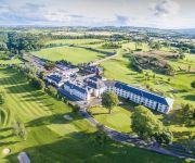
Roe Park Resort
Videos from this area
These are videos related to the place based on their proximity to this place.
The Bad Habits Limavady Jazz And Blues Festival 2009
The Bad Habits (Cara Robinson, Eilis Phillips and Jackie Rainey) playing in O'Briens, Limavady as part of the Limavady Jazz and Blues Festival 14th June 2009.
What is LOST?
What exactly is LOST? Well, it's far more than just "Limavady Outreach and Service Team"! We got a wide range of people that are or have been involved in LOST over the past ten years to share...
(D) Ballynarrig, Pride Of Orange F.B Limavady 12th July 2008 (1)
Ballynarrig, Pride Of Orange on Parade.
Marie Curie Cancer Care - Michael Coyle Charity Haircut
Michael Coyle raises a significant amount of money in aid of Marie Curie Cancer Care. Short video shot in Limavady, Co Derry.
Turkey Run Rally 2014 (IRISHRALLYING07)
Selection of clips from stages 2-4 of the traditional end of season Turkey Run Rally, based around Shackelton, Derry.
Videos provided by Youtube are under the copyright of their owners.
Attractions and noteworthy things
Distances are based on the centre of the city/town and sightseeing location. This list contains brief abstracts about monuments, holiday activities, national parcs, museums, organisations and more from the area as well as interesting facts about the region itself. Where available, you'll find the corresponding homepage. Otherwise the related wikipedia article.
Glack
Glack (from Irish: Glaic, meaning "hollow") is a hamlet and townland in County Londonderry, Northern Ireland. It is 4 km south of Ballykelly, in a raised spot overlooking Lough Foyle. In the 2001 Census it had a population of 183 people. Glack is within the Limavady Borough Council area. Glack is made up of three clusters of buildings. It has a primary school (St Finlough's, in neighbouring Sistrakeel townland) and a business called Paragon Tiles Ltd.
Droppin Well bombing
The Droppin Well bombing or Ballykelly bombing occurred on 6 December 1982, when the Irish National Liberation Army (INLA) exploded a time bomb at a disco in Ballykelly, Northern Ireland. The disco, known as the Droppin Well, was targeted because it was frequented by British Army soldiers from the nearby Shackleton Barracks. The bomb killed eleven soldiers and six civilians; 30 people were injured.
Broharris Canal
The Broharris Canal is a canal situated in County Londonderry, Northern Ireland.
Glack GAC
O'Connor's GAC Glack (Irish: CLG Uí Chonchúir, An Glaic) is a Gaelic Athletic Association club based in the Glack/Ballykelly area in County Londonderry, Northern Ireland. The club is a member of Derry GAA and currently caters for Gaelic football and Camogie. Underage teams up to U-12's play in North Derry league and championships, from U-14 upwards teams compete in All-Derry competitions.


