Safety Score: 3,0 of 5.0 based on data from 9 authorites. Meaning we advice caution when travelling to United Kingdom.
Travel warnings are updated daily. Source: Travel Warning United Kingdom. Last Update: 2024-08-13 08:21:03
Delve into Ballyhackamore
The district Ballyhackamore of Castlereagh in Belfast (Northern Ireland) is a subburb in United Kingdom about 320 mi north-west of London, the country's capital town.
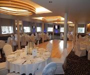
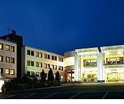
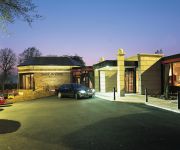
If you need a hotel, we compiled a list of available hotels close to the map centre further down the page.
While being here, you might want to pay a visit to some of the following locations: Belfast, Newtownabbey, Carrickfergus, Newtownards and Lisburn. To further explore this place, just scroll down and browse the available info.
Local weather forecast
Todays Local Weather Conditions & Forecast: 12°C / 54 °F
| Morning Temperature | 11°C / 52 °F |
| Evening Temperature | 12°C / 53 °F |
| Night Temperature | 11°C / 52 °F |
| Chance of rainfall | 0% |
| Air Humidity | 84% |
| Air Pressure | 1024 hPa |
| Wind Speed | Moderate breeze with 9 km/h (6 mph) from North-East |
| Cloud Conditions | Overcast clouds, covering 100% of sky |
| General Conditions | Overcast clouds |
Saturday, 16th of November 2024
9°C (48 °F)
6°C (43 °F)
Light rain, moderate breeze, overcast clouds.
Sunday, 17th of November 2024
7°C (44 °F)
2°C (36 °F)
Moderate rain, moderate breeze, broken clouds.
Monday, 18th of November 2024
3°C (38 °F)
3°C (37 °F)
Snow, gentle breeze, overcast clouds.
Hotels and Places to Stay
The Merchant Hotel
Rayanne House
Hilton Belfast
Malmaison Belfast
Central Belfast Apartments
Clayton Belfast
Ten Square Hotel
Harper's Boutique Bed & Breakfast
Hastings Stormont
PARK AVENUE HOTEL
Videos from this area
These are videos related to the place based on their proximity to this place.
BMI takeoff from Belfast City Airport
Short takeoff from Belfast City Airport (George Best) to London Heathrow, BMI A319.
23. Feb 2009. Belfast City to London Heathrow
BMI British Midland BD83. Belfast City Airport to London Heathrow. Airbus A319. Reg: G-DBCD.
Flybe Embraer E195 G-FBEM Take Off Belfast City Airport BHD BE969 [1080p HD]
Take off from George Best Belfast City Airport (BHD / EGAC) on a Flybe Embraer E195. MORE INFO: Airline: Flybe Aircraft: Embraer ERJ-195 (ERJ-190-200) Reg: G-FBEM Flight Number: BE969 Route:.
A380 Fly By at George Best Belfast City Airport
Something a bit different at BHD!!!! Video shows the second fly by of this beast after it completed an impressive right hand circuit over the city. The aircraft flew down from the north coast...
Flybe Bombardier Q400 Take off Belfast City
BE487 25/5/12 Belfast city - Manchester Bombardier Q400 G-JECG.
Take Off From Belfast City (BHD), Northern Ireland
Take off from Belfast City (BHD) to Aberdeen (ABZ) on a Flybe Bombardier Q400, BE117 This flight was recorded on Sunday, 12 October 2014.
Landing in Belfast City (BHD), Northern Ireland
Landing in Belfast City (BHD) from Aberdeen (ABZ) on a Flybe Bombardier Q400, BE 118 This flight was recorded on Friday, 10 October 2014.
Field Marshal Montgomery claim first UK Championship
In the pleasant surroundings of the Stormont Estate in Belfast, and with superb support from Belfast City Council and BBC Northern Ireland, the first UK Pipe Band Championships took place on...
Belfast City Airport March 2014 HD
Watch in 720p -------------------------------------------------- Well after having ,what I would definitely call 2 of the most historic months of my planespotting career I bring to you Belfast...
Flybe Embraer E195 G-FBEM Belfast City Airport Landing BHD BE964 [1080p HD]
Landing at George Best Belfast City Airport (BHD / EGAC) on a Flybe Embraer E195. MORE INFO: Airline: Flybe Aircraft: Embraer ERJ-195 (ERJ-190-200) Reg: G-FBEM Flight Number: BE964 Route:...
Videos provided by Youtube are under the copyright of their owners.
Attractions and noteworthy things
Distances are based on the centre of the city/town and sightseeing location. This list contains brief abstracts about monuments, holiday activities, national parcs, museums, organisations and more from the area as well as interesting facts about the region itself. Where available, you'll find the corresponding homepage. Otherwise the related wikipedia article.
Castlereagh (borough)
Castlereagh is a local government district with the status of borough in Northern Ireland. A mainly urban borough to the south of Belfast City, it is governed by Castlereagh Borough Council . Unusually, it has no natural borough centre. It consists mostly of suburbs of Belfast in the Castlereagh Hills (to the south-east of the city) with a small rural area in the south of the borough.
Stormont Castle
This article is about Stormont Castle. For The Parliament buildings of Northern Ireland, also known as Stormont, see Parliament Buildings (Northern Ireland). Stormont Castle is a baronial mansion on the Stormont Estate in east Belfast which is used as the main meeting place of the Northern Ireland Executive. Between 1921 and 1972, it served as the official residence of the Prime Minister of Northern Ireland.
Parliament Buildings (Northern Ireland)
The Parliament Buildings, commonly known as Stormont because of their location in the Stormont area of Belfast, are the seat of the Northern Ireland Assembly and the Northern Ireland Executive. They previously housed the defunct Parliament of Northern Ireland.
Glentoran F.C
Glentoran F.C. is a semi-professional football club in Northern Ireland. The club was founded in 1882 and plays its home games at the Oval in east Belfast. Club colours are green, red, and black. The clubs current manager is Eddie Patterson. Linfield and Glentoran are nicknamed Belfast's Big Two, as they have traditionally dominated local football in Northern Ireland since the demise of Belfast Celtic.
Stormont House
Stormont House (also called Speaker's House) is the headquarters of the Northern Ireland Office, it is situated in the Stormont Estate in Belfast in Northern Ireland. It served as the official residence of the Speaker of the House of Commons of Northern Ireland between 1921 and 1972. It was designed by Sir Edwin Lutyens.
The Oval (Belfast)
The Oval is a football stadium in Belfast, Northern Ireland. The stadium has been home to Glentoran since 1892.
Cherryvalley
Cherryvalley is an electoral ward of Belfast City Council, Northern Ireland. Along with neighbouring Stormont and Malone in south Belfast, Cherryvalley is considered one of Northern Ireland's most affluent and exclusive residential areas with average house prices reaching £2-3m. Cherryvalley is also an electoral ward of East Belfast which was created in 1985 in order to reduce the electorates of the neighbouring Stormont and Shandon wards.
Belfast East (Dáil Éireann constituency)
Belfast East, was a former potential Dáil Éireann parliamentary constituency. It was a Dáil constituency from 1921 to 1922.
Sydenham railway station, Northern Ireland
Sydenham railway station is located in the townland of Ballymisert in east Belfast, and is within walking distance of Belfast City Airport. The station is unstaffed, and opened on 1 November 1851.
Strand Cinema
The Strand Cinema is an independent four-screen cinema in Belfast, Northern Ireland. It is one of the two remaining independent cinemas in Belfast, alongside the Queen's Film Theatre. It is located on the Holywood Road. It has long been acclaimed for being one of the cheapest cinemas in Belfast. Opened in 1935, the cinema's design was influenced by its proximity to the nearby shipyard of Harland & Wolff, featuring curved walls and portholed foyer.
Holywood Exchange
Holywood Exchange is a major retail development on the borders of Belfast and Holywood, Northern Ireland. It is beside Belfast City Airport, in the townland of Knocknagoney. The site was previously known as D5 and Harbour Exchange. At present the development compromises an 11 unit 13,940 m (150,000 ft) retail warehouse centre with (as of November 2010); Harvey Norman, Next Home, Decathlon, and BHS-British Home Store (opened in December 2010).
Strathearn School
Strathearn School is a voluntary, all-girls' grammar school in Belfast, Northern Ireland. It is situated in the east of the city and attended by about 750 girls aged 11–18. The grounds include sports facilities and pitches for hockey and athletics as well as many mature trees, which surround the front lawn. The sports hall has facilities for many activities such as gymnastics, badminton, 5-a-side football and basketball. Every year, a sports captain and two vice-captains are elected.
RAF Sydenham
RAF Sydenham was a Royal Air Force station in Northern Ireland. In the 1970s it was the main servicing base for Blackburn Buccaneer aircraft, employing 650 civilian workers.
Belfast East (Assembly constituency)
Belfast East is a constituency in the Northern Ireland Assembly. The seat was first used for a Northern Ireland-only election for the Northern Ireland Assembly, 1973.
Belfast East (Northern Ireland Parliament constituency)
Belfast East was a borough constituency of the Parliament of Northern Ireland from 1921 - 1929. It returned four MPs, using the single transferable vote method of proportional representation.
Stormont Estate
The Stormont Estate is an estate east of Belfast in County Down, Northern Ireland. It is within the townland of Ballymiscaw. The Stormont Estate includes Northern Ireland's main government buildings, which are surrounded mainly by woodland.
Belfast Victoria (Northern Ireland Parliament constituency)
Belfast Victoria was a constituency of the Parliament of Northern Ireland.
Belfast Bloomfield (Northern Ireland Parliament constituency)
Belfast Bloomfield was a constituency of the Parliament of Northern Ireland.
The Comber Greenway
The Comber Greenway is a 7-mile traffic-free section of the National Cycle Network, in development along the old Belfast-Comber railway line. The cycle path starts on Dee Street in Belfast and finishes at Comber. Now completed the Greenway provides an eco-friendly cycle path with views of Stormont and Scrabo Tower. The most recent addition to the route was in November 2008 when the final link between Old Dundonald Road/Comber Rd junction and Comber was opened. This added 2.5 km to the route.
Stormont (cricket ground)
Stormont is a first-class cricket ground in Belfast, Northern Ireland. It is situated in the grounds of the Stormont Estate, the seat of government in Northern Ireland, and is the home of Civil Service North of Ireland Cricket Club. It is one of two ODI grounds in Ireland. The ground was established in 1949 and saw its first ODI in June 2006: the inaugural ODI match for the Irish cricket team, against England.
Bloomfield Collegiate School
Bloomfield Collegiate School is a girl's state grammar school in Belfast, Northern Ireland, for pupils in years 11-18.
Neill's Hill railway station
Neill's Hill railway station is a disused railway station / halt on the main line of the Belfast and County Down Railway. It ran from Queen's Quay, Belfast south to Newcastle, County Down in Northern Ireland. When the Belfast and County Down Railway was open, Neill's Hill railway station was the 4th station from Queen's Quay, Belfast.
Elmgrove Primary School
Elmgrove Primary School (Sometimes referred to as simply Elmgrove and originally known as Elmgrove Elementary School) is a large Primary School in Belfast, Northern Ireland. It opened in 1932 as Elmgrove Elementary School. In 2008 Elmgrove celebrated its 75th anniversary. Special medals made from Mambco, were given to all the pupils.
Knock railway station
Knock railway station was on the Belfast and County Down Railway which ran from Belfast to Newcastle, County Down in Northern Ireland.
Victoria Park, Belfast
Victoria Park was opened in 1906 in the Connswater area of Belfast. Belfast Harbour Commissioners investigated the idea in 1854, however the land was very marshy and needed draining near Belfast Lough. It was landscaped by Charles McKimm, who also built the Tropical Ravine in Botanic Gardens. Victoria Park contains a large lake.






!['Flybe Embraer E195 G-FBEM Take Off Belfast City Airport BHD BE969 [1080p HD]' preview picture of video 'Flybe Embraer E195 G-FBEM Take Off Belfast City Airport BHD BE969 [1080p HD]'](https://img.youtube.com/vi/lacJmV0MEw0/mqdefault.jpg)


!['Flybe Embraer E195 G-FBEM Belfast City Airport Landing BHD BE964 [1080p HD]' preview picture of video 'Flybe Embraer E195 G-FBEM Belfast City Airport Landing BHD BE964 [1080p HD]'](https://img.youtube.com/vi/TtaLXRoLxZA/mqdefault.jpg)
