Safety Score: 3,0 of 5.0 based on data from 9 authorites. Meaning we advice caution when travelling to United Kingdom.
Travel warnings are updated daily. Source: Travel Warning United Kingdom. Last Update: 2024-08-13 08:21:03
Touring Scarva
Scarva in Armagh City Banbridge and Craigavon (Northern Ireland) is a town located in United Kingdom about 325 mi (or 523 km) north-west of London, the country's capital place.
Time in Scarva is now 05:20 PM (Friday). The local timezone is named Europe / London with an UTC offset of zero hours. We know of 8 airports nearby Scarva, of which 3 are larger airports. The closest airport in United Kingdom is Belfast International Airport in a distance of 23 mi (or 37 km), North. Besides the airports, there are other travel options available (check left side).
There is one Unesco world heritage site nearby. The closest heritage site is Brú na Bóinne - Archaeological Ensemble of the Bend of the Boyne in Ireland at a distance of 55 mi (or 89 km). Also, if you like the game of golf, there are several options within driving distance. Need some hints on where to stay? We compiled a list of available hotels close to the map centre further down the page.
Being here already, you might want to pay a visit to some of the following locations: Banbridge, Craigavon, Newry, Armagh and Dundalk. To further explore this place, just scroll down and browse the available info.
Local weather forecast
Todays Local Weather Conditions & Forecast: 11°C / 52 °F
| Morning Temperature | 11°C / 52 °F |
| Evening Temperature | 12°C / 53 °F |
| Night Temperature | 11°C / 53 °F |
| Chance of rainfall | 0% |
| Air Humidity | 86% |
| Air Pressure | 1024 hPa |
| Wind Speed | Gentle Breeze with 8 km/h (5 mph) from North-East |
| Cloud Conditions | Overcast clouds, covering 100% of sky |
| General Conditions | Overcast clouds |
Saturday, 16th of November 2024
9°C (48 °F)
6°C (43 °F)
Light rain, moderate breeze, broken clouds.
Sunday, 17th of November 2024
7°C (44 °F)
4°C (39 °F)
Light rain, gentle breeze, scattered clouds.
Monday, 18th of November 2024
3°C (37 °F)
0°C (33 °F)
Rain and snow, moderate breeze, overcast clouds.
Hotels and Places to Stay
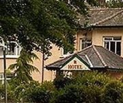
Bannville House Hotel
Videos from this area
These are videos related to the place based on their proximity to this place.
Scarva
Scarva 13th July 2014 Donloy A.C.C. BAND, White Memorial Bush Dungannon, Young Defenders Lisburn, Poyntzpass Silver Band.
Hamiltonsbawn Silver Band @ Scarva 2013
Hamiltonsbawn Silver Band (Co. Armagh) playing the Our Director march at Scarva 'The Thirteenth' Black parade on Saturday 13th July 2013.
Royal Black Institution Parades: Scarva 2008: Demesne
The annual Royal Black Institution/Preceptory demonstration in Scarva Demesne, Scarva, County Down on 14th July 2008. Video shows members of lodges in the Tandragee District No. 1 entering...
Scarva and Portadown 7 - Shieldhill Young Defenders, 13/7/2012
Shieldhill Young Defenders marching on July 13 2012 at the Scarva and Portadown parades.
Royal Black Institution Parades: Scarva 2008: King Billy
Royal Black Institution/Preceptory demonstration in Scarva Demesne, Scarva, County Down. This shows the Williamite and Jacobite forces before the small scale reenactment of the Battle of the...
Videos provided by Youtube are under the copyright of their owners.
Attractions and noteworthy things
Distances are based on the centre of the city/town and sightseeing location. This list contains brief abstracts about monuments, holiday activities, national parcs, museums, organisations and more from the area as well as interesting facts about the region itself. Where available, you'll find the corresponding homepage. Otherwise the related wikipedia article.
Gilford
Gilford is a village in County Down, Northern Ireland. The village sits on the River Bann between the towns of Banbridge, Tandragee and Portadown. It covers the townlands of Loughans, Ballymacanallen and Drumaran. It had a population of 1,573 people in the 2001 Census. Gilford is within the Banbridge (district) area.
Tullylish
Tullylish (from Irish: Tulaigh Lis, meaning "hillock of the fort") is a small village, townland and civil parish in County Down, Northern Ireland. It sits on the River Bann, along the main road between the towns of Banbridge and Portadown. In the 2001 Census it had a population of 105 people. It lies within the civil parish of Tullylish, barony of Iveagh Lower, Upper Half, and Banbridge District.
Scarva railway station
Scarva railway station serves Scarva in County Down, Northern Ireland. Despite serving the County Down village, the station itself is in County Armagh, the nearby Newry Canal being the boundary.
Lisnagade
Lisnagade is a large Celtic multivallate earthen ringfort, three miles west of Banbridge, County Down, Northern Ireland, just off the Scarva road. Lisnagade Fort rath and annex are State Care Historic Monuments in the townland of Lisnagade, in Banbridge District.
The Oriel
The Oriel (also known as The Oriel of Gilford) is a former restaurant located in Gilford, County Down, Northern Ireland. It was a fine dining restaurant that was awarded one Michelin star in 2004 and 2005. In 2005 the restaurant also gained recognition of the Egon Ronay Guide. The Guide listed it as one of the 25 best restaurants in the United Kingdom. The restaurant closed down in 2006. Head chef of The Oriel was Barry Smyth.
Goraghwood railway station
Goraghwood railway station was opened in 1854 and closed in 1965. Goraghwood was opened on the 06/03/1854 on the Dublin and Belfast Junction Railway. Goraghwood is a closed station in County Armagh in Northern Ireland. Goraghwood was an important junction on the Great Northern Railway of Ireland system located on the Dublin to Belfast railway line.


