Safety Score: 3,0 of 5.0 based on data from 9 authorites. Meaning we advice caution when travelling to United Kingdom.
Travel warnings are updated daily. Source: Travel Warning United Kingdom. Last Update: 2024-08-13 08:21:03
Discover Listullycurran
Listullycurran in Armagh City Banbridge and Craigavon (Northern Ireland) is a city in United Kingdom about 321 mi (or 517 km) north-west of London, the country's capital city.
Local time in Listullycurran is now 03:19 PM (Friday). The local timezone is named Europe / London with an UTC offset of zero hours. We know of 8 airports in the vicinity of Listullycurran, of which 3 are larger airports. The closest airport in United Kingdom is Belfast International Airport in a distance of 16 mi (or 25 km), North. Besides the airports, there are other travel options available (check left side).
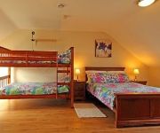
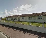
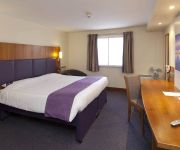
There is one Unesco world heritage site nearby. The closest heritage site is Brú na Bóinne - Archaeological Ensemble of the Bend of the Boyne in Ireland at a distance of 56 mi (or 91 km). Also, if you like golfing, there are a few options in driving distance. Looking for a place to stay? we compiled a list of available hotels close to the map centre further down the page.
When in this area, you might want to pay a visit to some of the following locations: Lisburn, Banbridge, Craigavon, Belfast and Antrim. To further explore this place, just scroll down and browse the available info.
Local weather forecast
Todays Local Weather Conditions & Forecast: 12°C / 53 °F
| Morning Temperature | 11°C / 52 °F |
| Evening Temperature | 11°C / 52 °F |
| Night Temperature | 11°C / 52 °F |
| Chance of rainfall | 0% |
| Air Humidity | 85% |
| Air Pressure | 1024 hPa |
| Wind Speed | Moderate breeze with 9 km/h (6 mph) from North-East |
| Cloud Conditions | Overcast clouds, covering 100% of sky |
| General Conditions | Overcast clouds |
Saturday, 16th of November 2024
9°C (48 °F)
6°C (43 °F)
Light rain, moderate breeze, overcast clouds.
Sunday, 17th of November 2024
6°C (44 °F)
3°C (37 °F)
Moderate rain, moderate breeze, broken clouds.
Monday, 18th of November 2024
3°C (37 °F)
1°C (34 °F)
Snow, gentle breeze, overcast clouds.
Hotels and Places to Stay
Dunhill Cottage
Drumlin Lane Self Catering
Ballinderry Inn
Lisburn
Videos from this area
These are videos related to the place based on their proximity to this place.
4x4 Late Exit - Lisburn Sprucefield
M1 motorway junction 8, lisburn sprucefield. Late exit by an Irish registered 4x4, a Toyota RAV4 I think. 29-02-2012 17:15 Captured on a Flip UltraHD with Panavise / Gekko suction...
KTM 1190 Adventure with Phillip McCallen & Jeremy McWilliams
KTM 1190 Adventure Launch - with Phillip McCallen and Jeremy McWilliams at Phillip McCallen Motorcycles, Lisburn, Northern Ireland. March 2013.
Belle 5 Month old airedale at play
Belle the 5 Month old Airedale terrier puppy playing at the Beechgrove doggy fun park Near Banbridge County Down, Northern Ireland.
Excellence Together Events
Lisburn based company Andrew Ingredients, supplier of specialist ingredients to bakers and food manufacturers across Ireland, held two special events which showcased the latest innovations...
Portadown Baptist, Men's Fellowship Trip to the Ulster Aviation Society
Portadown Baptist, Men's Fellowship Trip to the Ulster Aviation Society Visit.
Croob View
A short tour of Croob View Self Catering Accommodation Hillsborough, at Drumlin Lane. Two bedrom Self Catering Accommodation in the scenic countryside of Cou...
IRISH ARMY BAND3 HILLSBOROUGH
"I want to hold your hand" (part of). Irish Army No.1 band from Cathal Brugha barracks in Dublin played their first official engagement in Northern Ireland at a Hillsborough Castle garden party...
The Malpass Brothers -- I'm So Lonesome I could Cry - at Omagh 2011
"I'm So Lonesome I Could Cry" performed by The Malpass Brothers at Omagh Appalachian & Bluegrass Festival in the Ulster - American Folk Park, County Tyrone on 3rd September 2011.
Videos provided by Youtube are under the copyright of their owners.
Attractions and noteworthy things
Distances are based on the centre of the city/town and sightseeing location. This list contains brief abstracts about monuments, holiday activities, national parcs, museums, organisations and more from the area as well as interesting facts about the region itself. Where available, you'll find the corresponding homepage. Otherwise the related wikipedia article.
A1 road (Northern Ireland)
The A1 is a major route in Northern Ireland. It runs from Belfast via Lisburn and Banbridge to the border with the Republic of Ireland south of Newry, from where the road continues to Dublin, becoming the N1 road and M1 motorway. Between Sprucefield and Carrickcarnan the road forms part of the European route E01.
St Colman's Primary School, Dromore
St. Colman's Primary School is a primary school located in Dromore, County Down, Northern Ireland. It caters for girls and boys aged from 3 to 11 and has 90 pupils. The school lies only 500 yards north of the town and almost all of the pupils come from the town and the surrounding area. It is within the Southern Education and Library Board area. The school is sited in pleasant surroundings on Gallows Street, beside the Roman Catholic chapel, to which the school is linked. In February 2006 St.
Dromore Central Primary School
Dromore Central Primary School (colloquially referred to as "the Central") is a primary school located in Dromore, County Down, Northern Ireland. The school was built in 1938 (with major extension and refurbishment in 1979) and has 600 pupils aged from 4–11 years in 21 classes. The schools aims "to promote the all-round development of every pupil". It is within the Southern Education and Library Board area.
Break of Dromore
The Break of Dromore is a name given to a battle fought during the Williamite War in Ireland on March 14, 1689. The battle was fought between Catholic Jacobite troops under Richard Hamilton and Protestant Williamites. The engagement, fought near Dromore, County Down resulted in the rout of the Williamites and the Jacobite's securing of eastern Ulster. It is known as a "Break", because the Williamites put up little resistance, being put to flight after only a short fight.
Kilwarlin Moravian Church
Kilwarlin Moravian Church was founded in 1755 by the evangelist John Cennick following a Moravian mission in Ireland that began in Dublin in 1746. Kilwarlin is a small village near Hillsborough in County Down.
Ashfield Halt railway station
Ashfield Halt railway station served Ashfield in County Down, Northern Ireland. Sited south of Dromore the station was served by the line from Lisburn to Banbridge.
Dromore Cathedral
Dromore Cathedral or, more correctly, The Cathedral Church of Christ the Redeemer, Dromore, is one of two cathedral churches (the other is Down Cathedral) in the Diocese of Down and Dromore of the Church of Ireland. It is situated in the small town of Dromore, County Down, Northern Ireland in the ecclesiastical province of Armagh. The present building was originally constructed in 1661 by Jeremy Taylor, Bishop of Down and Connor and has been several times expanded to its present size.


