Safety Score: 3,0 of 5.0 based on data from 9 authorites. Meaning we advice caution when travelling to United Kingdom.
Travel warnings are updated daily. Source: Travel Warning United Kingdom. Last Update: 2024-08-13 08:21:03
Explore Scolboa
Scolboa in Antrim and Newtownabbey (Northern Ireland) is located in United Kingdom about 335 mi (or 540 km) north-west of London, the country's capital.
Local time in Scolboa is now 01:41 PM (Friday). The local timezone is named Europe / London with an UTC offset of zero hours. We know of 9 airports in the wider vicinity of Scolboa, of which 4 are larger airports. The closest airport in United Kingdom is Belfast International Airport in a distance of 7 mi (or 11 km), South. Besides the airports, there are other travel options available (check left side).
There is one Unesco world heritage site nearby. The closest heritage site is Brú na Bóinne - Archaeological Ensemble of the Bend of the Boyne in Ireland at a distance of 77 mi (or 124 km). Also, if you like golfing, there are multiple options in driving distance. If you need a place to sleep, we compiled a list of available hotels close to the map centre further down the page.
Depending on your travel schedule, you might want to pay a visit to some of the following locations: Antrim, Ballymena, Lisburn, Newtownabbey and Belfast. To further explore this place, just scroll down and browse the available info.
Local weather forecast
Todays Local Weather Conditions & Forecast: 12°C / 53 °F
| Morning Temperature | 11°C / 51 °F |
| Evening Temperature | 11°C / 52 °F |
| Night Temperature | 11°C / 52 °F |
| Chance of rainfall | 0% |
| Air Humidity | 86% |
| Air Pressure | 1024 hPa |
| Wind Speed | Gentle Breeze with 8 km/h (5 mph) from North-East |
| Cloud Conditions | Overcast clouds, covering 100% of sky |
| General Conditions | Overcast clouds |
Saturday, 16th of November 2024
9°C (48 °F)
6°C (43 °F)
Light rain, moderate breeze, overcast clouds.
Sunday, 17th of November 2024
6°C (44 °F)
2°C (36 °F)
Moderate rain, moderate breeze, broken clouds.
Monday, 18th of November 2024
3°C (37 °F)
2°C (36 °F)
Snow, light breeze, overcast clouds.
Hotels and Places to Stay
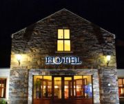
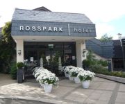
Hilton Belfast Templepatrick Golf - Country Club
Dunsilly
Rosspark
Videos from this area
These are videos related to the place based on their proximity to this place.
Lifan LF125J CITY X
2006 Lifan LF125J CITY X,easy to ride learner,that does loads of miles to the gallon,kick & electric start with a box big enough for a helmet,gloves and your secret stash...
swl on 40 Meter band
Radio communications ,( recorded this short clip from Antrim town} Antenna for SWL ( Avanti moonraker 6 }
6.683 lsb , ham or pirate ? maybe 45 metres ?
picked up on falcon dipole ,12 miles N.West of Belfast ,
Videos provided by Youtube are under the copyright of their owners.
Attractions and noteworthy things
Distances are based on the centre of the city/town and sightseeing location. This list contains brief abstracts about monuments, holiday activities, national parcs, museums, organisations and more from the area as well as interesting facts about the region itself. Where available, you'll find the corresponding homepage. Otherwise the related wikipedia article.
Donegore
Donegore is the name of a hill, a townland, a small cluster of residences, and a civil parish in the barony of Upper Antrim, County Antrim, Northern Ireland. Donegore lies approximately 5 miles (8 km) east of Antrim town. The largest settlement in the parish is the village of Parkgate. Donegore Hill stands prominently above the Six Mile Water valley, enjoying panoramic views to the east, south, and most notably the west, where it overlooks Lough Neagh and the Sperrins beyond.
Tobergill
Tobergill (Irish: Tobar Geal meaning "bright well") is the largest townland in the Parish of Donegore, County Antrim, Northern Ireland. Comprising 1,044 acres (423 hectares), it lies on the western aspect of Donegore Hill.
Dunamuggy
Dunamuggy (from Irish: Dún na mBogaigh, meaning "stronghold of the bogs") is a townland in the Parish of Donegore, County Antrim, Northern Ireland. It lies on the eastern aspect of Donegore Hill.
Ballycraigy
Ballycraigy is a mainly loyalist housing estate in Antrim, about 10 miles north of Belfast, Northern Ireland. Ballycraigy has its own band "Ballycraigy Sons of Ulster" with Purple/Lilac attire for their uniform. The ballycraigy estate is made up of the mostly Protestant religion group. Every July 12th many of them celebrate by lighting a bonfire in the centre of the estate. The bonfire for 2006 was the largest in Northern Ireland.


