Safety Score: 3,0 of 5.0 based on data from 9 authorites. Meaning we advice caution when travelling to United Kingdom.
Travel warnings are updated daily. Source: Travel Warning United Kingdom. Last Update: 2024-08-13 08:21:03
Explore Ribbesford
Ribbesford in Worcestershire (England) is located in United Kingdom about 110 mi (or 178 km) north-west of London, the country's capital.
Local time in Ribbesford is now 10:00 AM (Saturday). The local timezone is named Europe / London with an UTC offset of zero hours. We know of 10 airports in the wider vicinity of Ribbesford, of which 5 are larger airports. The closest airport in United Kingdom is Birmingham International Airport in a distance of 25 mi (or 40 km), East. Besides the airports, there are other travel options available (check left side).
There are several Unesco world heritage sites nearby. The closest heritage site in United Kingdom is Blaenavon Industrial Landscape in a distance of 48 mi (or 77 km), South-West. Also, if you like golfing, there are multiple options in driving distance. We found 1 points of interest in the vicinity of this place. If you need a place to sleep, we compiled a list of available hotels close to the map centre further down the page.
Depending on your travel schedule, you might want to pay a visit to some of the following locations: Stourport-on-Severn, Romsley, Cotheridge, Leigh and Bransford. To further explore this place, just scroll down and browse the available info.
Local weather forecast
Todays Local Weather Conditions & Forecast: 10°C / 50 °F
| Morning Temperature | 3°C / 37 °F |
| Evening Temperature | 14°C / 57 °F |
| Night Temperature | 14°C / 58 °F |
| Chance of rainfall | 17% |
| Air Humidity | 94% |
| Air Pressure | 997 hPa |
| Wind Speed | Strong breeze with 20 km/h (12 mph) from North |
| Cloud Conditions | Overcast clouds, covering 100% of sky |
| General Conditions | Moderate rain |
Sunday, 24th of November 2024
15°C (58 °F)
9°C (48 °F)
Moderate rain, high wind, near gale, overcast clouds.
Monday, 25th of November 2024
9°C (48 °F)
7°C (45 °F)
Light rain, strong breeze, clear sky.
Tuesday, 26th of November 2024
9°C (49 °F)
9°C (48 °F)
Light rain, fresh breeze, broken clouds.
Hotels and Places to Stay
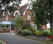
Mercure Bewdley The Heath Hotel
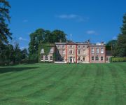
Hallmark Stourport Manor
The Elms Hotel
Gainsborough House
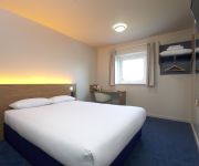
TRAVELODGE KIDDERMINSTER
TRAVELODGE HARTLEBURY
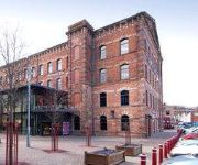
Kidderminster
Videos from this area
These are videos related to the place based on their proximity to this place.
Driving On The A456 & B4195 Between Bewdley & Stourport on Severn, Worcestershire, England
Sorry but my camera was not focusing properly during some parts of this journey. Driving along the A456 & B4195 (Stourport Road & Bewdley Road North) between Bewdley & Stourport on Severn,...
Leafers at Coney Green - Jan09
Members of the Severn Valley Leafers (Land Rover Club) having fun on the off-road course at Coney Green Farm, during the clubs first Off-Road Fun Day of 2009. To find out more, visit www.severnv...
BEWDLEY FLOOD FEB9TH 2014 LAST PART 6
BEWDLEY WORCS RIVER SEVERN BRIDGE FLOODS FEB 9TH 2014 0730AM A456 Main Road Closed at Bewdley central Bridge ...due to flood barriers on Beales Corner..
BEWDLEY FLOOD FEB9TH 2014 PART 4
BEWDLEY WORCS RIVER SEVERN BRIDGE FLOODS FEB 9TH 2014 0730AM A456 Main Road Closed at Bewdley central Bridge ...due to flood barriers on Beales Corner..
BEWDLEY FLOOD FEB9TH 2014 PART 1
BEWDLEY WORCS RIVER SEVERN BRIDGE FLOODS FEB 9TH 2014 0730AM A456 Main Road Closed at Bewdley central Bridge ...due to flood barriers on Beales Corner..
BEWDLEY FLOOD FEB 9TH 2014 PART 5
BEWDLEY WORCS RIVER SEVERN BRIDGE FLOODS FEB 9TH 2014 0730AM A456 Main Road Closed at Bewdley central Bridge ...due to flood barriers on Beales Corner..
Leafers at Coney Green - Mar09
Members of the Severn Valley Leafers (Land Rover Club) having fun on the off-road course at Coney Green Farm, during the clubs first Off-Road Fun Day of 2009. To find out more, visit www.severnv...
BEWDLEY FLOOD FEB9TH 2014 PART 3
BEWDLEY WORCS RIVER SEVERN BRIDGE FLOODS FEB 9TH 2014 0730AM A456 Main Road Closed at Bewdley central Bridge ...due to flood barriers on Beales Corner..
Leafers at Coney Green - Dec08 - Part 1 of 2
Members of the Severn Valley Leafers (Land Rover Club) having fun on the off-road course at Coney Green Farm, during the clubs last Off-Road Fun Day of 2008. To find out more, visit www.severnva...
Videos provided by Youtube are under the copyright of their owners.
Attractions and noteworthy things
Distances are based on the centre of the city/town and sightseeing location. This list contains brief abstracts about monuments, holiday activities, national parcs, museums, organisations and more from the area as well as interesting facts about the region itself. Where available, you'll find the corresponding homepage. Otherwise the related wikipedia article.
West Midland Safari Park
West Midland Safari and Leisure Park is a safari park located in Bewdley in Worcestershire, England. It was opened in spring 1973. The park holds over 165 species of exotic animals. The 4-mile safari contains about 600 animals from around 40 different species from Europe, Africa, North America and Asia. The park also includes a large amusement park and a "Discovery Trail" including reptile and insect houses. There is also access to Spring Grove House, the grounds of which the park is built in.
A456 road
The A456 is a main road in England running between Central Birmingham and Woofferton, Shropshire, south of Ludlow.
Bewdley railway station
Bewdley railway station serves the town of Bewdley in Worcestershire, England. It is the administrative headquarters of the Severn Valley Railway, and is the principal intermediate station on the line.
Northwood Halt railway station
Northwood Halt is an unstaffed request stop on the Severn Valley Railway in Worcestershire, situated a little to the north of Bewdley on the outskirts of the Wyre Forest. There is a level crossing just to the south of the single platform. It is the only surviving original halt on the line. The halt first opened in June 1935 and was in use until the end of British Railways passenger services beyond Bewdley in 1963.
Tenbury and Bewdley Railway
|} The Tenbury and Bewdley Railway was a railway that ran from Tenbury in Shropshire to Bewdley in Worcestershire, England. The line is sometimes referred to as the Wyre Forest line or simply the Tenbury Line.
Chain Wire Club Ground
The Chain Wire Club Ground in Stourport-on-Severn, Worcestershire was used for first-class cricket by Worcestershire County Cricket Club on a single occasion: a County Championship match against Lancashire in 1980, which Worcestershire won by an innings and 153 runs. David Humphries made 108 not out for the home side, while Norman Gifford produced an outstanding first-innings return of 18-13-15-6, then took four more wickets in the second innings.
Bewdley Bridge
Bewdley Bridge is a three-span masonry arch bridge over the River Severn at Bewdley, Worcestershire. The two side spans are each 52 feet, with the central span 60 feet . The central arch rises 18 feet . Smaller flood arches on the bank bridge the towpath. The bridge is 27 feet wide.
Tickenhill Palace
Tickenhill Palace (also known as Tickenhill House or Tickenhall Manor) is a historic building in Bewdley, Worcestershire, England. It is a grade II* listed building. As a Tudor palace, it was the site of the marriage by proxy of Arthur, Prince of Wales to Catherine of Aragon in 1499. It was also the birthplace of the poet Mary Sidney. The park which surrounds the manor house was established in the 14th century.


