Safety Score: 3,0 of 5.0 based on data from 9 authorites. Meaning we advice caution when travelling to United Kingdom.
Travel warnings are updated daily. Source: Travel Warning United Kingdom. Last Update: 2024-08-13 08:21:03
Discover Kempsey
Kempsey in Worcestershire (England) with it's 2,609 citizens is a town in United Kingdom about 99 mi (or 160 km) north-west of London, the country's capital city.
Current time in Kempsey is now 07:15 PM (Tuesday). The local timezone is named Europe / London with an UTC offset of zero hours. We know of 9 airports near Kempsey, of which 5 are larger airports. The closest airport in United Kingdom is Gloucestershire Airport in a distance of 17 mi (or 27 km), South. Besides the airports, there are other travel options available (check left side).
There are several Unesco world heritage sites nearby. The closest heritage site in United Kingdom is Blaenavon Industrial Landscape in a distance of 39 mi (or 62 km), South-West. Also, if you like playing golf, there are a few options in driving distance. Looking for a place to stay? we compiled a list of available hotels close to the map centre further down the page.
When in this area, you might want to pay a visit to some of the following locations: Worcester, Bransford, Leigh, Cotheridge and Stourport-on-Severn. To further explore this place, just scroll down and browse the available info.
Local weather forecast
Todays Local Weather Conditions & Forecast: 6°C / 43 °F
| Morning Temperature | 5°C / 42 °F |
| Evening Temperature | 4°C / 39 °F |
| Night Temperature | 3°C / 37 °F |
| Chance of rainfall | 0% |
| Air Humidity | 91% |
| Air Pressure | 1023 hPa |
| Wind Speed | Light breeze with 5 km/h (3 mph) from North |
| Cloud Conditions | Broken clouds, covering 78% of sky |
| General Conditions | Broken clouds |
Wednesday, 4th of December 2024
6°C (43 °F)
11°C (52 °F)
Light rain, fresh breeze, overcast clouds.
Thursday, 5th of December 2024
13°C (55 °F)
8°C (47 °F)
Light rain, strong breeze, overcast clouds.
Friday, 6th of December 2024
8°C (47 °F)
13°C (56 °F)
Moderate rain, strong breeze, overcast clouds.
Hotels and Places to Stay
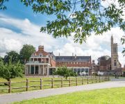
Stanbrook Abbey
Worcester Whitehouse
BANK HOUSE HOTEL SPA AND GOLF
St. Lawrence Hotel
TRAVELODGE WORCESTER
Gilberts End Farm - B&B
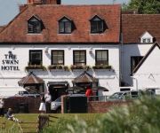
The Swan Hotel
Days Inn Tewkesbury
Jct6) Worcester (M5
FOWNES HOTEL
Videos from this area
These are videos related to the place based on their proximity to this place.
Driving Along Worcester Road & Malvern Road From Great Malvern To Worcester, Worcestershire, England
Driving along Worcester Road (A449), Malvern Road (A449 & B4206) & St John's (B4486) from Great Malvern to Worcester, Worcestershire, England Videoed on Wednesday, 27th March 2013 Playlist:.
Diglis Basin & Severn Way, Worcester, Worcestershire, England 31st July 2011
Video of Diglis basin & the Severn Way from Diglis to the Ketch Caravan Park (near Carrington bridge), Worcester, Worcestershire, UK Videoed on Sunday, 31st July 2011 Playlist: http://www.youtube....
Driving Along Commandery Road, Bath Road & Worcester Road, Worcester, Worcestershire, UK
Driving along Commandery Road (A38), Bath Road (A38) & Worcester Road (A38), Worcester, Worcestershire, England. Videoed on Saturday,14th April 2012 Playlist: ...
Driving On A4440 Broomhall Way & Temeside Way, Worcester, Worcestershire, England
Driving along the A4440 Broomhall Way & Temeside Way, Worcester, Worcestershire, England Videoed on Monday, 6th April 2015 Playlist: ...
Driving From Severn Stoke To Clifton, Worcestershire, England 9th March 2012
Driving from Severn Stoke to Clifton, Worcestershire, England Videoed on Friday, 9th March 2012 Playlist: http://www.youtube.com/playlist?list=PLD94CA3439A31F519.
Driving On The A4104 & A38 From Upton upon Severn To Worcester, Worcestershire, England 7th April
Driving on the A4104 & A38 from Upton upon Severn to Worcester,, Worcestershire, England Videoed on Sunday, 7th April 2013 Playlist: ...
Driving Along Church Lane, Norton & Crookbarrow Road, Brockhill Village, Worcestershire, England
Driving along Church Lane from Norton to Brockhill Village & then along Crookbarrow Road, Brockhill Village, Worcester, Worcestershire, England Videoed on Thursday, 12th April 2012 Playlist:...
Driving Through Powick On The A449, Worcester, Worcestershire, England 9th January 2010
Driving through the village of Powick on the A449 (Malvern Road), Worcester, Worcestershire, England Videoed on Saturday, 9th January 2010 Playlist: http://www.youtube.com/view_play_list?p=2F85.
Driving Through Powick B4424 & A449, Worcestershire, England 26th May 2009
Driving through Powick village (B4424 & A449), Worcestershire, England Videoed Tuesday, 26th May 2009.
Videos provided by Youtube are under the copyright of their owners.
Attractions and noteworthy things
Distances are based on the centre of the city/town and sightseeing location. This list contains brief abstracts about monuments, holiday activities, national parcs, museums, organisations and more from the area as well as interesting facts about the region itself. Where available, you'll find the corresponding homepage. Otherwise the related wikipedia article.
St Peter the Great
St Peter the Great is a suburb of the City of Worcester in Worcestershire, England. It is almost due south of the city centre, on the east side of the river Severn, and has a population of 5,620. The parish is named after the church of St Peter the Great. The parish of the church was divided into parts - St Peter the Great City and St Peter the Great County. The former was merged eventually with other Worcester parishes to form a united civil parish St Peter the Great County Parish Council.
Battle of Powick Bridge
The Battle of Powick Bridge, fought on 23 September 1642, was the first major cavalry engagement of the English Civil War. It was a Royalist victory. According to Hugh Peters it was "where England's sorrows began". {{#invoke:Footnotes|sfn}}
Stanbrook Abbey
Stanbrook Abbey is an abbey originally built as a contemplative house for Benedictine nuns. It was founded in 1625 in Cambrai, Flanders, then part of the Spanish Netherlands, under the auspices of the English Benedictine Congregation,. The English Benedictine Congregation have now re-located to Wass in the North York Moors National Park. The property is currently operational as an events venue, and is owned by Clarenco LLP.
Croome Court
Croome Court is a mid 18th century Neo-Palladian mansion surrounded by an extensive landscaped parkland near Pershore in south Worcestershire. The mansion, and park, were designed by Lancelot "Capability" Brown with some of the internal rooms designed by Robert Adam. The park and garden are owned by the National Trust. The mansion house, Croome Court, was purchased by the Croome Heritage Trust and is currently leased to the National Trust.
Red Hill, Worcester
Red Hill is an area of Worcester, Worcestershire, England. It is in the south-east of the city on the A44. It has historically been used as high ground to attack the city and as a place of execution.
Old Hills
The Old Hills are an area of common land in Worcestershire, England. They are located around 2 miles to the east of Great Malvern and about a mile west of the River Severn near the village of Callow End. They reach a height of 65 metres (considerably lower than the nearby Malvern Hills) but are popular with walkers for their views towards Malvern.


