Safety Score: 3,0 of 5.0 based on data from 9 authorites. Meaning we advice caution when travelling to United Kingdom.
Travel warnings are updated daily. Source: Travel Warning United Kingdom. Last Update: 2024-08-13 08:21:03
Explore Henwick
The district Henwick of in Worcestershire (England) is located in United Kingdom about 102 mi north-west of London, the country's capital.
If you need a place to sleep, we compiled a list of available hotels close to the map centre further down the page.
Depending on your travel schedule, you might want to pay a visit to some of the following locations: Worcester, Bransford, Cotheridge, Leigh and Stourport-on-Severn. To further explore this place, just scroll down and browse the available info.
Local weather forecast
Todays Local Weather Conditions & Forecast: 9°C / 47 °F
| Morning Temperature | 5°C / 41 °F |
| Evening Temperature | 7°C / 44 °F |
| Night Temperature | 5°C / 42 °F |
| Chance of rainfall | 0% |
| Air Humidity | 77% |
| Air Pressure | 1028 hPa |
| Wind Speed | Light breeze with 4 km/h (3 mph) from North-East |
| Cloud Conditions | Overcast clouds, covering 100% of sky |
| General Conditions | Overcast clouds |
Saturday, 16th of November 2024
10°C (49 °F)
7°C (44 °F)
Overcast clouds, gentle breeze.
Sunday, 17th of November 2024
8°C (46 °F)
3°C (38 °F)
Light rain, moderate breeze, overcast clouds.
Monday, 18th of November 2024
6°C (43 °F)
1°C (35 °F)
Moderate rain, moderate breeze, overcast clouds.
Hotels and Places to Stay
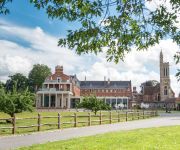
Worcester Whitehouse
Stanbrook Abbey
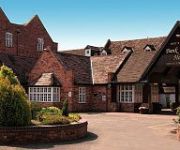
BANK HOUSE HOTEL SPA AND GOLF
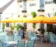
Hadley Bowling Green Inn
Puddle Lane B&B
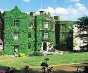
The Abbey Great Malvern
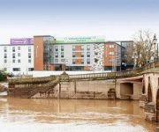
TRAVELODGE WORCESTER
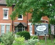
St. Lawrence Hotel
Jct6) Worcester (M5
Worcester City Centre
Videos from this area
These are videos related to the place based on their proximity to this place.
Accommodation at University of Worcester
Visit http://www.worcester.ac.uk/your-home/ for more information about our accommodation. Starting university life is an exciting and challenging time and arranging a place to live is high...
Open Day at the University of Worcester
Visit http://www.worcester.ac.uk/opendays to register and find out more about our Open Days. Like us on Facebook - http://t.co/V3cFvMZC Follow us on Twitter - http://bit.ly/NmBKFy The best...
Accommodation Facts - University of Worcester
An audio gallery with a voiceover from Judith Bick, Deputy Residential Services Manager, talking about our accommodation. Visit http://www.worcester.ac.uk/your-home/ to find out more about...
Take your place at the University of Worcester
Take your place at the University of Worcester Visit our website for more information: http://www.worcester.ac.uk/ Like us on Facebook - http://t.co/V3cFvMZC Follow us on Twitter - http://bit.ly/N...
What makes studying Psychology at the University of Worcester different?
Dr Tim Jones, Head of Psychology, sharing some of the reasons why studying Psychology at the University of Worcester is different and unique. We have 6 different Psychology courses to choose...
Fine Art Practice BA (Hons) Student View - University of Worcester
Visit http://www.worcester.ac.uk/fine-art to find out more about the Fine Art Practice BA (Hons) course at the University of Worcester. Take a look at what Harriet, a recent student studying...
Drama and Performance BA (Hons) - University of Worcester
Visit www.worcester.ac.uk/drama-ba to find out more. Like us on Facebook - http://t.co/V3cFvMZC Follow us on Twitter - http://bit.ly/NmBKFy.
Driving On Bromyard Road, Tudor Way & Grenville Road, Worcester, England 28th March 2014
Driving along Bromyard Road A44, Tudor Way & Grenville Road, Worcester, Worcestershire, England Videoed on Friday, 28th March 2014 Playlist: ...
Pete Weber @ Worcester Tenpin Bowling, 7-10 split pickup
This video was shot at Worcester Tenpin Bowling in the UK, on Wednesday 1st October 2008. Pete Weber & James pickup a 7-10 split, bowling a ball each at the same time.
Driving On Malvern Road, Bromyard Road & Tudor Way, Worcester, Worcestershire, England
Driving along Malvern Road B4026, St John's B4486, Bromyard Road A44 & Tudor Way, Worcester, Worcestershire, England Videoed on Monday, 6th April 2015 Playlist: ...
Videos provided by Youtube are under the copyright of their owners.
Attractions and noteworthy things
Distances are based on the centre of the city/town and sightseeing location. This list contains brief abstracts about monuments, holiday activities, national parcs, museums, organisations and more from the area as well as interesting facts about the region itself. Where available, you'll find the corresponding homepage. Otherwise the related wikipedia article.
Battle of Worcester
The Battle of Worcester took place on 3 September 1651 at Worcester, England and was the final battle of the English Civil War. Oliver Cromwell and the Parliamentarians defeated the Royalist, predominantly Scottish, forces of King Charles II. The 16,000 Royalist forces were overwhelmed by the 28,000 strong "New Model Army" of Cromwell.
Royal Grammar School Worcester
The Royal Grammar School Worcester (also known as RGS Worcester) is an independent coeducational school in Worcester, England. Founded before 1291, it is one of the oldest British independent schools. It began accepting girls in 2002 prior to the merger. In September 2007 it merged with the neighbouring Alice Ottley School and was briefly known as RGS Worcester and The Alice Ottley School before reverting to its original name.
The King's School, Worcester
The King's School, Worcester (also known as King's Worcester or KSW, archaically Worcester Cathedral Grammar School or Worcester Cathedral King's School) is an English independent school refounded by Henry VIII in 1541. It occupies a site adjacent to Worcester Cathedral on the banks of the River Severn in the centre of the city of Worcester. It offers mixed-sex mainstream education that follows the UK National Curriculum to around 1,465 students aged 2 to 18.
Anglican Diocese of Worcester
The Diocese of Worcester forms part of the Province of Canterbury in England. The diocese was founded in around 679 by St Theodore of Canterbury at Worcester to minister to the kingdom of the Hwicce, one of the many Anglo Saxon petty-kingdoms of that time. The original borders of the diocese are believed to be based on those of that ancient kingdom.
New Road, Worcester
New Road, Worcester, England, has been the home cricket ground of Worcestershire County Cricket Club since 1896. Immediately to the northwest is a road called New Road, part of the A44, hence the name.
Worcester Porcelain Museum
The Royal Worcester porcelain factory's former site in Worcester, England, includes a visitor centre and the independent Worcester Porcelain Museum (formerly known as the Dyson Perrins Museum), owned by the Dyson Perrins Museum Trust. The museum houses the world’s largest collection of Worcester porcelain.
Gheluvelt Park
Gheluvelt Park is a public park in Worcester, England. The park was opened on the 17 June 1922 to commemorate the Worcestershire Regiment's 2nd Battalion after their part in Battle of Gheluvelt, a World War I battle that took place on 31 October 1914 in Gheluvelt, Belgium. It was opened by Field Marshal John French, 1st Earl of Ypres, who stated, "on that day the 2nd Worcesters saved the British Empire.
Worcester City F.C
Worcester City Football Club is an English football club based in Worcester, Worcestershire. The club participates in the Conference North, the sixth tier of English football. Established in 1902, they have spent the majority of their history in non league football. The team plays at St George's Lane.
Worcester Foregate Street railway station
Worcester Foregate Street railway station, opened by the Great Western Railway in 1860, is situated in the centre of the city of Worcester, in Worcestershire, England. It is physically the smaller of the two stations serving the city, but is more centrally located. The other station is Worcester Shrub Hill situated to the east. The station layout is unusual in that travelling east the two platforms serve different routes, rather than different directions.
Battle of Powick Bridge
The Battle of Powick Bridge, fought on 23 September 1642, was the first major cavalry engagement of the English Civil War. It was a Royalist victory. According to Hugh Peters it was "where England's sorrows began". {{#invoke:Footnotes|sfn}}
The Alice Ottley School
The Alice Ottley School was an independent all-girls school in Worcester that existed under this name - referencing its first headmistress - between 1883 and 2007 before it merged with the Worcester Royal Grammar School.
Siege of Worcester
The Siege of Worcester took place in 1646, towards the end of the First English Civil War, when Parliamentary forces under the command of Thomas Rainsborough besieged the city of Worcester, accepting the capitulation of the 104 Royalist defenders on 22 July 1646. By 1646 the Royalist cause was in terminal decline. The Battle of Stow-on-the-Wold, the last pitched battle of the First English Civil War, was fought on 21 March 1646.
Worcester Racecourse
Worcester Racecourse is a thoroughbred horse racing venue located in the city of Worcester, Worcestershire, England. The course is laid out as an oval circuit of about 13 furlongs in length and situated by the south side of the River Severn. During the 2007 floods, the racecourse was inundated and all the fixtures after June 30 had to be cancelled. 13 Fur = Approximately 2,615.2meters
Worcester College of Technology
Worcester College of Technology is a Further Education College situated in the city of Worcester in the United Kingdom. It also has a Construction Centre located in the nearby town of Malvern.
RGS Springfield
RGS Springfield (Royal Grammar School Springfield) is a co-ed Junior School of RGS Worcester. It is located in Britannia Square in Worcester, United Kingdom. It is located 100 yards west of the Senior School. After the RGS/AO merger, Springfield became co-educational. The headmistress of the school is Mrs Laura Brown. Its former head is Mrs Marion Lloyd. The other RGS prep School is RGS The Grange.
Diglis Basin
Diglis Basin is a canal basin on the Worcester and Birmingham Canal. It is situated in Diglis in the centre of Worcester, England, near The Commandery (a command post during the English Civil War). To the north is Tibberton (8.41 miles and 14 locks away) and to the west is Diglis Junction (0.25 miles and 2 locks to the west) where the canal meets the River Severn. It is the first basin (with associated amenities) reached after joining the canal from the River Severn.
The Commandery
The Commandery is a historic building open to visitors and located in the city of Worcester, England. It opened as a museum in 1977 and was for a while the only museum in England dedicated solely to the Civil Wars. The Commandery ceased to be a Civil War museum when it reopened to the public in May 2007, having undergone a year and a half of refurbishments and reinterpretation jointly funded by the Heritage Lottery Fund and Worcester City Council, who own the building.
Rushwick
Rushwick is a village and civil parish in the Malvern Hills District in the county of Worcestershire, England. Situated to the west of the city of Worcester, Rushwick Parish comprises the four villages and hamlets of Broadmore Green, Crown East, Rushwick village and Upper Wick. The Worcester to Hereford railway line passes through the village. Rushwick village has been circumvented by the Western By-pass, reducing through traffic, making it much quieter compared with previous times.
Glover's Needle
The Glover's Needle (or St Andrews Spire) is a spire-carrying tower in the city of Worcester, England.
1 and 2 Tai Cochin
1 and 2 Tai Cochin consists of a pair of joined cottages in the village of Nannerch, Flintshire, Wales. Each of the cottages is a Grade II listed building. They were built for the railway engineer William Barber Buddicom in 1877–88 and designed by the Chester architect John Douglas. The cottages are built in brick in vernacular revival style with tiled hipped roofs.
Worcester City Art Gallery & Museum
The Worcester City Art Gallery & Museum is an art gallery and local museum in Worcester, the county town of Worcestershire, England. The museum was originally founded in 1833 by members of the Worcestershire Natural History Society. It is located in a Victorian building in central Worcester, which opened in 1896. The gallery has a programme of contemporary art and craft exhibitions.
Greyfriars, Worcester
Greyfriars, Worcester, was a Franciscan friary and school in Worcester, England.
CrownGate Shopping Centre
CrownGate Worcester is a shopping centre in Worcester, England. It contains 60 stores, with a range of both large and smaller units, including anchor tenants House of Fraser, Debenhams and Primark. There are also three restaurants, a large car park with Bus Station and The Huntingdon Hall Theater. The Centre has just undergone an extensive £4million refurbishment and rebranding with new floors, canopies and lights as well as modern street furniture and art.
St Swithun's Church, Worcester
St Swithun's Church, Worcester, is a redundant Anglican church in the city of Worcester, Worcestershire, England. It has been designated by English Heritage as a Grade I listed building, and is under the care of the Churches Conservation Trust. The church is considered to be "one of the best preserved examples of an early Georgian church in England". Clifton-Taylor includes the church in his list of 'best' English parish churches.
Worcester Library


