Safety Score: 3,0 of 5.0 based on data from 9 authorites. Meaning we advice caution when travelling to United Kingdom.
Travel warnings are updated daily. Source: Travel Warning United Kingdom. Last Update: 2024-08-13 08:21:03
Delve into Defford
Defford in Worcestershire (England) with it's 571 habitants is a town located in United Kingdom about 94 mi (or 152 km) north-west of London, the country's capital town.
Time in Defford is now 05:03 AM (Friday). The local timezone is named Europe / London with an UTC offset of zero hours. We know of 10 airports closer to Defford, of which 5 are larger airports. The closest airport in United Kingdom is Gloucestershire Airport in a distance of 13 mi (or 22 km), South. Besides the airports, there are other travel options available (check left side).
There are several Unesco world heritage sites nearby. The closest heritage site in United Kingdom is Blaenavon Industrial Landscape in a distance of 40 mi (or 64 km), South-West. Also, if you like the game of golf, there are some options within driving distance. In need of a room? We compiled a list of available hotels close to the map centre further down the page.
Since you are here already, you might want to pay a visit to some of the following locations: Worcester, Uckington, Swindon Village, Bransford and Leigh. To further explore this place, just scroll down and browse the available info.
Local weather forecast
Todays Local Weather Conditions & Forecast: 8°C / 47 °F
| Morning Temperature | 5°C / 40 °F |
| Evening Temperature | 6°C / 43 °F |
| Night Temperature | 5°C / 41 °F |
| Chance of rainfall | 0% |
| Air Humidity | 78% |
| Air Pressure | 1028 hPa |
| Wind Speed | Light breeze with 4 km/h (3 mph) from North-East |
| Cloud Conditions | Overcast clouds, covering 100% of sky |
| General Conditions | Overcast clouds |
Saturday, 16th of November 2024
8°C (47 °F)
7°C (44 °F)
Overcast clouds, light breeze.
Sunday, 17th of November 2024
8°C (47 °F)
3°C (38 °F)
Light rain, gentle breeze, overcast clouds.
Monday, 18th of November 2024
6°C (43 °F)
3°C (37 °F)
Moderate rain, gentle breeze, overcast clouds.
Hotels and Places to Stay
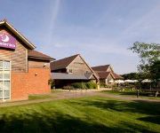
Hilton Puckrup Hall Tewkesbury
ANGEL INN HOTEL
Days Inn Tewkesbury
Tewkesbury
Videos from this area
These are videos related to the place based on their proximity to this place.
Driving Along Crabbe Lane & Sunningdale Close From Wadborough To Pershore, Worcestershire
Driving along Crabbe Lane & Sunningdale Close from Wadborough to Pershore, Worcestershire, England. Videoed on Sunday, 27th March 2011 Playlist: ...
Driving Along The B4084 From Drakes Broughton To Pershore, Worcestershire 25th March 2011
Driving along the B4084 from Drakes Broughton to Pershore, Worcestershire, England. Videoed on Friday, 25th March 2011 Playlist: http://www.youtube.com/view_play_list?p=61DC4C5A6C4D96A1.
Driving Along The B4084 Between Drakes Broughton & Pershore, Worcestershire UK 14th March 2010
Driving along the B4084 Between Drakes Broughton & Pershore, Worcestershire, England Videoed on Sunday,14th March 2010 Playlist: http://www.youtube.com/playlist?list=PL798B01F2AA4FE513.
Driving On The B4084 Between Worcester & Pershore, Worcestershire, England 23rd August 2013
Driving on the B4084 (from junction 7 M5 motorway) between Worcester & Pershore, Worcestershire, England Videoed on Friday, 23rd August 2013 Playlist: ...
Driving On Worcester Road, Three Springs Road, Defford Road & Broad Street, Pershore, England
Driving along Worcester Road (B4084), Three Springs Road (A4104), Defford Road (B4536) & Broad Street (B4536), Pershore, Worcestershire, England Videoed on Sunday, 28th April 2013 Playlist:...
Driving On The B4084 Between Drakes Broughton & Pershore, Worcestershire, UK 31st January 2010
Driving along the B4084 Between Drakes Broughton & Pershore, Worcestershire, England Videoed on Sunday, 31st January 2010 Playlist: http://www.youtube.com/playlist?list=PL92163F02629FEE74.
Driving Along Farleigh Road, Abbey Road & St Andrew's Road, Pershore, Worcestershire, England
Driving along Farleigh Road, Abbey Road & St Andrew's Road, Pershore, Worcestershire, England Videoed on Sunday, 28th April 2013 Playlist: ...
Driving Along Broad Street & Defford Road, Pershore, Worcestershire 27th March 2011
Driving along Broad Street (B4536) Defford Road (B4536 & A4104), Pershore, Worcestershire, England. Videoed on Sunday, 27th March 2011 Playlist: ...
Driving Along Defford Road, Broad Street, High Street & Worcester Road, Pershore, Worcestershire
Driving along Defford Road (A4104 & B4536), Broad Street (B4536), High Street (B4084) & Worcester Road (B4084), Pershore, Worcestershire, England. Videoed on Sunday, 27th March 2011 Playlist:.
Driving On Newlands & Three Springs Road, Pershore, Worcestershire, UK 15th October 2010
Driving along Newlands & Three Springs Road (A4104), Pershore, Worcester, Worcestershire, England Videoed on Friday, 15th October 2010 Playlist: ...
Videos provided by Youtube are under the copyright of their owners.
Attractions and noteworthy things
Distances are based on the centre of the city/town and sightseeing location. This list contains brief abstracts about monuments, holiday activities, national parcs, museums, organisations and more from the area as well as interesting facts about the region itself. Where available, you'll find the corresponding homepage. Otherwise the related wikipedia article.
Wychavon
Wychavon is a local government district in Worcestershire, England. Its council is based in Pershore. Other towns in the district include Droitwich Spa, Evesham and Broadway. The district extends from the south-east corner of Worcestershire north and west. The districts to the west are Malvern Hills and Worcester and to the north Wyre Forest. The district was created under the Local Government Act 1972, on 1 April 1974.
M50 motorway (Great Britain)
The M50 is a motorway in Gloucestershire, Worcestershire and Herefordshire, England. It is 21 miles long and is sometimes referred to as the Ross Spur. It is the only motorway-class road in Herefordshire.
RAF Defford
RAF Defford was a Royal Air Force station located 1.1 miles north west of Defford in Worcestershire, England.
Ramsden, Worcestershire
Ramsden is a hamlet in the English county of Worcestershire. Ramsden is located due west of the town of Pershore. It lies on the Regional Cycle Route 46, connecting Pershore and Worcester.
St John the Baptist's Church, Strensham
St John the Baptist's Church, Strensham, is a redundant Anglican church in the village of Strensham, Worcestershire, England. It has been designated by English Heritage as a Grade I listed building, and is under the care of the Churches Conservation Trust. Clifton-Taylor includes the church in his list of 'best' English parish churches.


